




CBSE Class 12 Geography Question Paper 2025 Code 64/S/3 (Compartment) is available for download here. CBSE conducted the Class 12 Geography exam on July 15, 2025 from 10:30 AM to 1:30 PM. The Geography theory paper is of 70 marks.
Also Check: CBSE Class 12 Question Paper 2025 (All Subjects)
The Geography question paper includes the following types of questions:
- The question paper has 30 questions, all compulsory, for 70 marks in 3 hours, with 15 minutes of extra reading time
- Section A (Q1 to Q17) has 17 multiple choice questions of 1 mark each, and Section B (Q18 and Q19) has 2 source-based questions of 3 marks each
- Section C (Q20 to Q23) has 4 short answer questions of 3 marks each, to be answered in 80 to 100 words
- Section D (Q24 to Q28) has 5 long answer questions of 5 marks each, to be answered in 120 to 150 words
- Section E (Q29 and Q30) has 2 map-based questions of 5 marks each
- There is no overall choice, but internal choice (OR) is given in a few questions of Sections B to D
CBSE Class 12 Geography Question Paper 2025 Code 64/S/3 (Compartment) PDF
| CBSE Official PDF | CD PDF | CD PDF with Solutions |
|---|---|---|
| Download official PDF 0.92 MB | Download Collegedunia PDF 1.75 MB | – |
CBSE Class 12 Geography Compartment 2025 Set 3 (64/S/3) Questions with Solutions
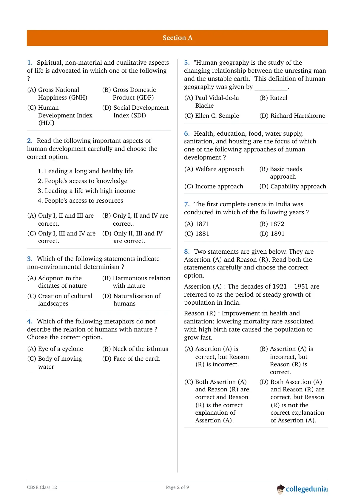
Spiritual, non-material and qualitative aspects of life is advocated in which one of the following ?
Read the following important aspects of human development carefully and choose the correct option.
- Leading a long and healthy life
- People's access to knowledge
- Leading a life with high income
- People's access to resources
Which of the following statements indicate non-environmental determinism ?
Which of the following metaphors do not describe the relation of humans with nature ? Choose the correct option.
"Human geography is the study of the changing relationship between the unresting man and the unstable earth." This definition of human geography was given by __________.
Health, education, food, water supply, sanitation, and housing are the focus of which one of the following approaches of human development ?
The first complete census in India was conducted in which of the following years ?
Two statements are given below. They are Assertion (A) and Reason (R). Read both the statements carefully and choose the correct option.
Assertion (A) : The decades of 1921 – 1951 are referred to as the period of steady growth of population in India.
Reason (R) : Improvement in health and sanitation; lowering mortality rate associated with high birth rate caused the population to grow fast.
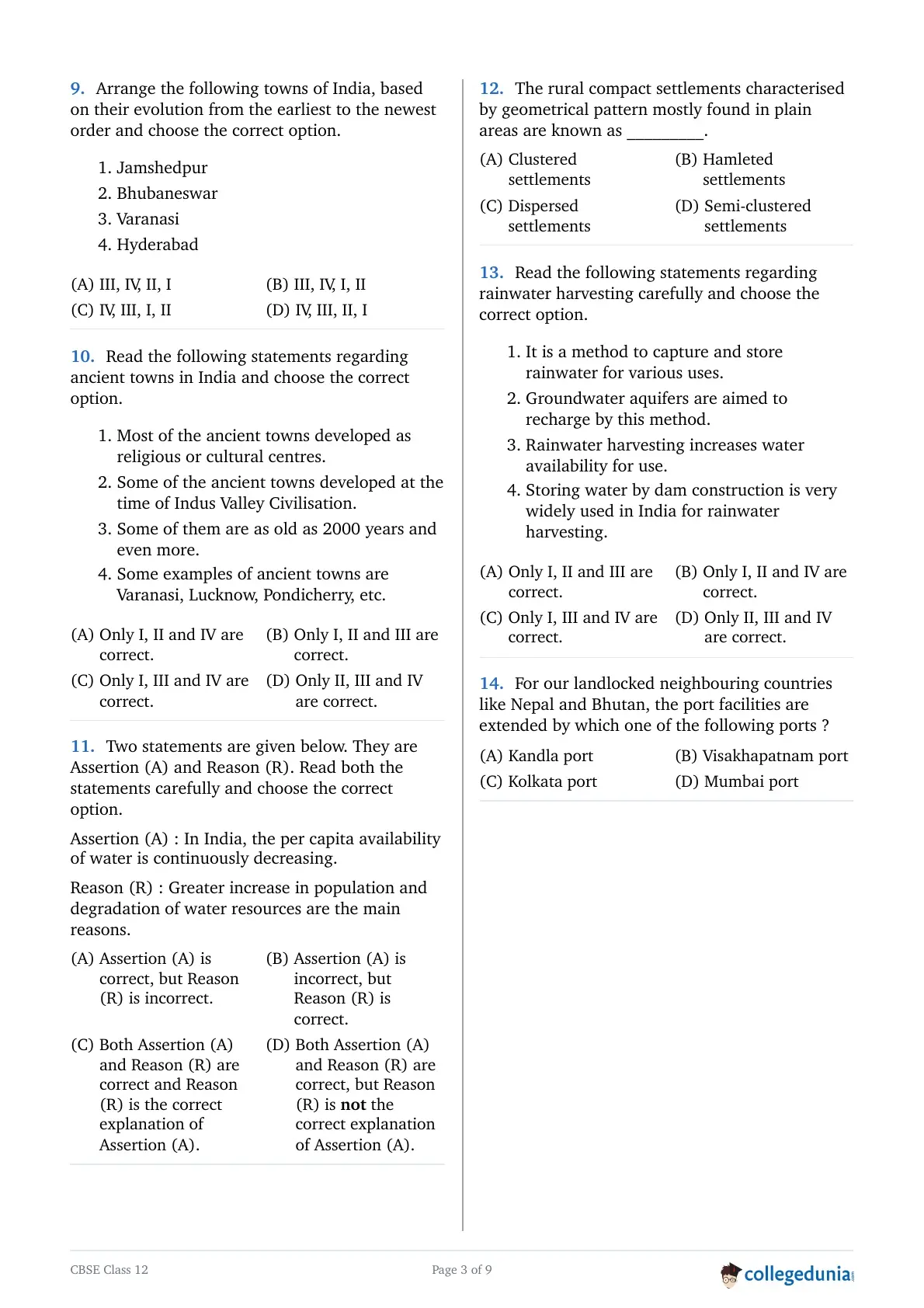
Arrange the following towns of India, based on their evolution from the earliest to the newest order and choose the correct option.
- Jamshedpur
- Bhubaneswar
- Varanasi
- Hyderabad
Read the following statements regarding ancient towns in India and choose the correct option.
- Most of the ancient towns developed as religious or cultural centres.
- Some of the ancient towns developed at the time of Indus Valley Civilisation.
- Some of them are as old as 2000 years and even more.
- Some examples of ancient towns are Varanasi, Lucknow, Pondicherry, etc.
Two statements are given below. They are Assertion (A) and Reason (R). Read both the statements carefully and choose the correct option.
Assertion (A) : In India, the per capita availability of water is continuously decreasing.
Reason (R) : Greater increase in population and degradation of water resources are the main reasons.
The rural compact settlements characterised by geometrical pattern mostly found in plain areas are known as _________.
Read the following statements regarding rainwater harvesting carefully and choose the correct option.
- It is a method to capture and store rainwater for various uses.
- Groundwater aquifers are aimed to recharge by this method.
- Rainwater harvesting increases water availability for use.
- Storing water by dam construction is very widely used in India for rainwater harvesting.
For our landlocked neighbouring countries like Nepal and Bhutan, the port facilities are extended by which one of the following ports ?
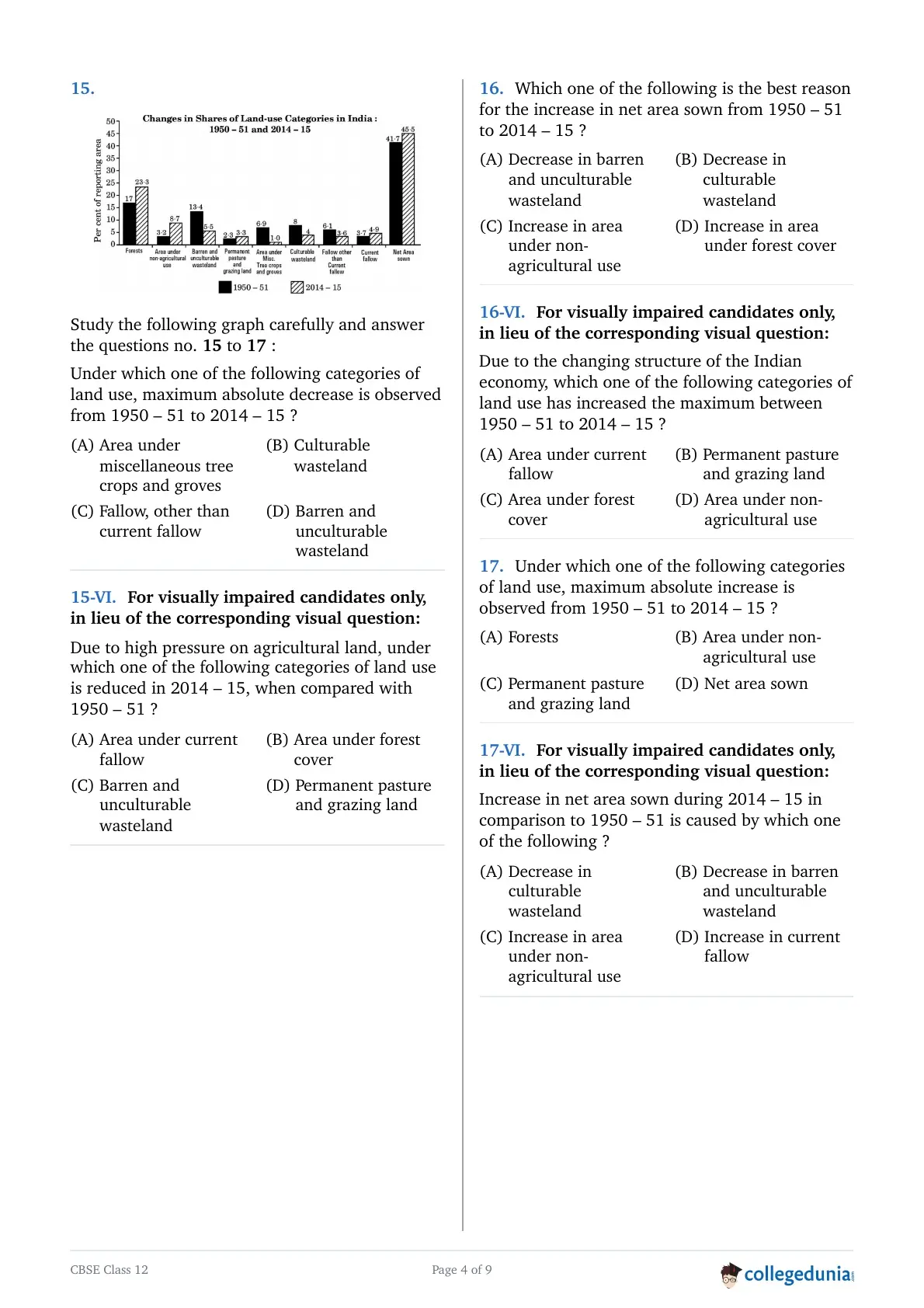
Study the following graph carefully and answer the questions no. 15 to 17 :
Under which one of the following categories of land use, maximum absolute decrease is observed from 1950 – 51 to 2014 – 15 ?
Study the following graph carefully and answer the questions no. 15 to 17 :
Which one of the following is the best reason for the increase in net area sown from 1950 – 51 to 2014 – 15 ?
Study the following graph carefully and answer the questions no. 15 to 17 :
Under which one of the following categories of land use, maximum absolute increase is observed from 1950 – 51 to 2014 – 15 ?
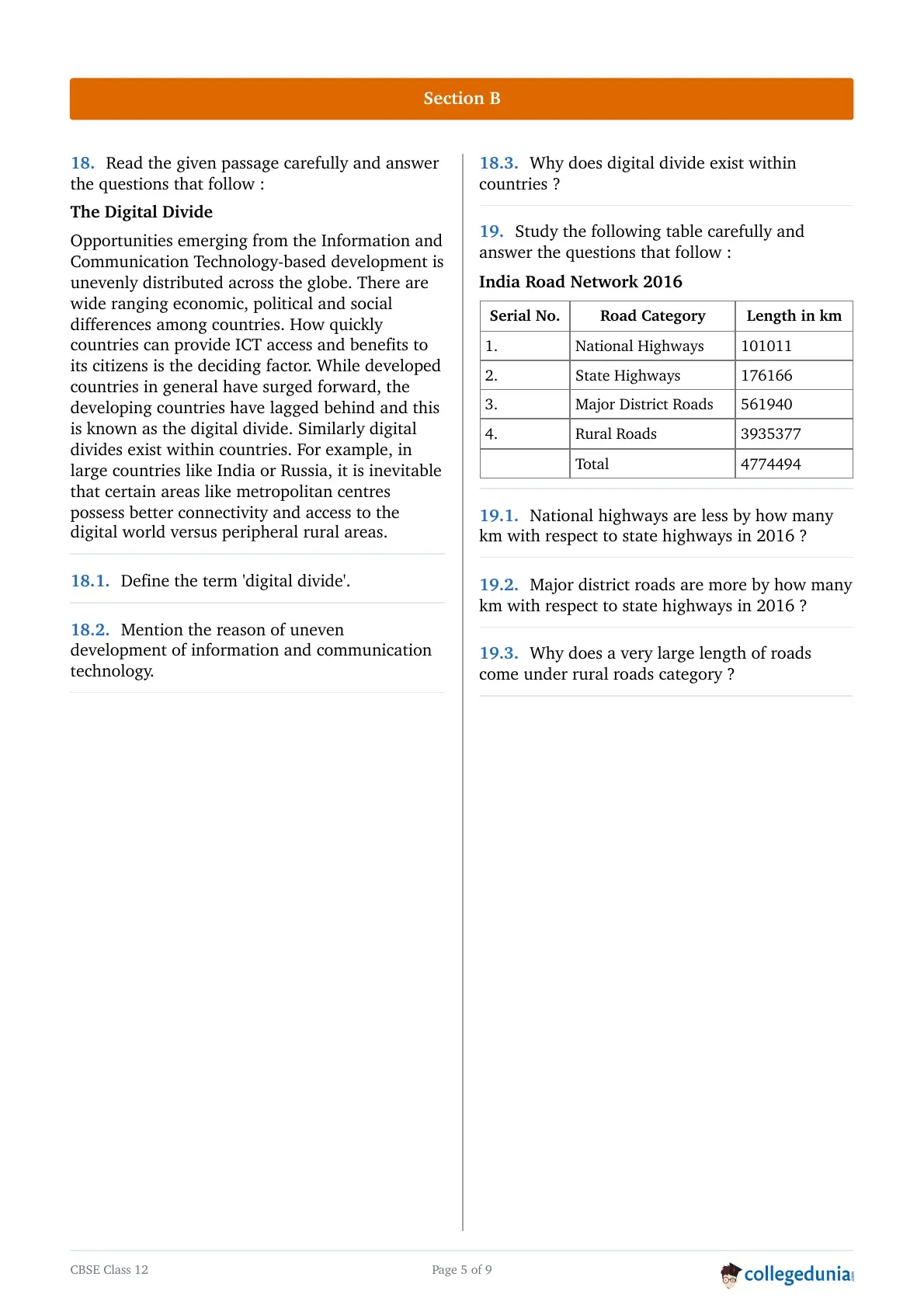
Define the term 'digital divide'.
Mention the reason of uneven development of information and communication technology.
Why does digital divide exist within countries ?
National highways are less by how many km with respect to state highways in 2016 ?
Major district roads are more by how many km with respect to state highways in 2016 ?
Why does a very large length of roads come under rural roads category ?
Explain any three economic factors influencing the distribution of world population.
Explain the three components of change in world population.
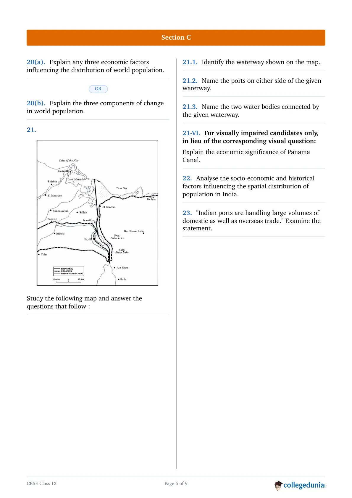
Identify the waterway shown on the map.
Name the ports on either side of the given waterway.
Name the two water bodies connected by the given waterway.
Analyse the socio-economic and historical factors influencing the spatial distribution of population in India.
"Indian ports are handling large volumes of domestic as well as overseas trade." Examine the statement.
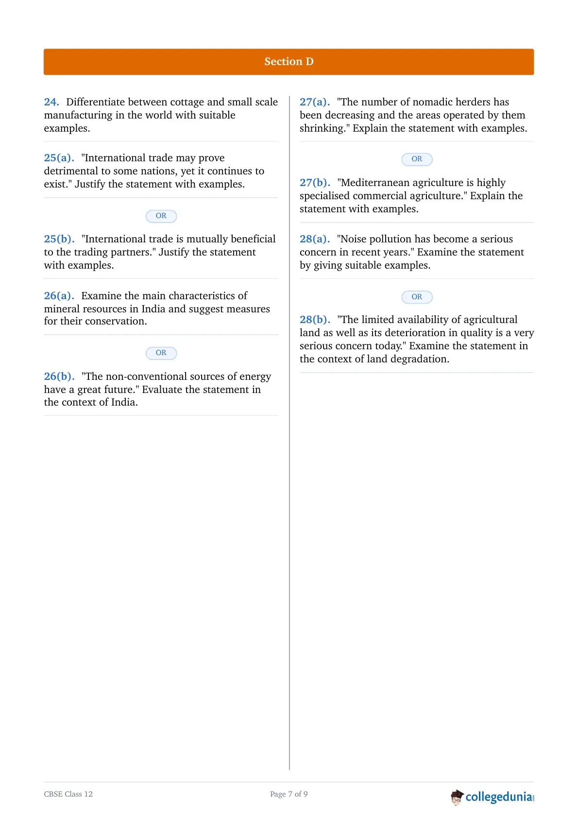
Differentiate between cottage and small scale manufacturing in the world with suitable examples.
"International trade may prove detrimental to some nations, yet it continues to exist." Justify the statement with examples.
"International trade is mutually beneficial to the trading partners." Justify the statement with examples.
Examine the main characteristics of mineral resources in India and suggest measures for their conservation.
"The non-conventional sources of energy have a great future." Evaluate the statement in the context of India.
"The number of nomadic herders has been decreasing and the areas operated by them shrinking." Explain the statement with examples.
"Mediterranean agriculture is highly specialised commercial agriculture." Explain the statement with examples.
"Noise pollution has become a serious concern in recent years." Examine the statement by giving suitable examples.
"The limited availability of agricultural land as well as its deterioration in quality is a very serious concern today." Examine the statement in the context of land degradation.
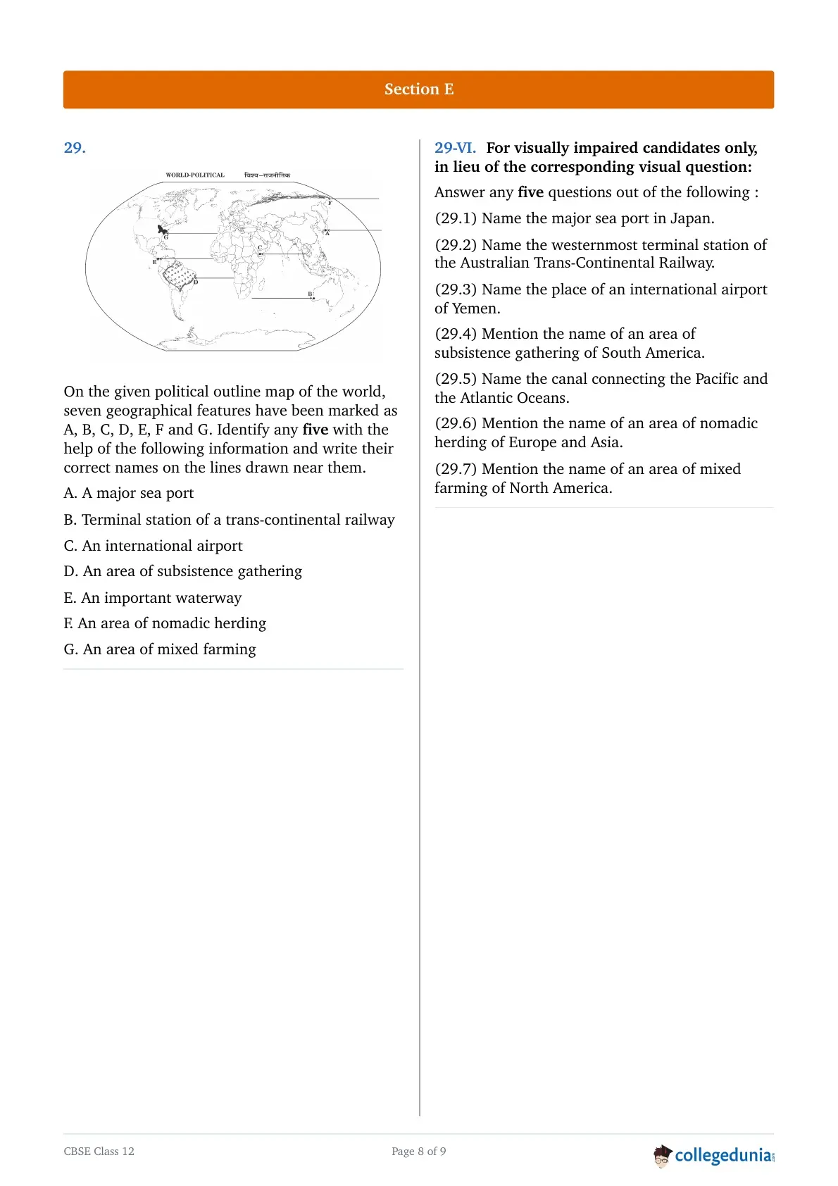
On the given political outline map of the world (on page 25), seven geographical features have been marked as A, B, C, D, E, F and G. Identify any five with the help of the following information and write their correct names on the lines drawn near them.
A. A major sea port
B. Terminal station of a trans-continental railway
C. An international airport
D. An area of subsistence gathering
E. An important waterway
F. An area of nomadic herding
G. An area of mixed farming
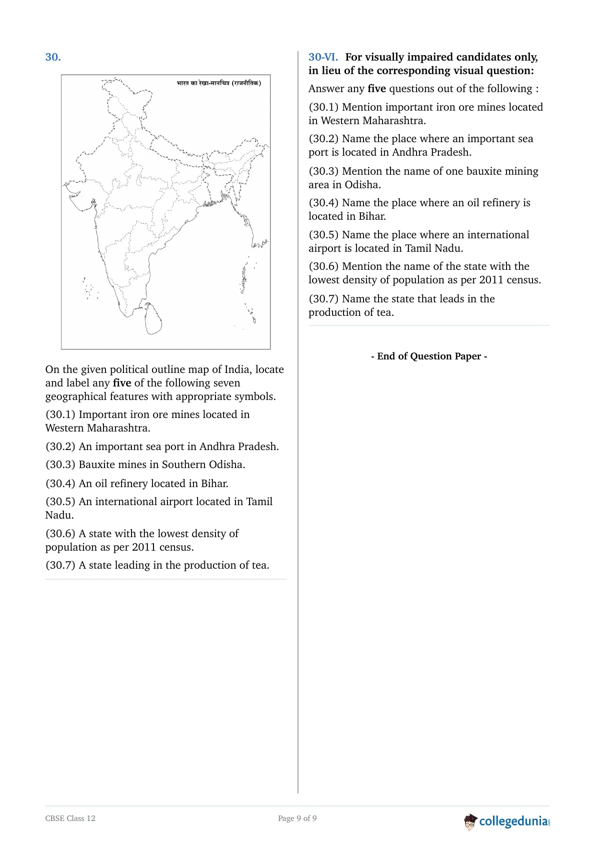
On the given political outline map of India (on page 27), locate and label any five of the following seven geographical features with appropriate symbols.
(30.1) Important iron ore mines located in Western Maharashtra.
(30.2) An important sea port in Andhra Pradesh.
(30.3) Bauxite mines in Southern Odisha.
(30.4) An oil refinery located in Bihar.
(30.5) An international airport located in Tamil Nadu.
(30.6) A state with the lowest density of population as per 2011 census.
(30.7) A state leading in the production of tea.
CBSE Class 12 Geography 2025 Question Paper Details
| Exam | CBSE Class 12 Board Examination 2025 |
| Subject | Geography |
| Paper code | 64/S/3 (Compartment) |
| Exam date | July 15, 2025 |
| Time allowed | 3 hours (plus 15 minutes of reading time, 10:15 AM to 10:30 AM) |
| Maximum marks | 70 |
| Total questions | 30 (attempt 30) |
CBSE Class 12 Geography Question Paper Pattern and Marking Scheme
The CBSE Class 12 Geography 2025 question paper is of 70 marks and has 30 questions, of which 30 are to be attempted. The tables below give the section-wise paper pattern and the split of marks, as printed in the official question paper.
CBSE Class 12 Geography Question Paper Pattern 2025
| Section | Questions | Question Type | Choice | Marks per Question | Marks |
|---|---|---|---|---|---|
| Section A | Q1-Q17 | Multiple choice questions (MCQs) | All 17 | 1 | 17 |
| Section B | Q18-Q19 | Source-based questions | All 2 | 3 | 6 |
| Section C | Q20-Q23 | Short answer type questions (80 to 100 words), with internal choice in some | All 4 | 3 | 12 |
| Section D | Q24-Q28 | Long answer type questions (120 to 150 words), with internal choice in some | All 5 | 5 | 25 |
| Section E | Q29-Q30 | Map-based questions | All 2 | 5 | 10 |
| Total | 30 questions | Attempt 30 | 70 |
CBSE Class 12 Geography Marks Distribution 2025
| Question Type | Questions to Attempt | Marks per Question | Total Marks |
|---|---|---|---|
| Multiple choice questions (MCQs) (Section A) | 17 | 1 | 17 |
| Source-based questions (Section B) | 2 | 3 | 6 |
| Short answer type questions (80 to 100 words), with internal choice in some (Section C) | 4 | 3 | 12 |
| Long answer type questions (120 to 150 words), with internal choice in some (Section D) | 5 | 5 | 25 |
| Map-based questions (Section E) | 2 | 5 | 10 |
| Total | 30 | 70 |



Comments