The NCERT Solutions for Class 11 Geography Chapter 15 India Location cover every exercise question from the latest 2026-27 NCERT book. The chapter explains India's latitudinal and longitudinal extent, Indian Standard Time, coastline, neighbouring countries and map-based project work.
The PDF solves 3 exercise and activity groups from India Location.
Key facts include 8°4′N to 37°6′N, Bangladesh as the longest land-frontier neighbour, China as a larger country and 82°30′E as India's standard meridian.
Use the embedded question cards below for direct answers, expert explanations and the atlas or census references needed for the activity.
Student Feedback: In a Collegedunia student survey of 12,080 Class 11 Geography students before the 2026 exams, many students said this chapter becomes easier when location facts are revised in two columns: coordinate facts and their practical effects on time, climate, trade and administration.
Each answer in this Class 11 Geography Chapter 15 solutions PDF follows the 2026-27 NCERT exercise and keeps the wording school-exam ready.
The exercise asks students to connect map facts with everyday effects. MCQs test fixed textbook facts, short answers test time, coastline and latitude, and the activity checks atlas and census-table reading.
Exercise area
Questions
What it checks
MCQs
4 parts
Latitude, longest land frontier, area rank and standard meridian
Short answers
4 parts
Time zones, coastline uses, latitude advantages and common clock time
Project work
1 activity group
District graphs, density comparison, coastal units and boundary-state sequence
The MCQ key used in the PDF is (b), (a), (a), and (b). These answers match the official NCERT map facts and the standard answer keys checked during PDF preparation.
India's location is studied through absolute position and relative position. Absolute position uses latitude and longitude. Relative position explains how India connects with the Indian Ocean, neighbouring countries and world trade routes.
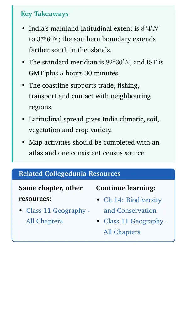
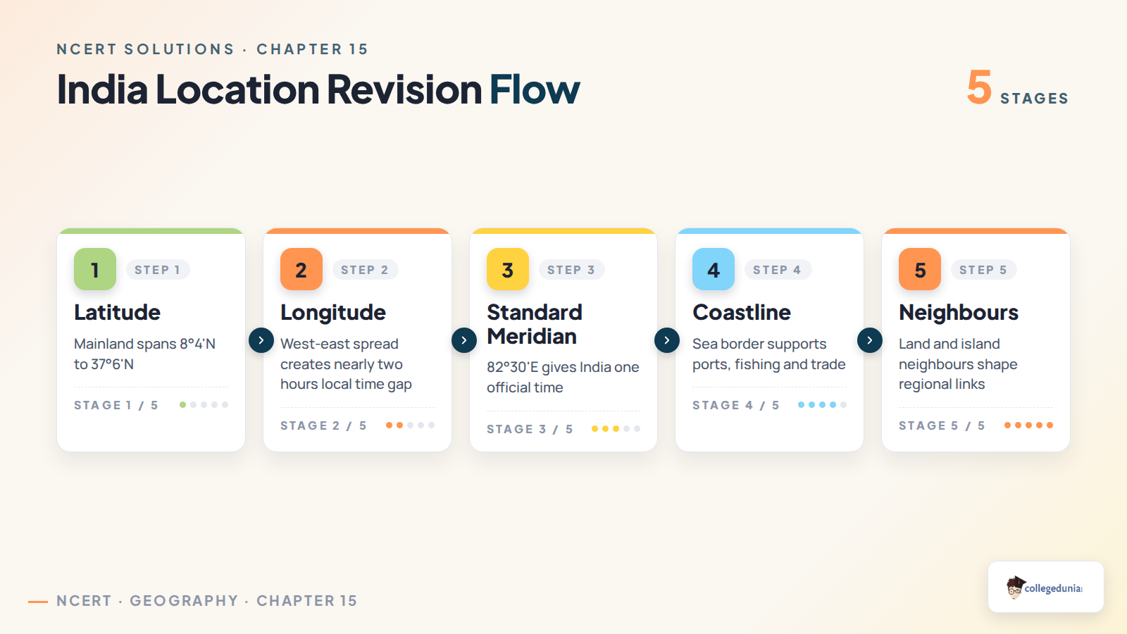
Latitude: the mainland extends from 8°4′N to 37°6′N.
Longitude: the country spreads across about 30 degrees from west to east.
Standard meridian: 82°30′E is used for Indian Standard Time.
Relative position: the coastline and central Indian Ocean location support trade, ports, fishing and strategic contact.
For short answers, write the map fact first and then write its effect on climate, time, transport or people.
Latitude, Longitude and Standard Time in India Location
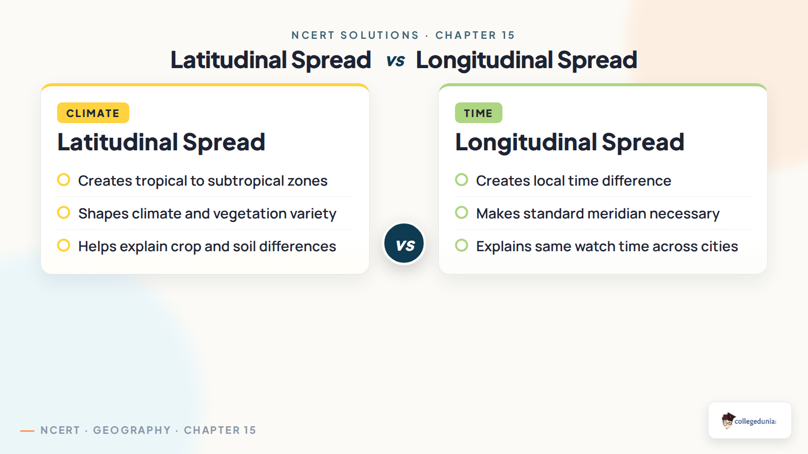
Latitudinal spread affects climate, vegetation, crop variety and regional temperature. Longitudinal spread affects local time. Since the sun rises earlier in the east, places such as Kohima receive daylight earlier than places farther west, but the country follows one official time based on the standard meridian.
Spread
Main effect
Answer cue
Latitudinal spread
Creates tropical to subtropical conditions
Climate, crops, forests and soils vary
Longitudinal spread
Creates local time differences
Eastern sunrise is earlier than western sunrise
Standard meridian
Gives one official clock time
Kohima and New Delhi show the same watch time
Coastline, Neighbours and Map Work in India Location
A long coastline gives India maritime trade, ports, fishing grounds, salt production, tourism, naval reach and contact with island neighbours. It also creates coastal-management needs because cyclones, storm surges and erosion affect coastal settlements.
Longest land frontier: Bangladesh shares the longest land boundary with India among the NCERT options.
Larger country in MCQs: China is larger than India in area among the four listed choices.
Project work: use an atlas and census table instead of guessing district, area, density and coastal-unit patterns.
Exam tip: Do not write only a place name in project answers. Add the source used, such as atlas map, census table or state map.
How to Use the Class 11 Geography Chapter 15 Solutions PDF
Use the PDF in two rounds. First, memorise the four MCQ facts. Then practise the short answers by pairing each location fact with one practical effect.
For standard time, connect 82°30′E with national coordination.
For coastline, include economic uses and coastal-risk management.
For latitude, write climate and resource diversity.
For map work, support every answer with atlas or census evidence.
Quick recall: latitude explains climate variety, longitude explains time difference, and coastline explains maritime advantage.
All NCERT Solutions for Class 11 Geography Chapter 15 India Location with Step-by-Step Solutions
The cards below include every exercise question. Use Check Solution for the direct answer and Expert Solution for a second explanation.
Each card keeps the direct answer and expert explanation separate.
Use the atlas and census cues beside the related short-answer and project-work parts.
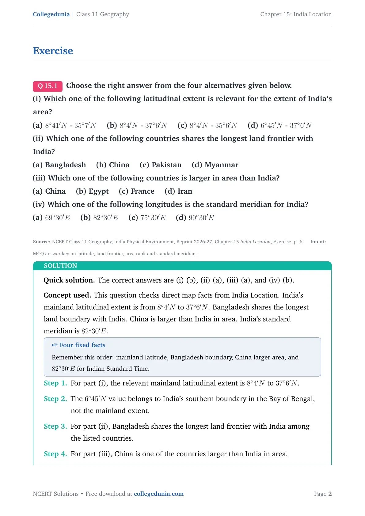
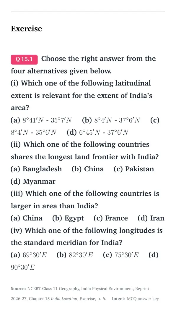
Q 15.1
Choose the right answer from the four alternatives given below.
(i) Which one of the following latitudinal extent is relevant for the extent of India's area?
(a) 8∘41'N - 35∘7'N (b) 8∘4'N - 37∘6'N (c) 8∘4'N - 35∘6'N (d) 6∘45'N - 37∘6'N
(ii) Which one of the following countries shares the longest land frontier with India?
(a) Bangladesh (b) China (c) Pakistan (d) Myanmar
(iii) Which one of the following countries is larger in area than India?
(a) China (b) Egypt (c) France (d) Iran
(iv) Which one of the following longitudes is the standard meridian for India?
(a) 69∘30'E (b) 82∘30'E (c) 75∘30'E (d) 90∘30'E
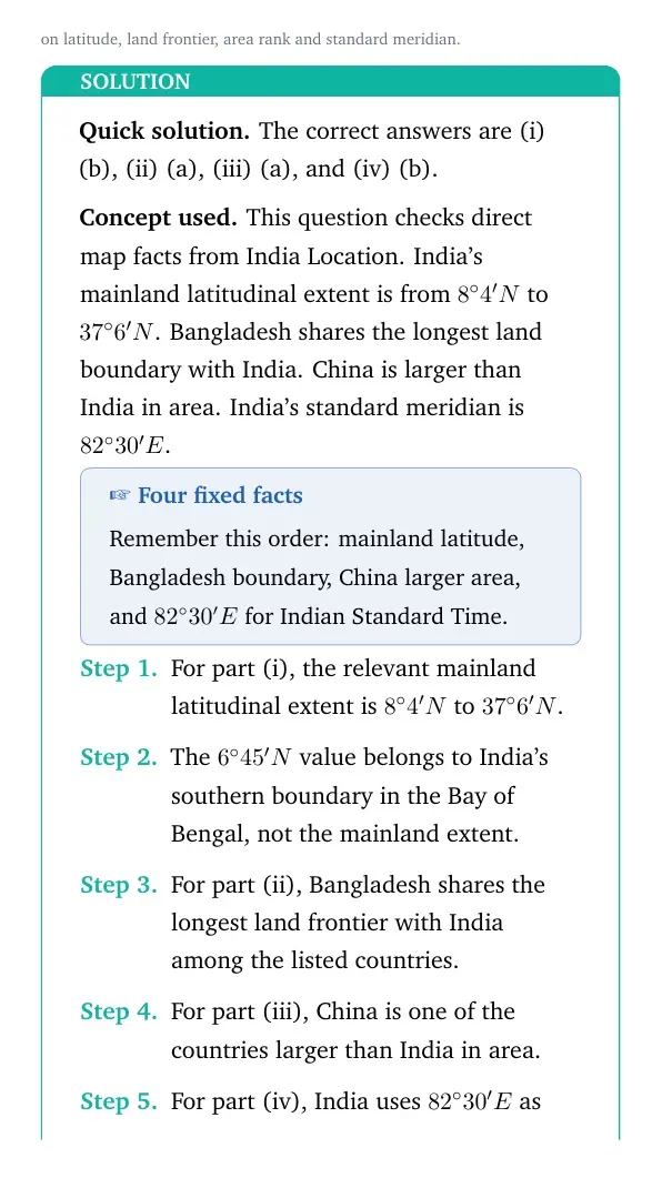
The correct answers are (i) (b), (ii) (a), (iii) (a), and (iv) (b).
Concept used. This question checks direct map facts from India Location. India's mainland latitudinal extent is from 8∘4'N to 37∘6'N. Bangladesh shares the longest land boundary with India. China is larger than India in area. India's standard meridian is 82∘30'E.
Four fixed facts
Remember this order: mainland latitude, Bangladesh boundary, China larger area, and 82∘30'E for Indian Standard Time.
For part (i), the relevant mainland latitudinal extent is 8∘4'N to 37∘6'N.
The 6∘45'N value belongs to India's southern boundary in the Bay of Bengal, not the mainland extent.
For part (ii), Bangladesh shares the longest land frontier with India among the listed countries.
For part (iii), China is one of the countries larger than India in area.
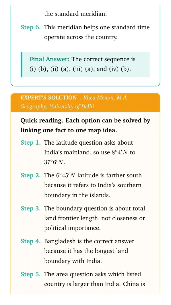
For part (iv), India uses 82∘30'E as the standard meridian.
This meridian helps one standard time operate across the country.
The correct sequence is (i) (b), (ii) (a), (iii) (a), and (iv) (b).
RM
Rhea Menon
M.A. Geography, University of Delhi
Verified Expert
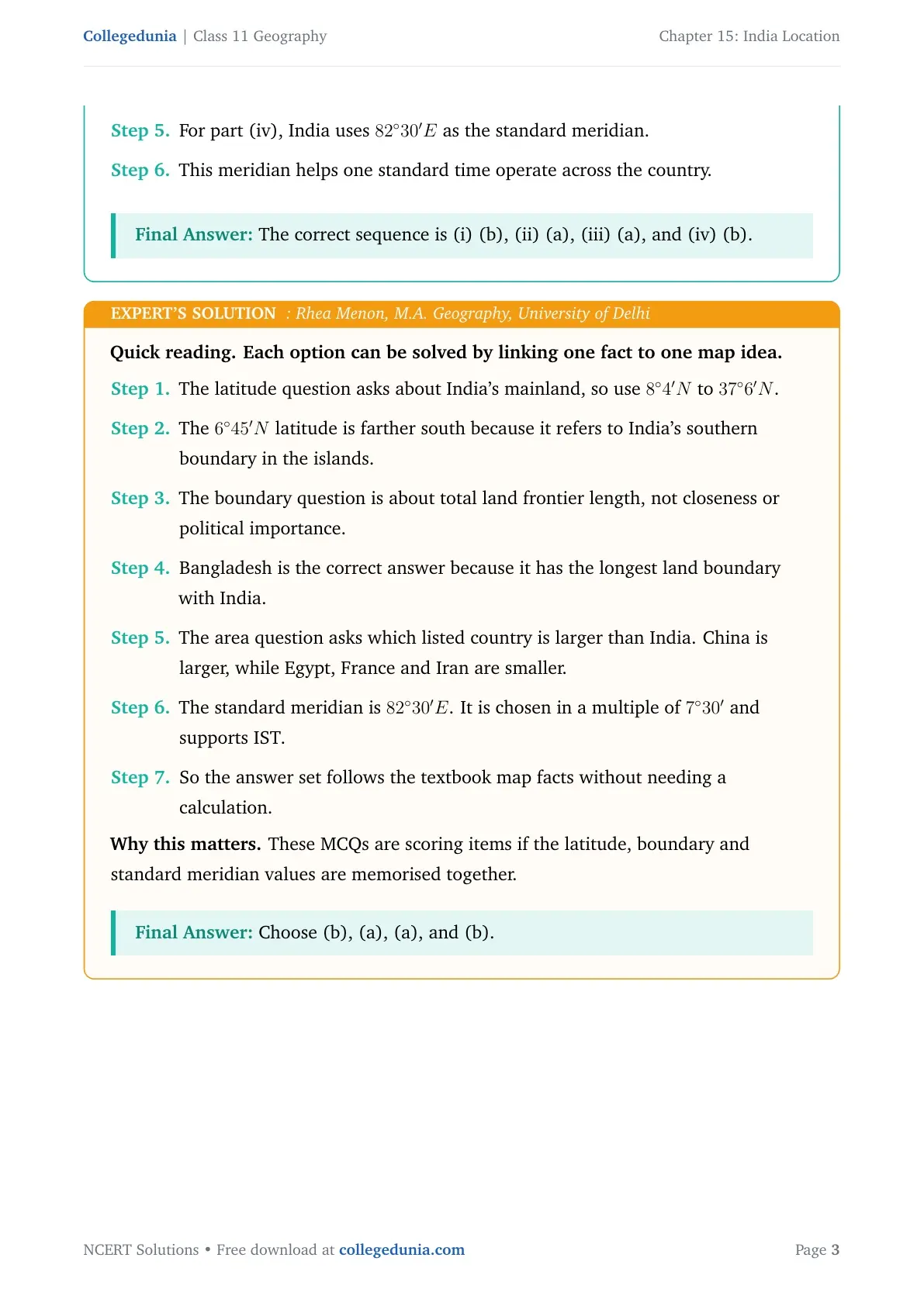
Quick reading. Each option can be solved by linking one fact to one map idea.
The latitude question asks about India's mainland, so use 8∘4'N to 37∘6'N.
The 6∘45'N latitude is farther south because it refers to India's southern boundary in the islands.
The boundary question is about total land frontier length, not closeness or political importance.
Bangladesh is the correct answer because it has the longest land boundary with India.
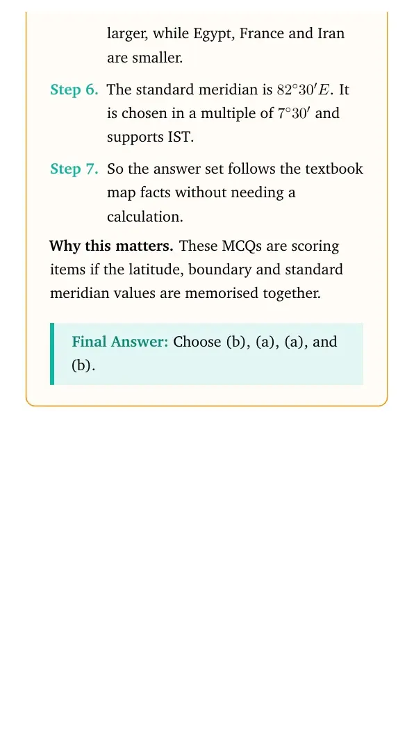
The area question asks which listed country is larger than India. China is larger, while Egypt, France and Iran are smaller.
The standard meridian is 82∘30'E. It is chosen in a multiple of 7∘30' and supports IST.
So the answer set follows the textbook map facts without needing a calculation.
Why this matters. These MCQs are scoring items if the latitude, boundary and standard meridian values are memorised together.
Choose (b), (a), (a), and (b).
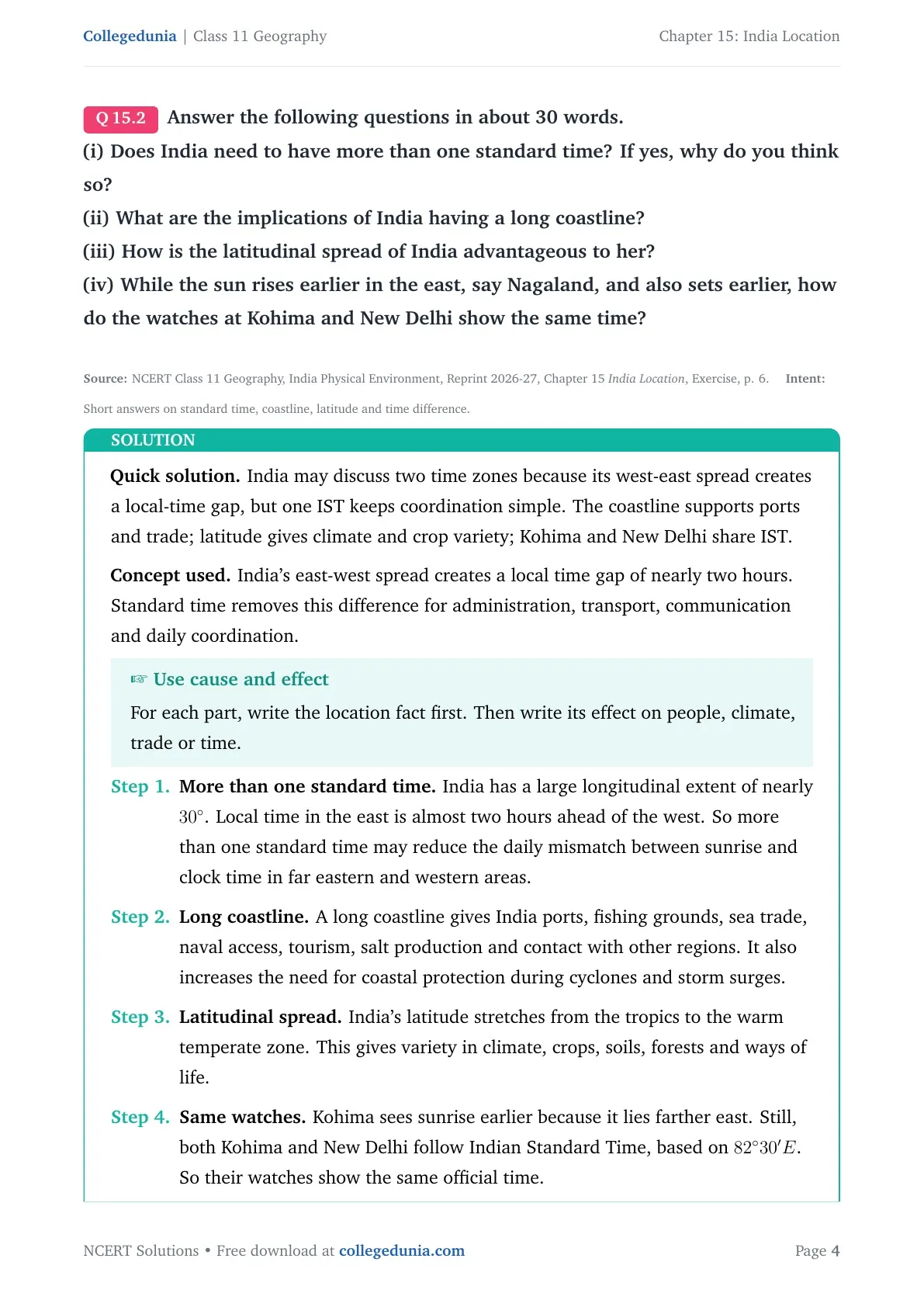
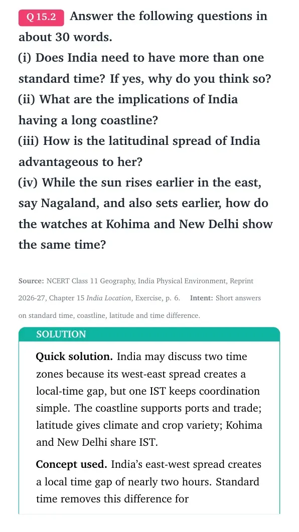
Q 15.2
Answer the following questions in about 30 words.
(i) Does India need to have more than one standard time? If yes, why do you think so?
(ii) What are the implications of India having a long coastline?
(iii) How is the latitudinal spread of India advantageous to her?
(iv) While the sun rises earlier in the east, say Nagaland, and also sets earlier, how do the watches at Kohima and New Delhi show the same time?
India may discuss two time zones because its west-east spread creates a local-time gap, but one IST keeps coordination simple. The coastline supports ports and trade; latitude gives climate and crop variety; Kohima and New Delhi share IST.
Concept used. India's east-west spread creates a local time gap of nearly two hours. Standard time removes this difference for administration, transport, communication and daily coordination.
Use cause and effect
For each part, write the location fact first. Then write its effect on people, climate, trade or time.
More than one standard time. India has a large longitudinal extent of nearly 30∘. Local time in the east is almost two hours ahead of the west. So more than one standard time may reduce the daily mismatch between sunrise and clock time in far eastern and western areas.
Long coastline. A long coastline gives India ports, fishing grounds, sea trade, naval access, tourism, salt production and contact with other regions. It also increases the need for coastal protection during cyclones and storm surges.
Latitudinal spread. India's latitude stretches from the tropics to the warm temperate zone. This gives variety in climate, crops, soils, forests and ways of life.
Same watches. Kohima sees sunrise earlier because it lies farther east. Still, both Kohima and New Delhi follow Indian Standard Time, based on 82∘30'E. So their watches show the same official time.
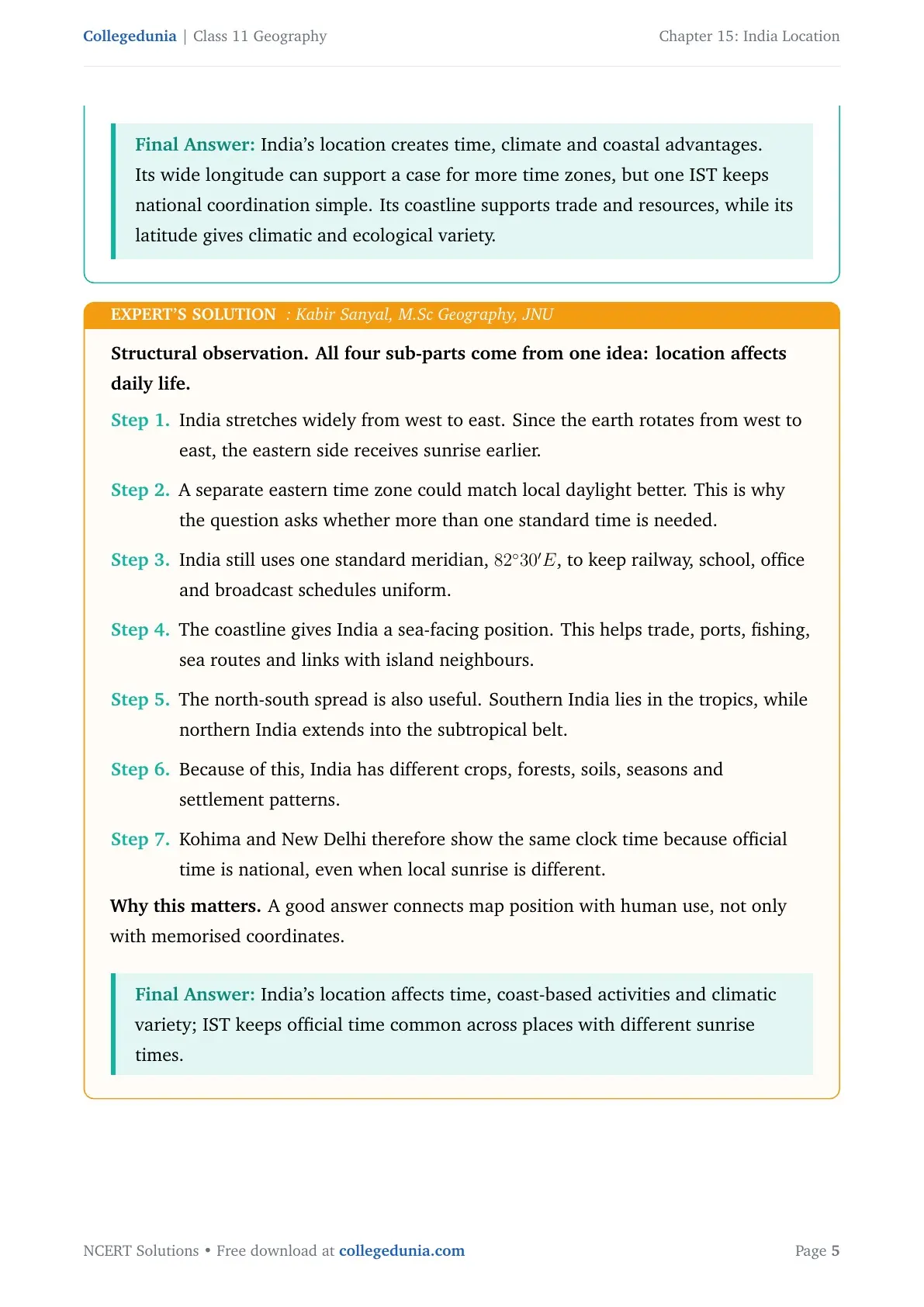
India's location creates time, climate and coastal advantages. Its wide longitude can support a case for more time zones, but one IST keeps national coordination simple. Its coastline supports trade and resources, while its latitude gives climatic and ecological variety.
KS
Kabir Sanyal
M.Sc Geography, JNU
Verified Expert
Structural observation. All four sub-parts come from one idea: location affects daily life.
India stretches widely from west to east. Since the earth rotates from west to east, the eastern side receives sunrise earlier.
A separate eastern time zone could match local daylight better. This is why the question asks whether more than one standard time is needed.
India still uses one standard meridian, 82∘30'E, to keep railway, school, office and broadcast schedules uniform.
The coastline gives India a sea-facing position. This helps trade, ports, fishing, sea routes and links with island neighbours.
The north-south spread is also useful. Southern India lies in the tropics, while northern India extends into the subtropical belt.
Because of this, India has different crops, forests, soils, seasons and settlement patterns.
Kohima and New Delhi therefore show the same clock time because official time is national, even when local sunrise is different.
Why this matters. A good answer connects map position with human use, not only with memorised coordinates.
India's location affects time, coast-based activities and climatic variety; IST keeps official time common across places with different sunrise times.
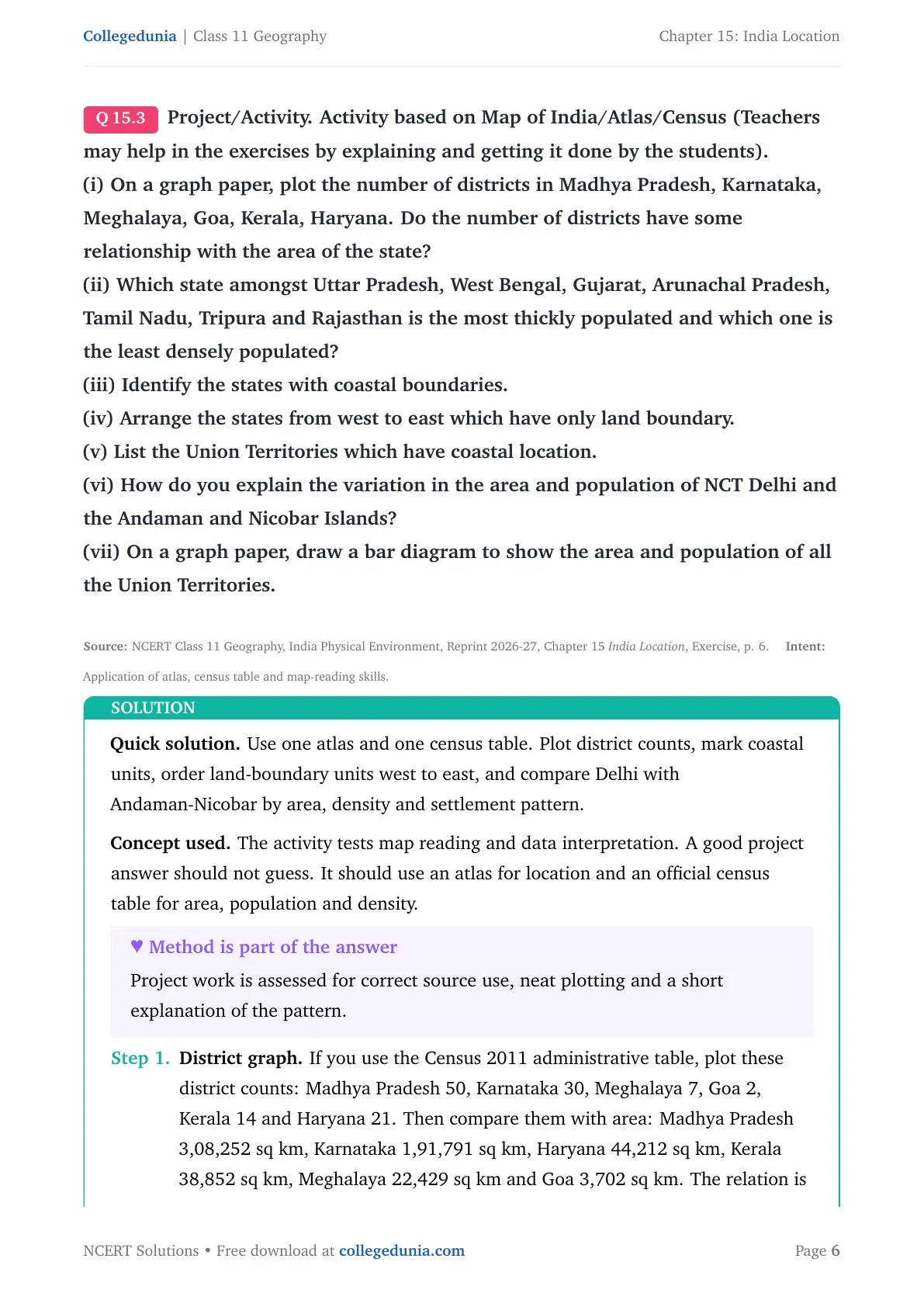
Q 15.3
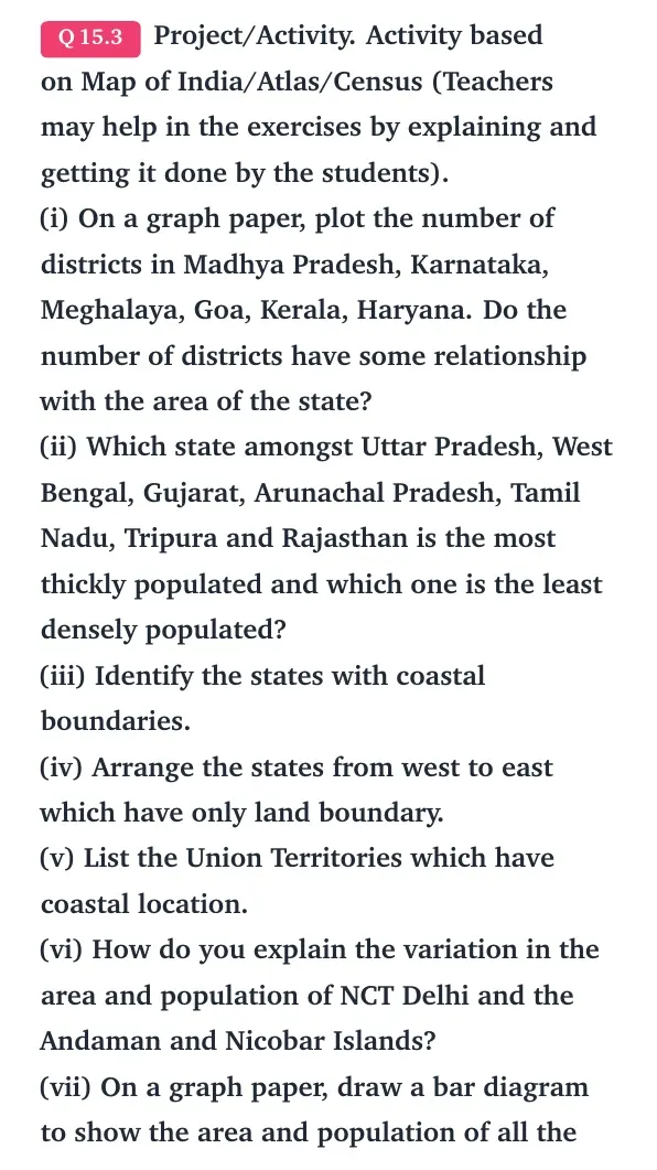
Project/Activity. Activity based on Map of India/Atlas/Census (Teachers may help in the exercises by explaining and getting it done by the students).
(i) On a graph paper, plot the number of districts in Madhya Pradesh, Karnataka, Meghalaya, Goa, Kerala, Haryana. Do the number of districts have some relationship with the area of the state?
(ii) Which state amongst Uttar Pradesh, West Bengal, Gujarat, Arunachal Pradesh, Tamil Nadu, Tripura and Rajasthan is the most thickly populated and which one is the least densely populated?
(iii) Identify the states with coastal boundaries.
(iv) Arrange the states from west to east which have only land boundary.
(v) List the Union Territories which have coastal location.
(vi) How do you explain the variation in the area and population of NCT Delhi and the Andaman and Nicobar Islands?
(vii) On a graph paper, draw a bar diagram to show the area and population of all the Union Territories.
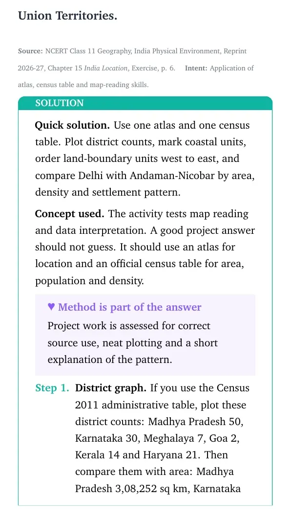
Use one atlas and one census table. Plot district counts, mark coastal units, order land-boundary units west to east, and compare Delhi with Andaman-Nicobar by area, density and settlement pattern.
Concept used. The activity tests map reading and data interpretation. A good project answer should not guess. It should use an atlas for location and an official census table for area, population and density.
Method is part of the answer
Project work is assessed for correct source use, neat plotting and a short explanation of the pattern.
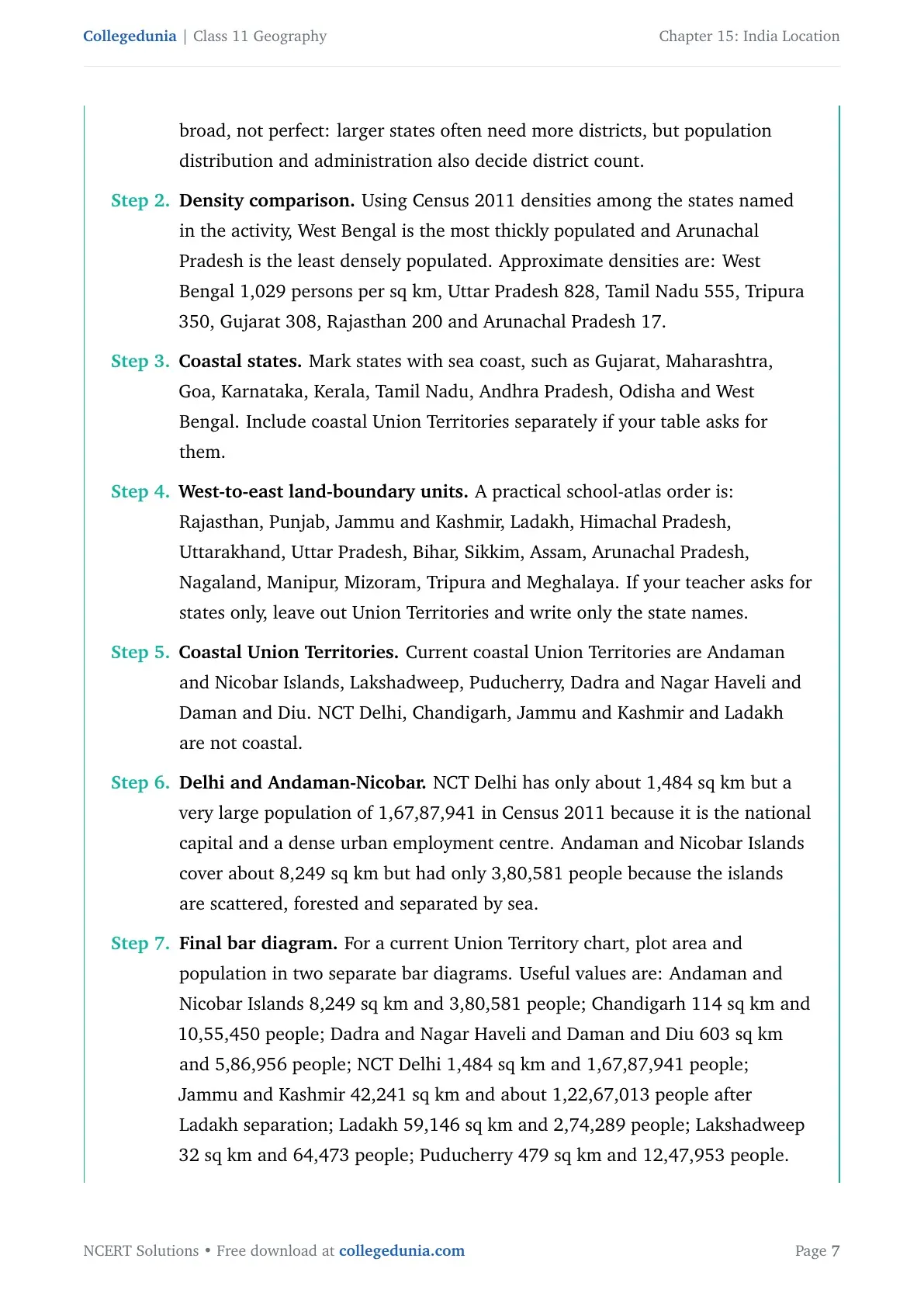
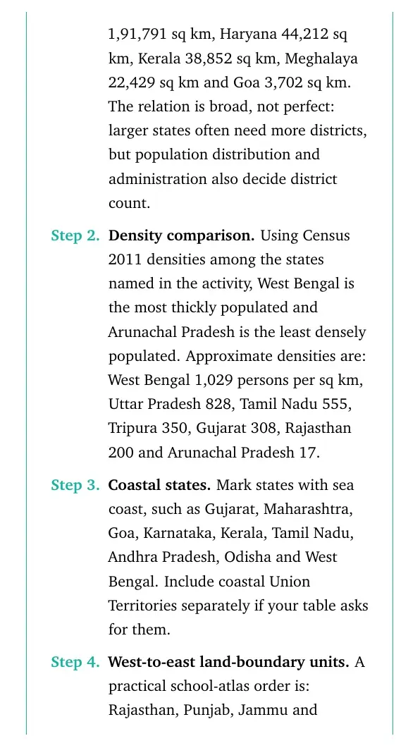
District graph. If you use the Census 2011 administrative table, plot these district counts: Madhya Pradesh 50, Karnataka 30, Meghalaya 7, Goa 2, Kerala 14 and Haryana 21. Then compare them with area: Madhya Pradesh 3,08,252 sq km, Karnataka 1,91,791 sq km, Haryana 44,212 sq km, Kerala 38,852 sq km, Meghalaya 22,429 sq km and Goa 3,702 sq km. The relation is broad, not perfect: larger states often need more districts, but population distribution and administration also decide district count.
Density comparison. Using Census 2011 densities among the states named in the activity, West Bengal is the most thickly populated and Arunachal Pradesh is the least densely populated. Approximate densities are: West Bengal 1,029 persons per sq km, Uttar Pradesh 828, Tamil Nadu 555, Tripura 350, Gujarat 308, Rajasthan 200 and Arunachal Pradesh 17.
Coastal states. Mark states with sea coast, such as Gujarat, Maharashtra, Goa, Karnataka, Kerala, Tamil Nadu, Andhra Pradesh, Odisha and West Bengal. Include coastal Union Territories separately if your table asks for them.
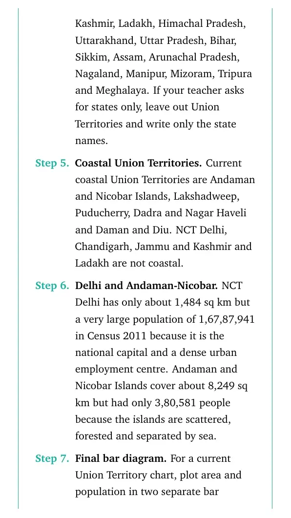
West-to-east land-boundary units. A practical school-atlas order is: Rajasthan, Punjab, Jammu and Kashmir, Ladakh, Himachal Pradesh, Uttarakhand, Uttar Pradesh, Bihar, Sikkim, Assam, Arunachal Pradesh, Nagaland, Manipur, Mizoram, Tripura and Meghalaya. If your teacher asks for states only, leave out Union Territories and write only the state names.
Coastal Union Territories. Current coastal Union Territories are Andaman and Nicobar Islands, Lakshadweep, Puducherry, Dadra and Nagar Haveli and Daman and Diu. NCT Delhi, Chandigarh, Jammu and Kashmir and Ladakh are not coastal.
Delhi and Andaman-Nicobar. NCT Delhi has only about 1,484 sq km but a very large population of 1,67,87,941 in Census 2011 because it is the national capital and a dense urban employment centre. Andaman and Nicobar Islands cover about 8,249 sq km but had only 3,80,581 people because the islands are scattered, forested and separated by sea.
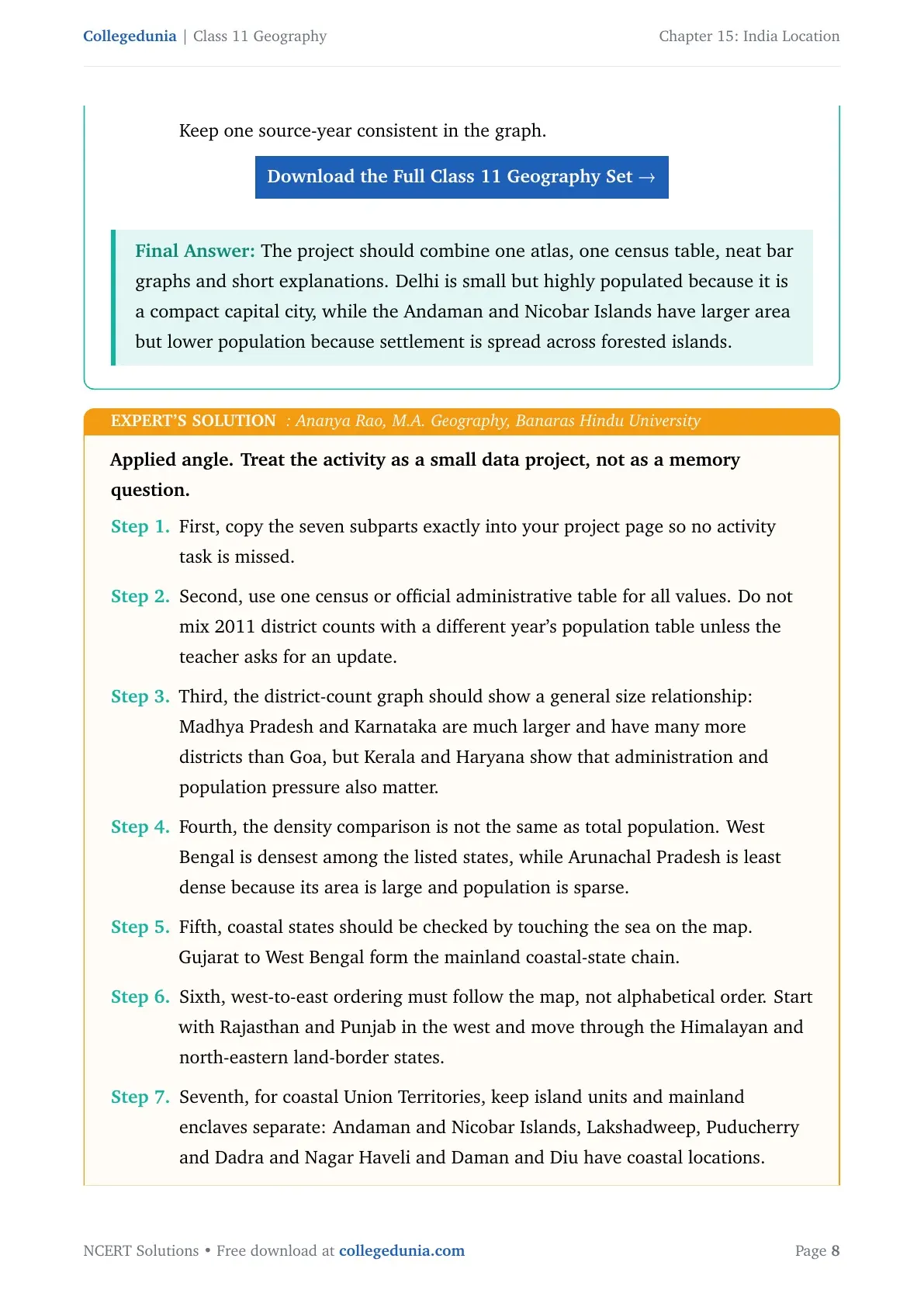
Final bar diagram. For a current Union Territory chart, plot area and population in two separate bar diagrams. Useful values are: Andaman and Nicobar Islands 8,249 sq km and 3,80,581 people; Chandigarh 114 sq km and 10,55,450 people; Dadra and Nagar Haveli and Daman and Diu 603 sq km and 5,86,956 people; NCT Delhi 1,484 sq km and 1,67,87,941 people; Jammu and Kashmir 42,241 sq km and about 1,22,67,013 people after Ladakh separation; Ladakh 59,146 sq km and 2,74,289 people; Lakshadweep 32 sq km and 64,473 people; Puducherry 479 sq km and 12,47,953 people. Keep one source-year consistent in the graph.
Download the Full Class 11 Geography Set
The project should combine one atlas, one census table, neat bar graphs and short explanations. Delhi is small but highly populated because it is a compact capital city, while the Andaman and Nicobar Islands have larger area but lower population because settlement is spread across forested islands.
AR
Ananya Rao
M.A. Geography, Banaras Hindu University
Verified Expert
Applied angle. Treat the activity as a small data project, not as a memory question.
First, copy the seven subparts exactly into your project page so no activity task is missed.
Second, use one census or official administrative table for all values. Do not mix 2011 district counts with a different year's population table unless the teacher asks for an update.
Third, the district-count graph should show a general size relationship: Madhya Pradesh and Karnataka are much larger and have many more districts than Goa, but Kerala and Haryana show that administration and population pressure also matter.
Fourth, the density comparison is not the same as total population. West Bengal is densest among the listed states, while Arunachal Pradesh is least dense because its area is large and population is sparse.
Fifth, coastal states should be checked by touching the sea on the map. Gujarat to West Bengal form the mainland coastal-state chain.
Sixth, west-to-east ordering must follow the map, not alphabetical order. Start with Rajasthan and Punjab in the west and move through the Himalayan and north-eastern land-border states.
Seventh, for coastal Union Territories, keep island units and mainland enclaves separate: Andaman and Nicobar Islands, Lakshadweep, Puducherry and Dadra and Nagar Haveli and Daman and Diu have coastal locations.
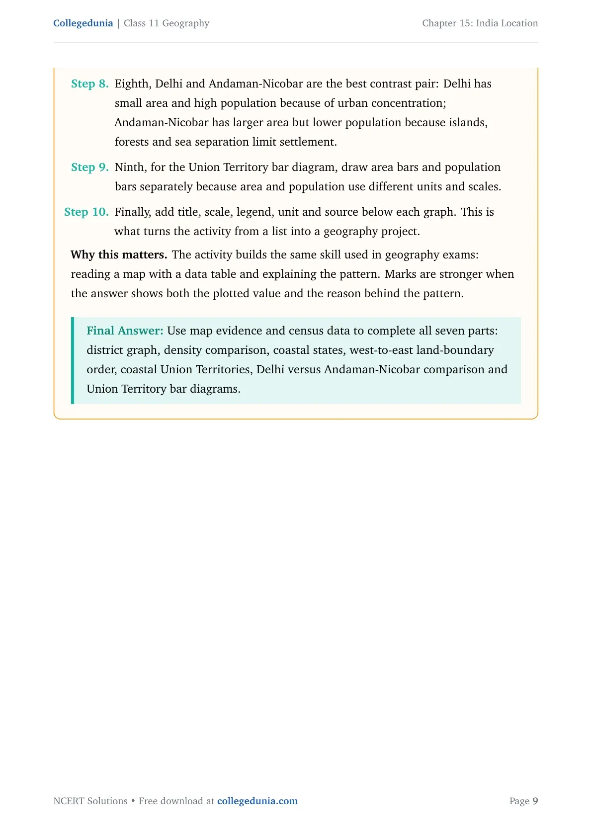
Eighth, Delhi and Andaman-Nicobar are the best contrast pair: Delhi has small area and high population because of urban concentration; Andaman-Nicobar has larger area but lower population because islands, forests and sea separation limit settlement.
Ninth, for the Union Territory bar diagram, draw area bars and population bars separately because area and population use different units and scales.
Finally, add title, scale, legend, unit and source below each graph. This is what turns the activity from a list into a geography project.
Why this matters. The activity builds the same skill used in geography exams: reading a map with a data table and explaining the pattern. Marks are stronger when the answer shows both the plotted value and the reason behind the pattern.
Use map evidence and census data to complete all seven parts: district graph, density comparison, coastal states, west-to-east land-boundary order, coastal Union Territories, Delhi versus Andaman-Nicobar comparison and Union Territory bar diagrams.
India Location Class 11 NCERT Solutions FAQs
Ques. How many questions are solved in Class 11 Geography Chapter 15 India Location?
Ans. The PDF solves all 3 exercise and activity groups from the 2026-27 NCERT Class 11 Geography Chapter 15 India Location textbook.
Ques. What is the standard meridian of India in this chapter?
Ans. India's standard meridian is 82°30′E. It is used to calculate Indian Standard Time and keeps one official clock time across the country.
Ques. Which country shares the longest land frontier with India?
Ans. Bangladesh shares the longest land frontier with India among the options given in the NCERT exercise.
Ques. Are these India Location solutions useful for the 2026-27 school exam?
Ans. Yes. The answers follow the latest 2026-27 NCERT exercise and explain coordinates, coastline, standard time and map-work tasks in Class 11 exam language.








Comments