




The class 10 geography handwritten notes chapter 1 Resources and Development have been carefully prepared and scanned for quick one-shot revision, according to the latest 2026-27 CBSE syllabus and Chapter 1 of Contemporary India II.

These pages turn the whole chapter, from resource classification to soil types and soil conservation, into clean notebook pages a student can skim in one sitting before a test.
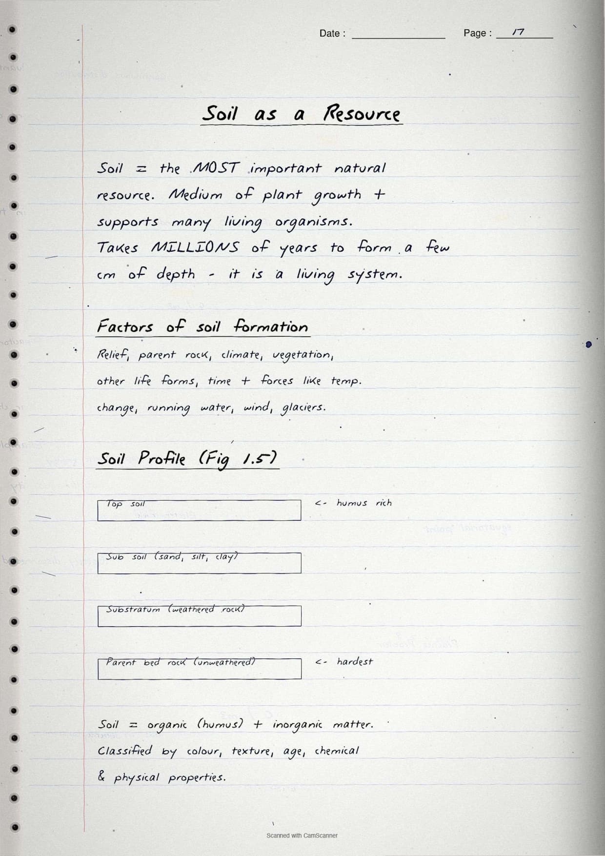
- Handwritten, scanned-style pages with boxed key terms, an India soil map sketch and a labelled soil profile.
- This Class 10 Geography chapter usually carries 3 to 5 marks in the Social Science board paper.
- Pairs with the NCERT Solutions, Notes and Book PDF for the same chapter, all linked lower on this page.
These Resources and Development handwritten notes are prepared from the official NCERT Contemporary India II textbook and checked against the last five years of CBSE Social Science board papers.
Student Feedback: In a Collegedunia poll of 11,400 Class 10 Social Science students before the 2026 boards, 76% of students said scanned handwritten notes felt faster to revise from than printed text for this chapter. Most students used the boxed soil-type list and the conservation-method box to recall the answer in the exam.
Source: 2026-27 Class 10 Social Science student poll. Sample of 11,400 students from CBSE schools across 14 states.
|
Table of Contents |
What These Handwritten Notes Include
Resources and Development is the first chapter of Contemporary India II. It explains what a resource is, how resources are classified, why resource planning matters, how land is used in India, and the six major soil types. Every page is built around the four threads the board paper tests:
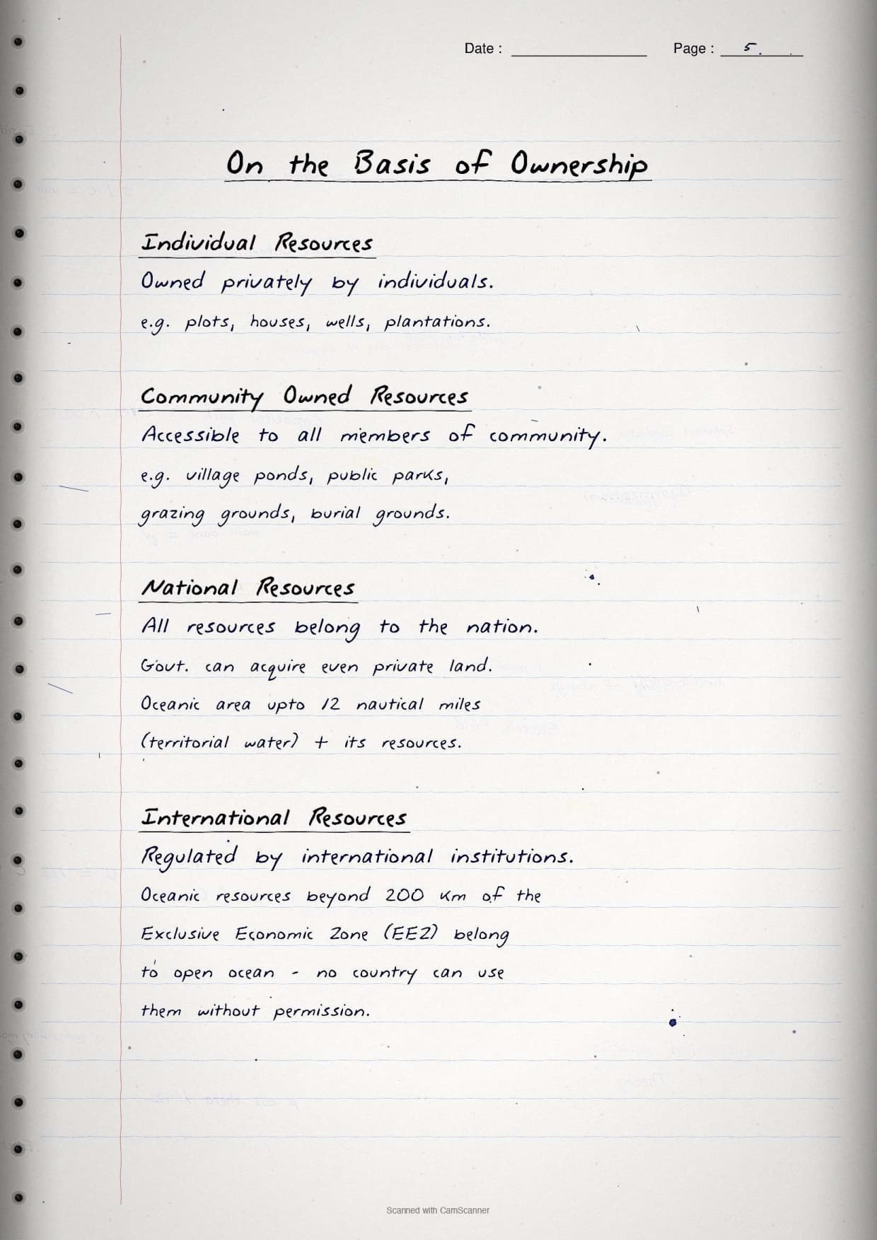
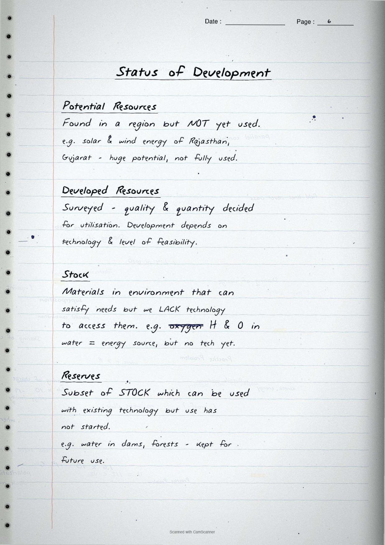
- Classification pages cover resources by origin, exhaustibility, ownership and development status.
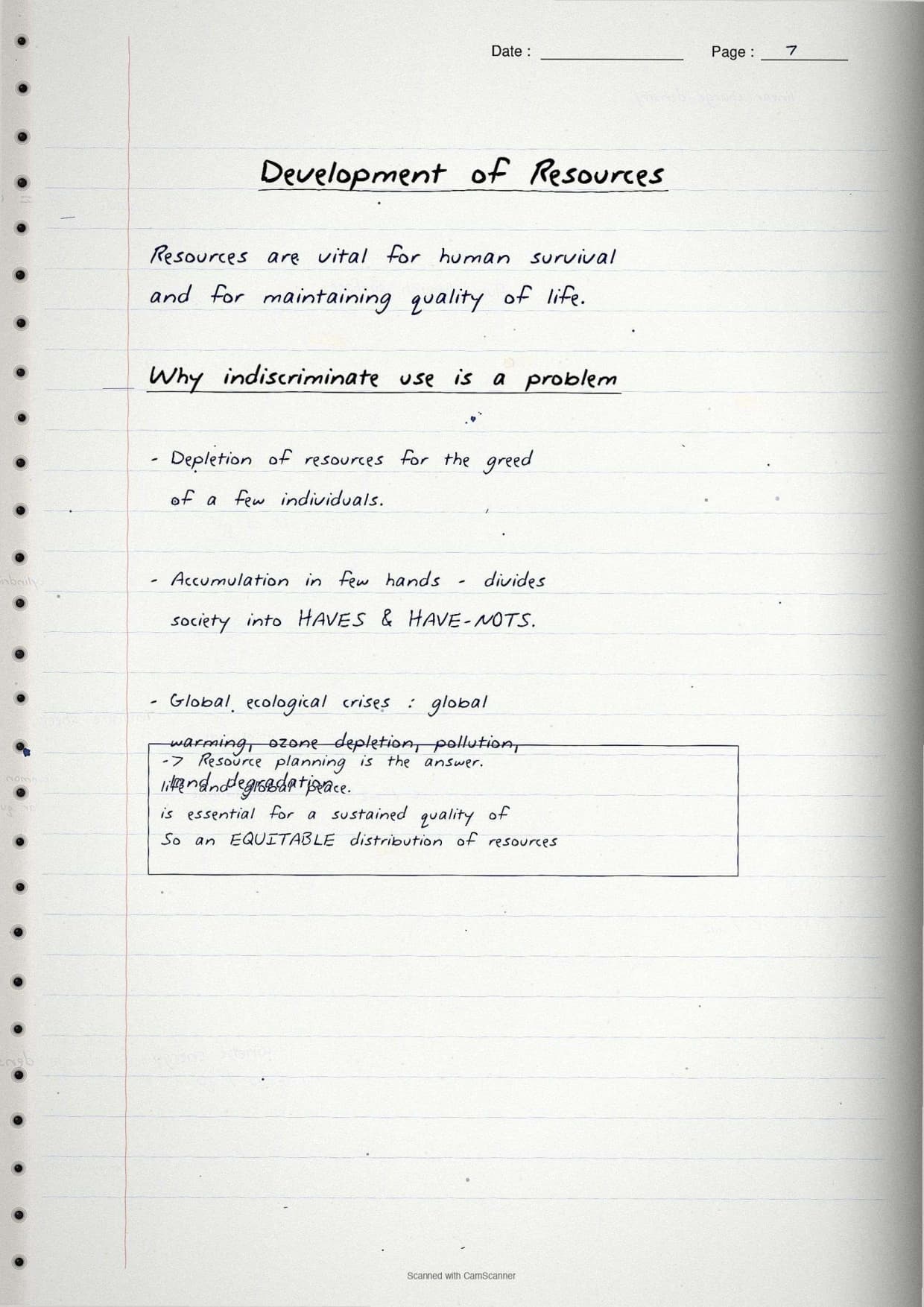
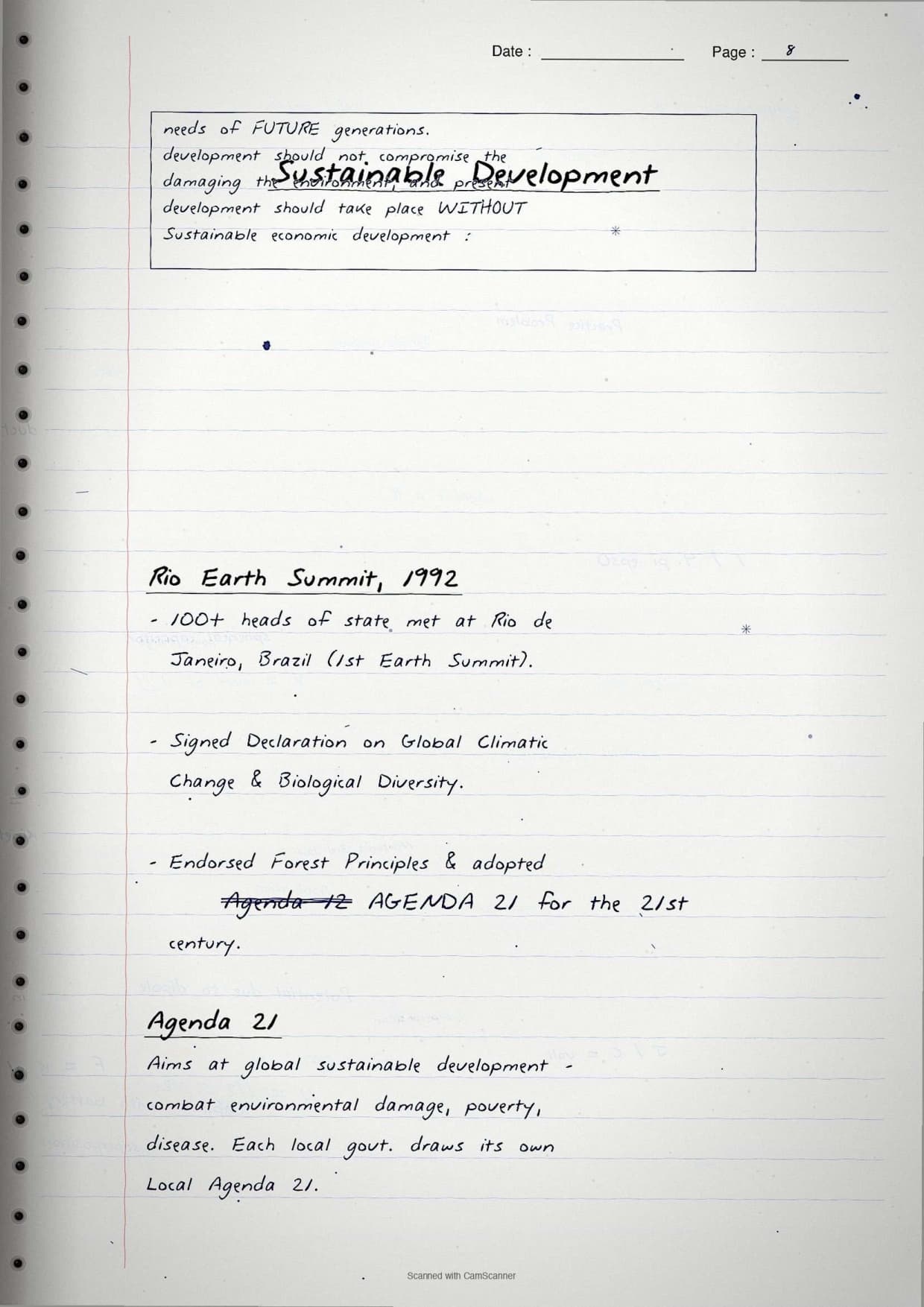
- Planning pages cover resource planning in India and sustainable development.
- Land pages cover land use, land degradation and conservation measures.
- Soil pages cover the six soil types and how soil erosion is controlled.
The key terms sit in boxes and important figures are underlined, so these Resources and Development handwritten notes are ideal for a last revision when there is no time to read full paragraphs.
Resource Classification Pages
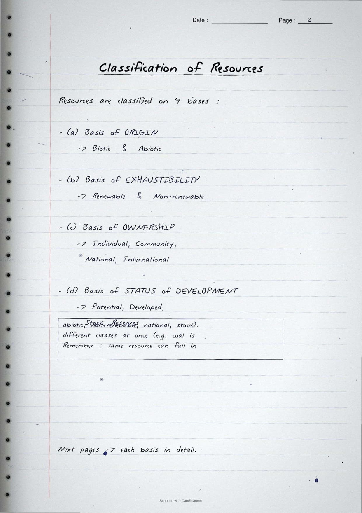
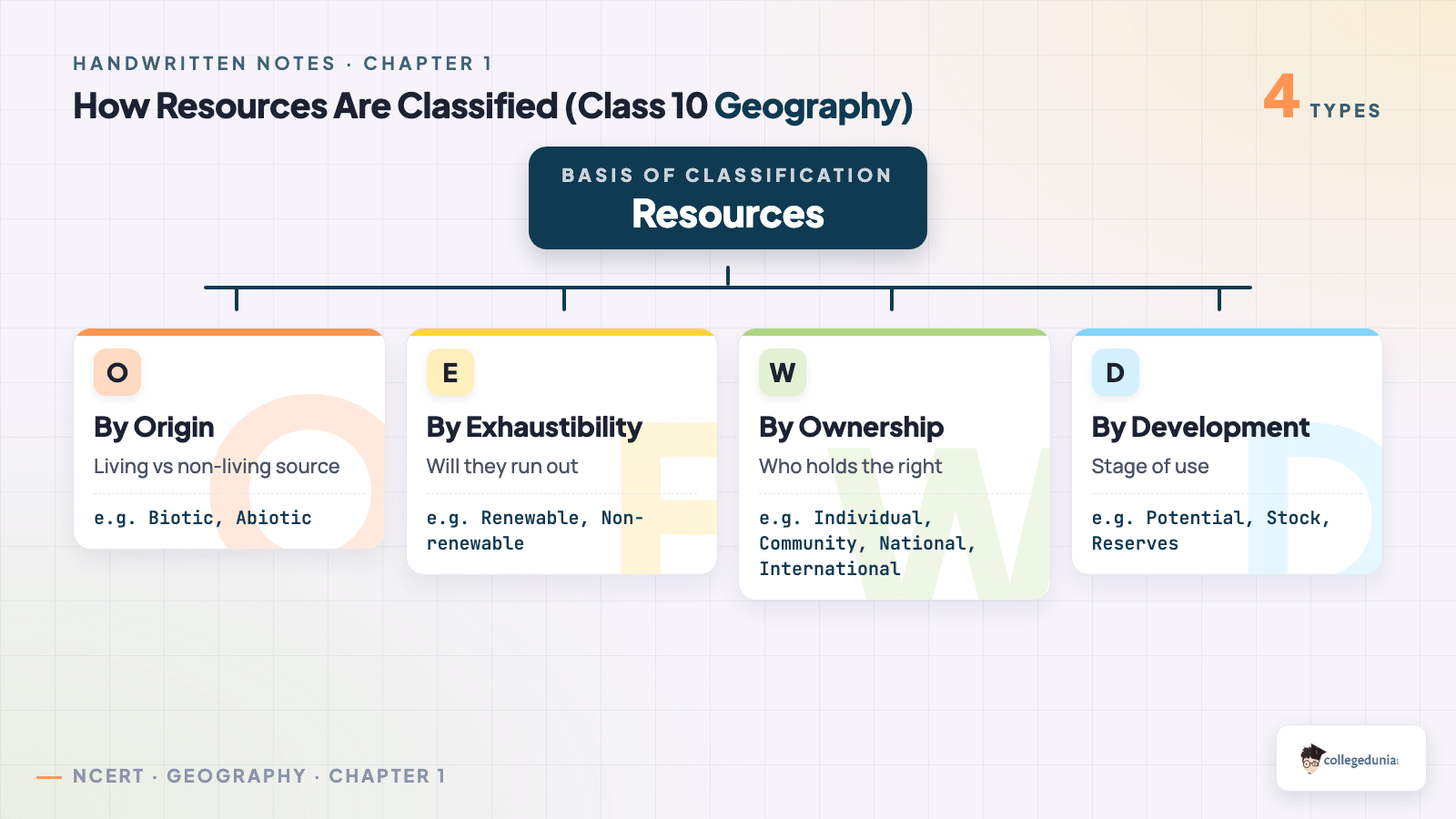
The four bases of resource classification sit side by side, since one-mark and three-mark questions are picked straight from this list.
| Basis | Types |
|---|---|
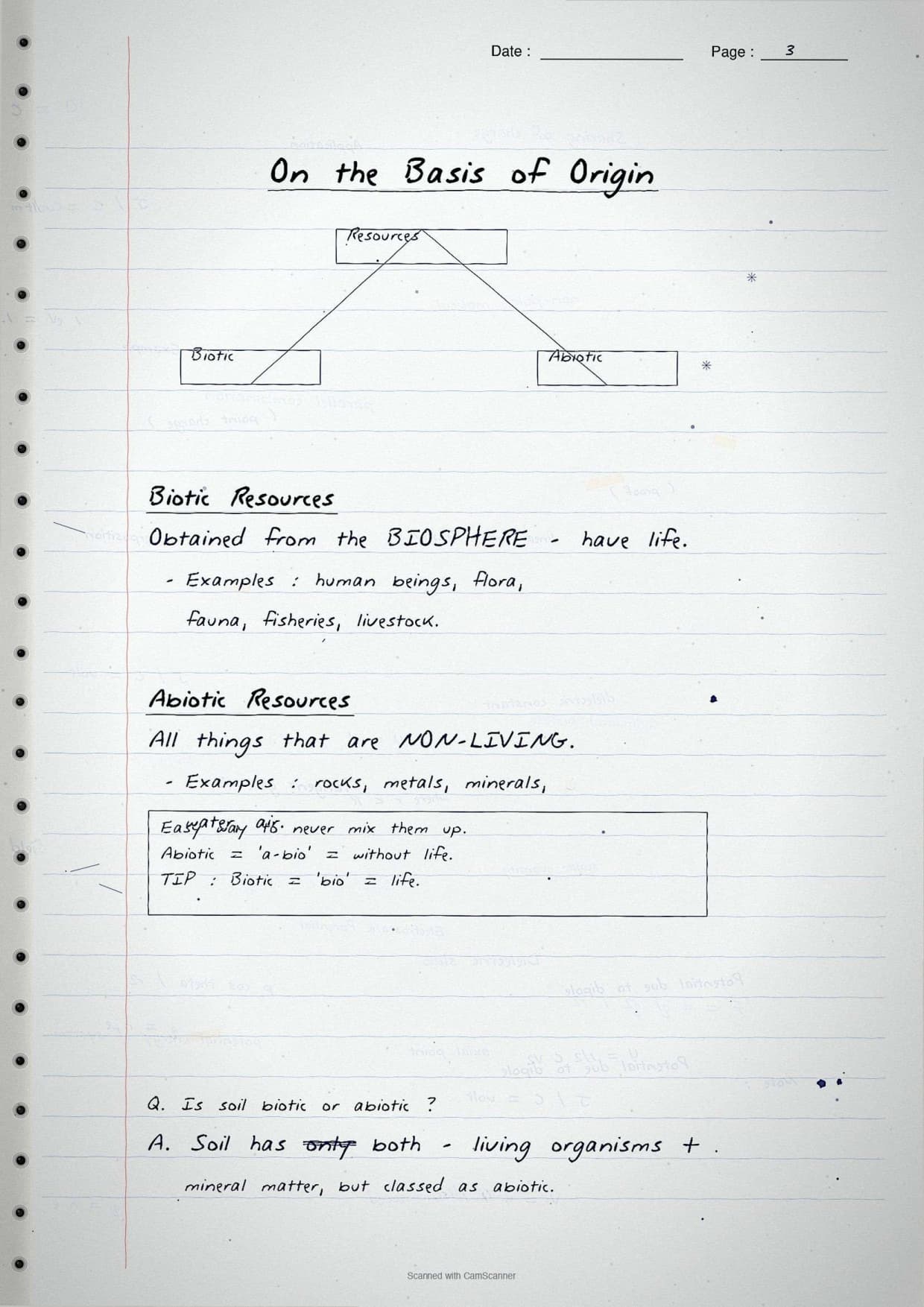
| Origin | Biotic resources (from living things) and abiotic resources (from non-living things). |
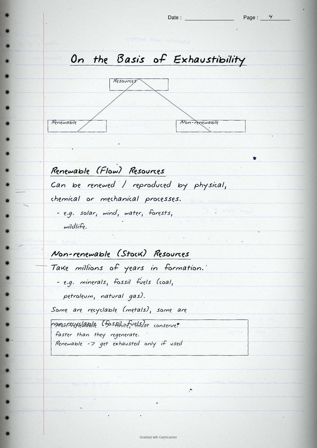
| Exhaustibility | Renewable resources (wind, water, forests) and non-renewable resources (coal, petroleum). |
| Ownership | Individual, community, national and international resources. |
| Development status | Potential, developed stock and reserves. |
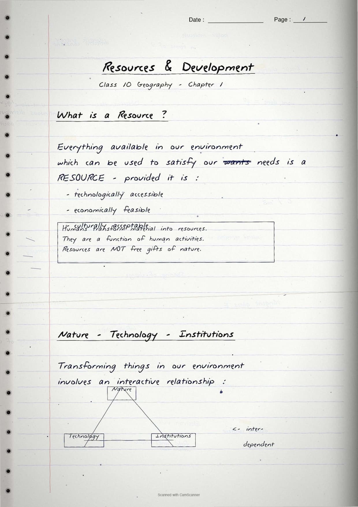
The most-tested definition is boxed in red ink: everything in our environment that can satisfy our needs, and is technologically accessible, economically feasible and culturally acceptable, is a resource. An arrow links it to the nature-technology-institutions triangle, the idea that resources are a function of human activity.
Sustainable Development and Resource Planning Pages
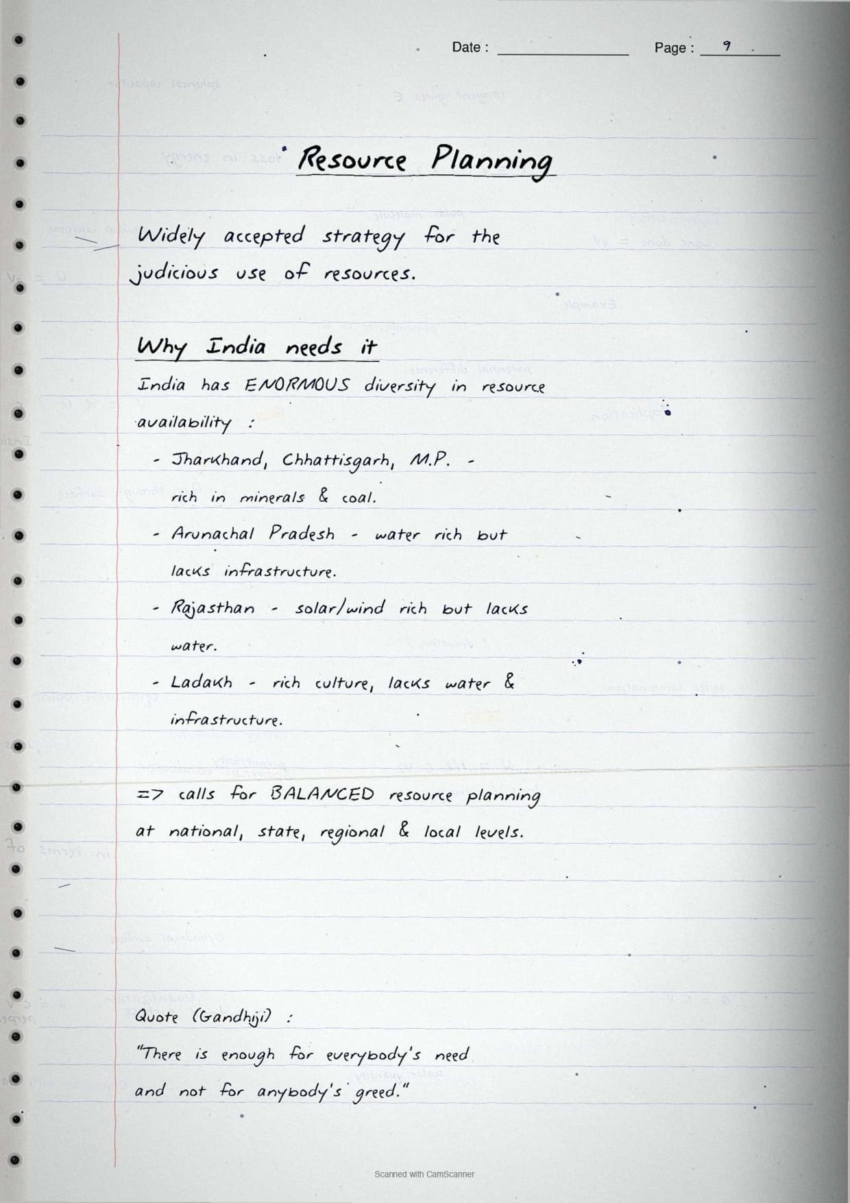
The board often asks why a resource-rich country still needs careful planning, so these pages give the problem first, then the solution. The key names and years sit in boxes.
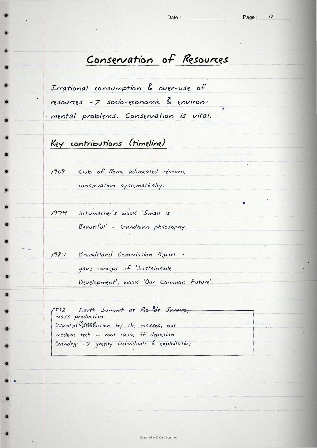
- Sustainable development: development that meets present needs without harming the needs of future generations.
- Rio Earth Summit (1992): over 100 heads of state met in Rio de Janeiro and adopted Agenda 21.
- Agenda 21: a UNCED declaration to fight environmental damage, poverty and disease through global co-operation.
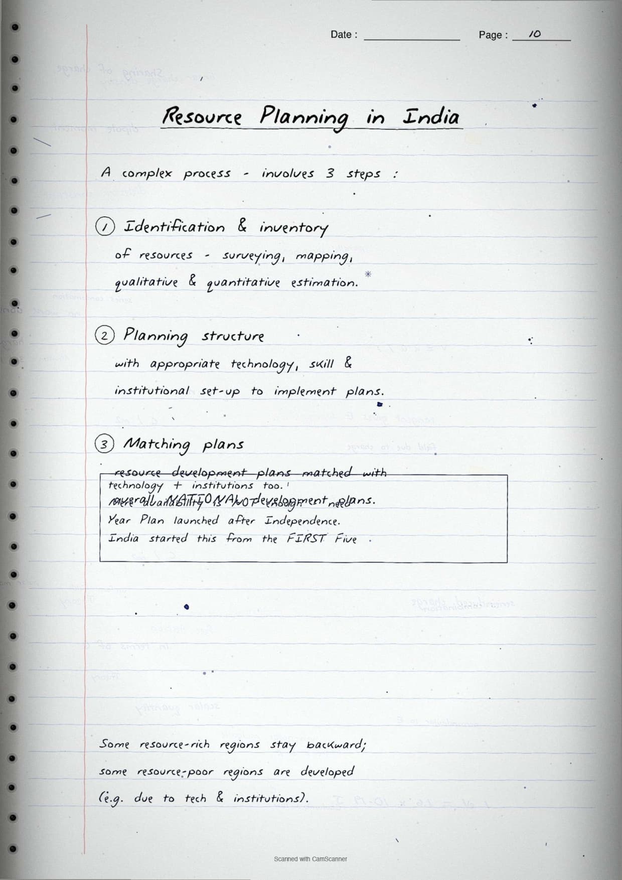
- Resource planning in India: identify and inventory resources, build a planning structure, then match plans with national goals.
Planning matters because some states are rich in one resource and poor in another, so India needs balanced planning at national, state, regional and local levels. A margin note adds Gandhiji's line, "enough for everybody's need but not for anybody's greed", which scores the value-based mark.
Resources and Development Class 10 Explained by Magnet Brains
Source: Magnet Brains on YouTube
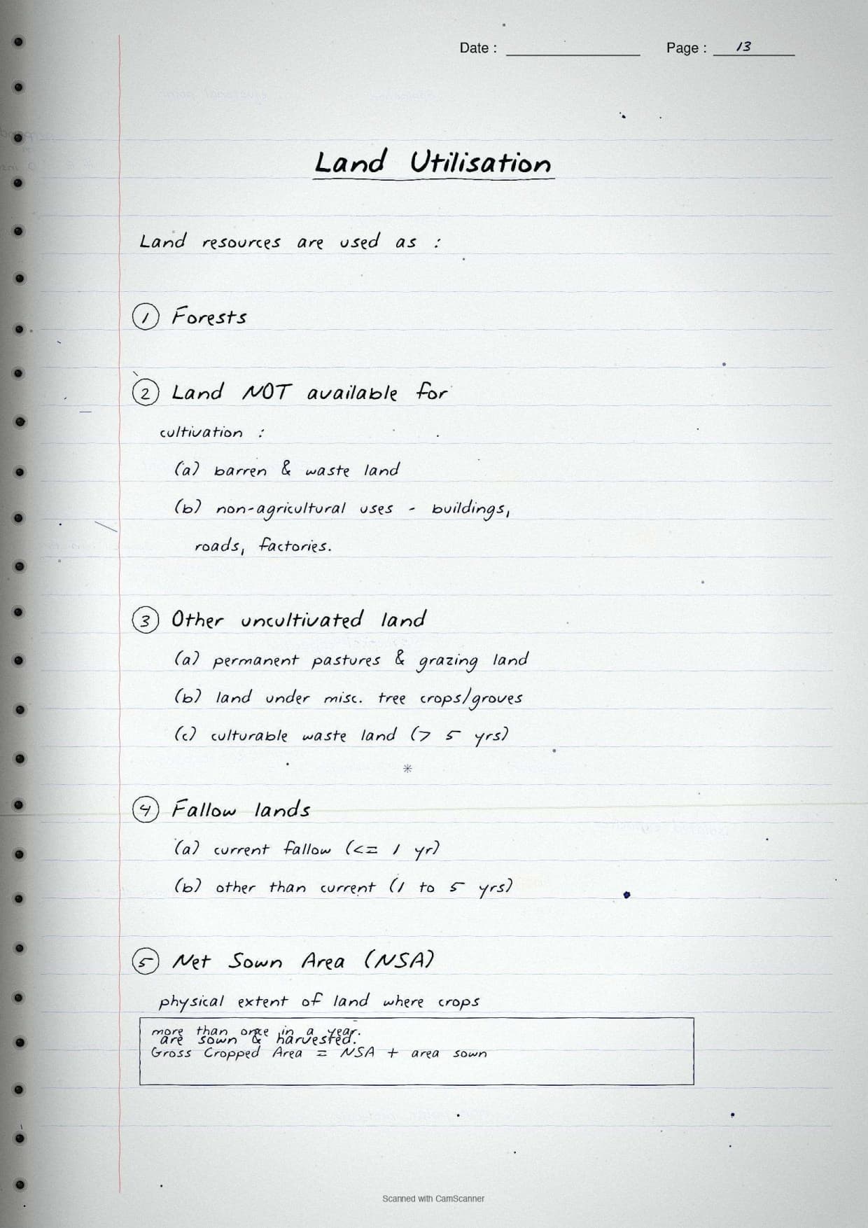
Land Resources and Land Use Pages
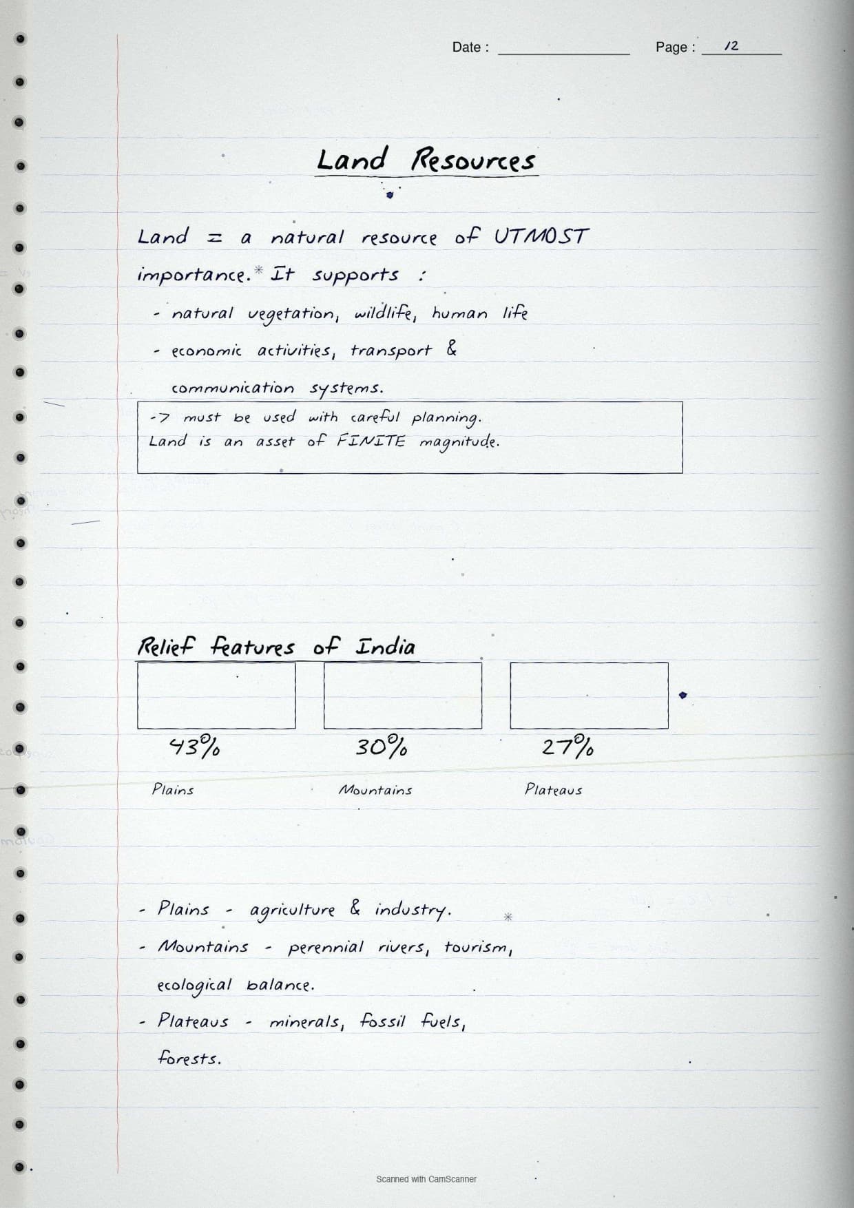
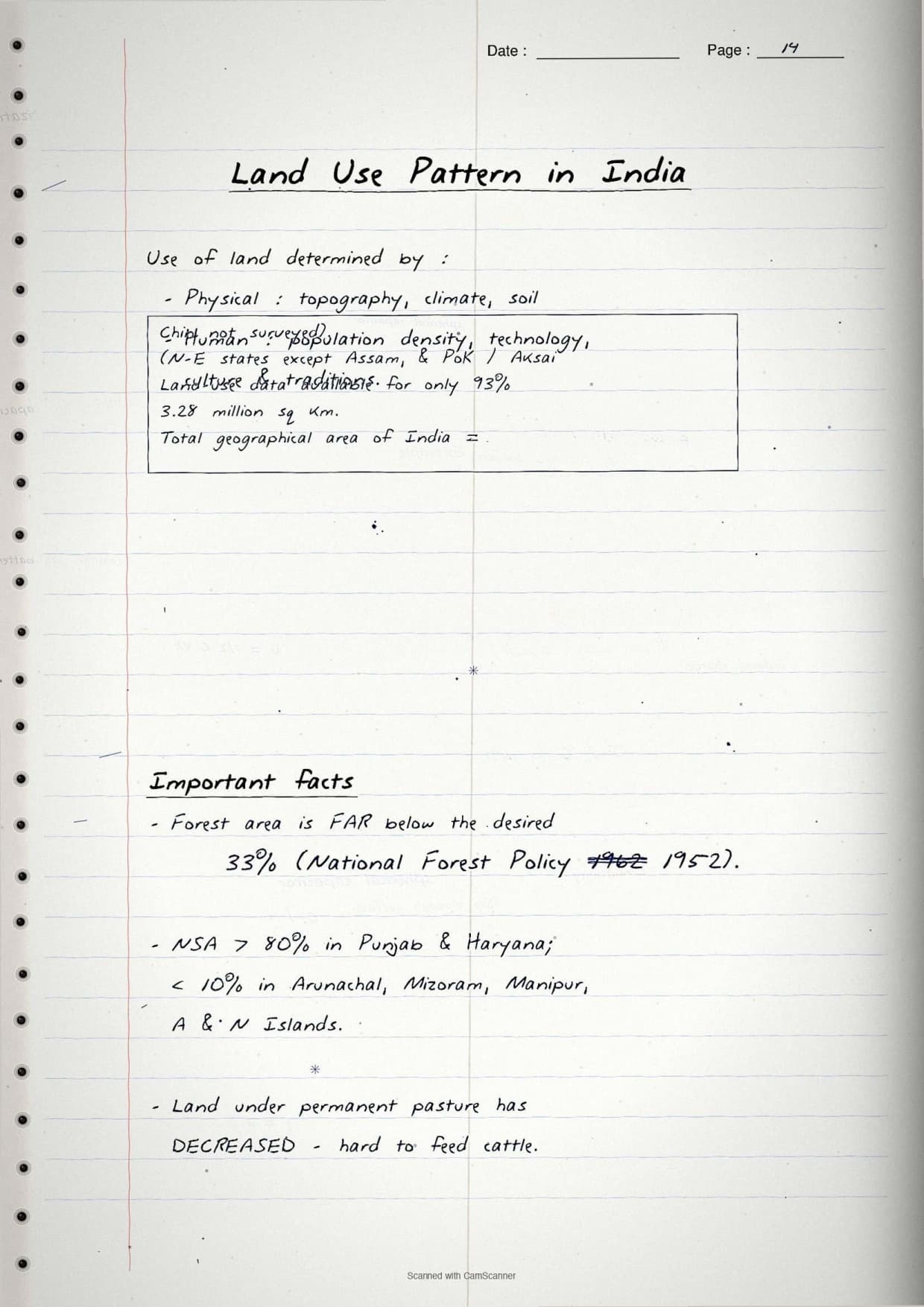
The data question is picked straight from these figures, so the relief split and land-use categories are boxed together with their percentages.
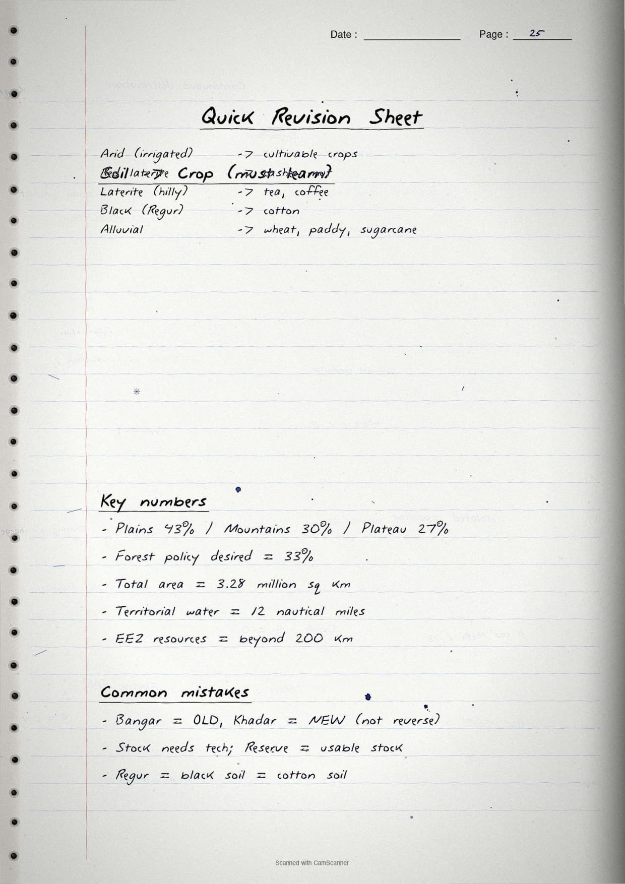
- Relief share: plains about 43%, mountains 30% and plateaus 27% of the land area.
- Land use categories: forests, land not available for cultivation, other uncultivated land, fallow land and net sown area.
- Net sown area: highest in Punjab and Haryana, lowest in Arunachal Pradesh, Mizoram and the islands.
- Forest cover: still far below the 33% target set by the National Forest Policy (1952).
A boxed data point: land use figures are available for only about 93% of the reporting area, because some north-east states and parts of Jammu and Kashmir were not surveyed. Keep "net sown area" apart from "gross cropped area" (land sown more than once a year), which is what the marker rewards.
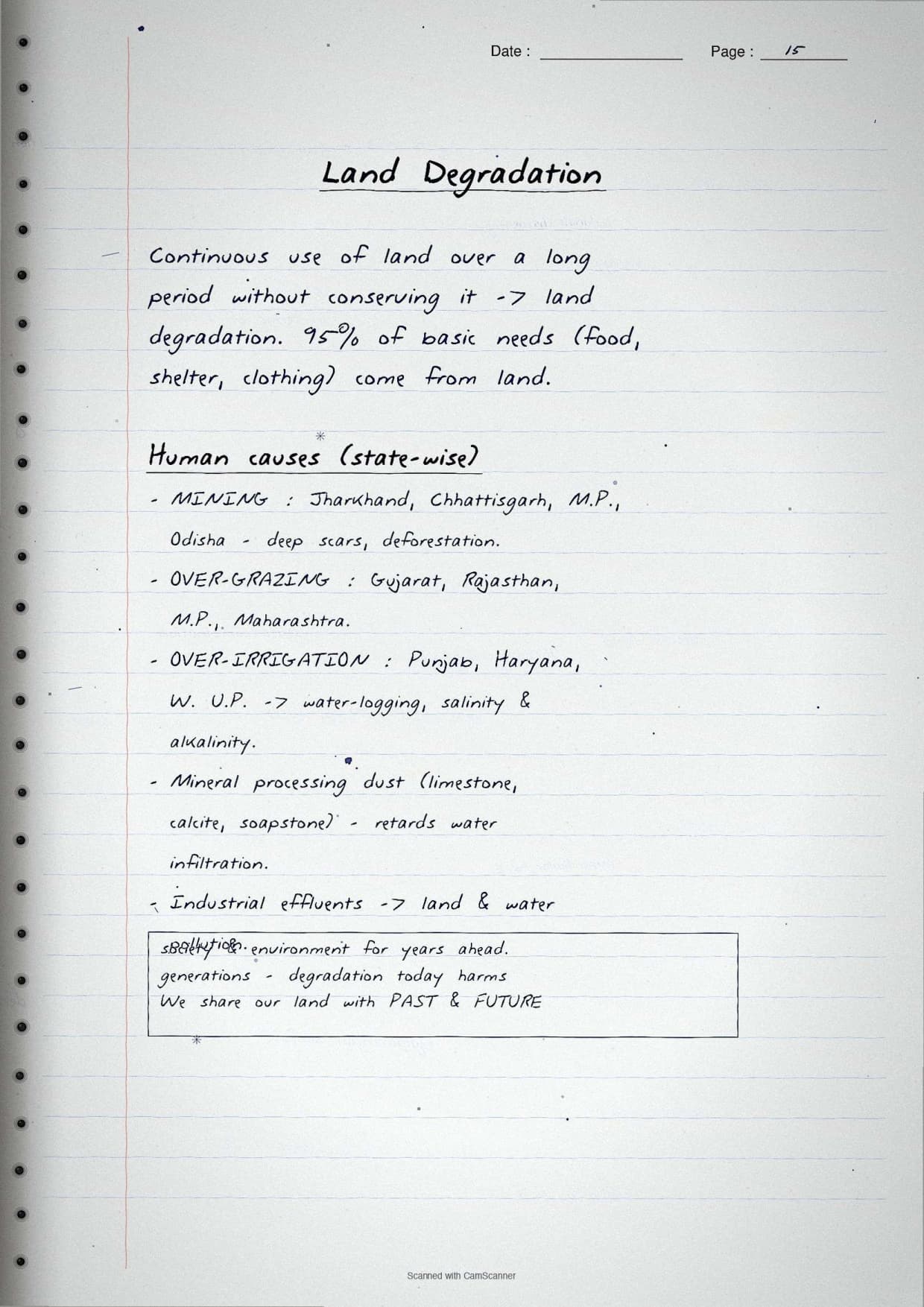
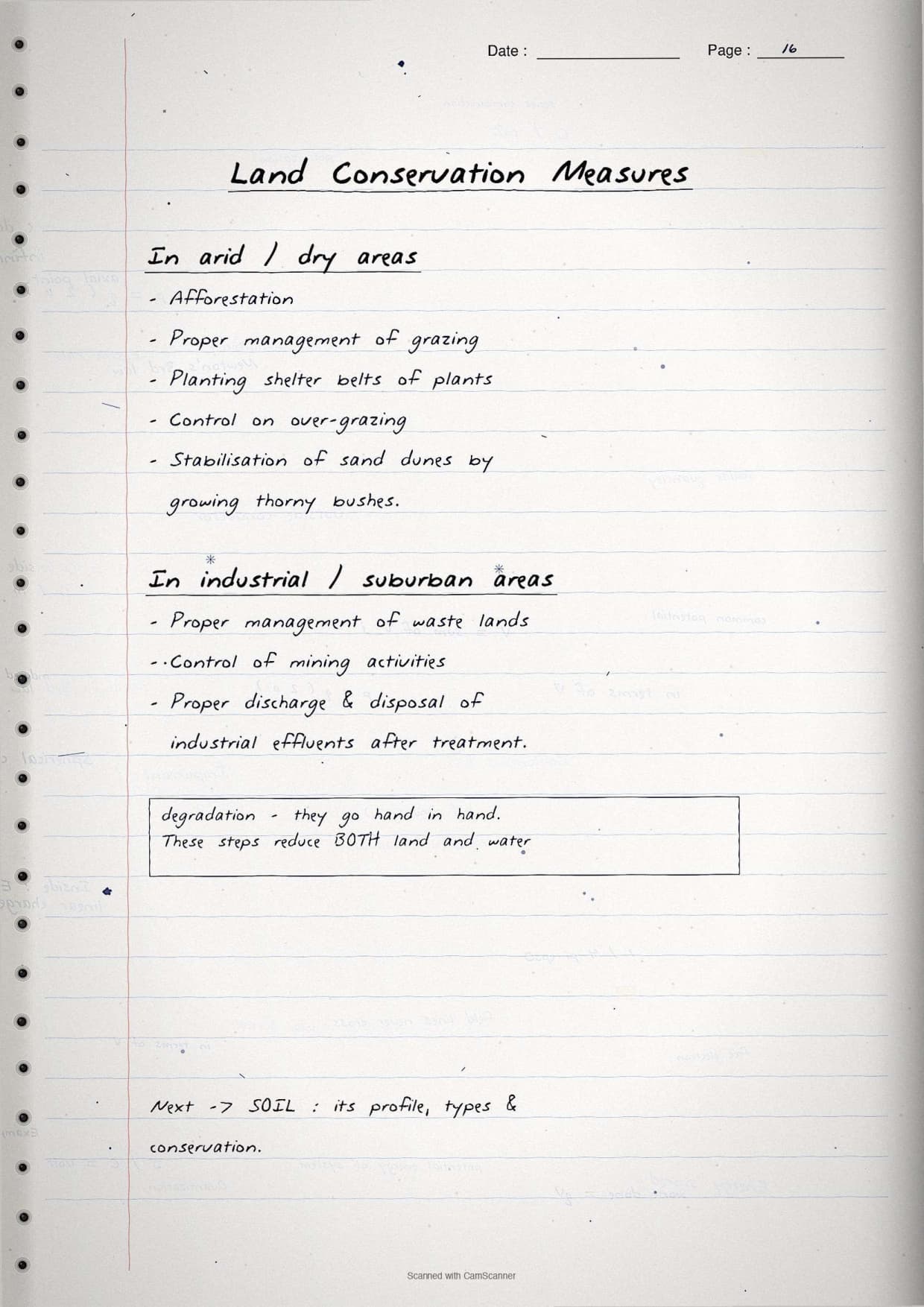
Land Degradation and Conservation Pages
The board pairs cause and cure in the same question, so these pages keep them side by side, human causes first, then conservation steps.
| Cause of land degradation | Where it is worst |
|---|---|
| Deforestation due to mining | Jharkhand, Chhattisgarh, Madhya Pradesh and Odisha. |
| Overgrazing | Gujarat, Rajasthan, Madhya Pradesh and Maharashtra. |
| Over-irrigation (water logging, salinity) | Punjab, Haryana and western Uttar Pradesh. |
| Mineral processing and industrial effluents | Cement and ceramic belts; many parts of the country. |
The boxed conservation list: afforestation, proper grazing management, shelter belts of plants, stabilising sand dunes with thorny bushes, and treating industrial waste before discharge. Writing the matched cause-and-cure pair is what turns an average answer into a full-marks one.
Soil Types and Soil Erosion Pages
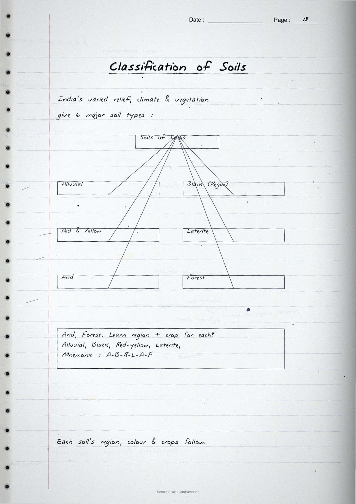
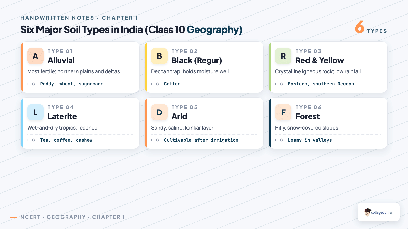
The soil pages are the heart of the chapter, with one box per soil type giving its region and best crop, plus an India soil-map sketch and a labelled soil profile for the map-work and diagram questions.
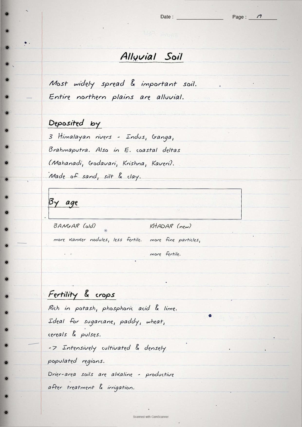
- Alluvial soil: the northern plains and river deltas; very fertile; good for paddy, wheat and sugarcane.
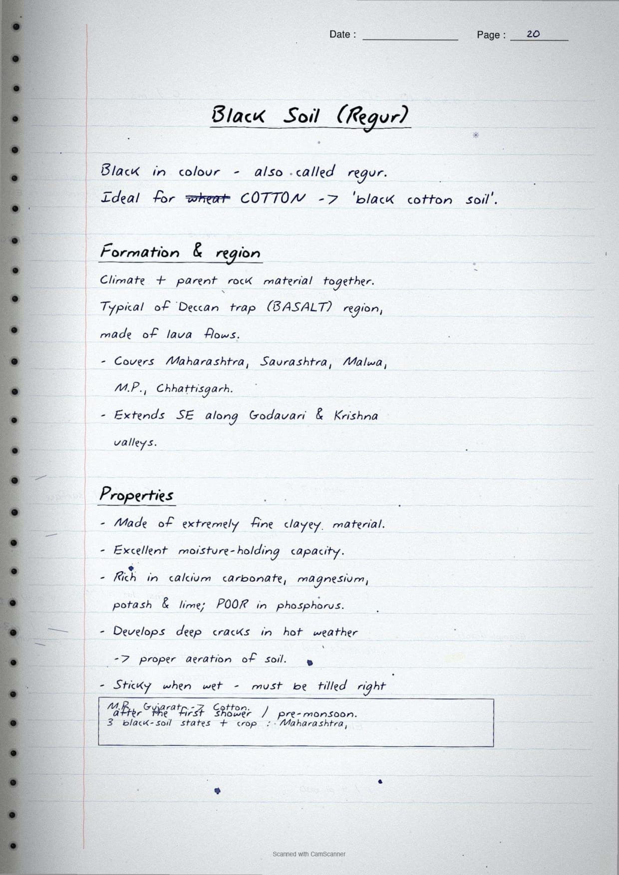
- Black soil (regur): the Deccan trap; holds moisture well; ideal for cotton.
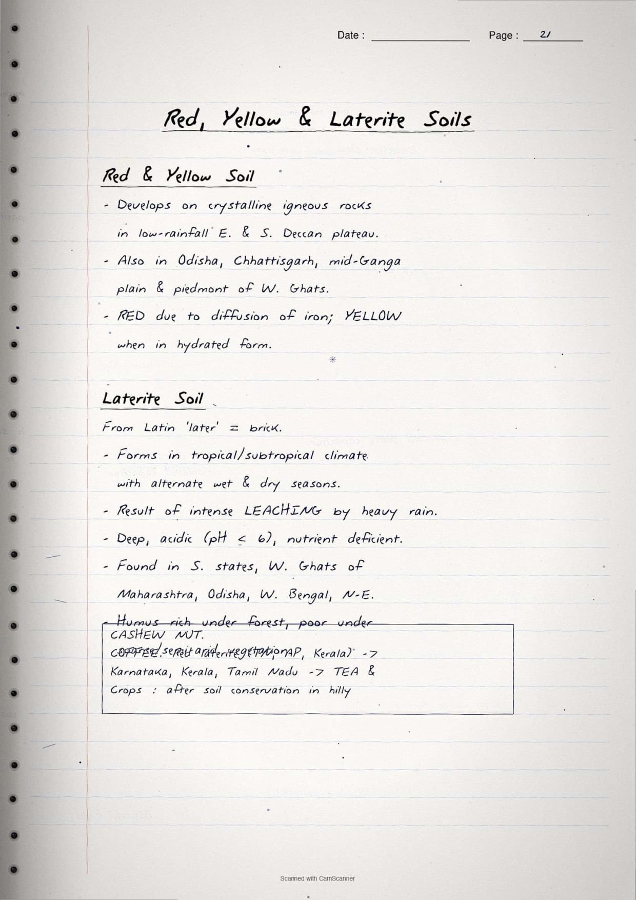
- Red and yellow soil: low-rainfall eastern and southern Deccan; reddish from iron diffusion.
- Laterite soil: wet-and-dry tropical areas; good for tea, coffee and cashew after treatment.
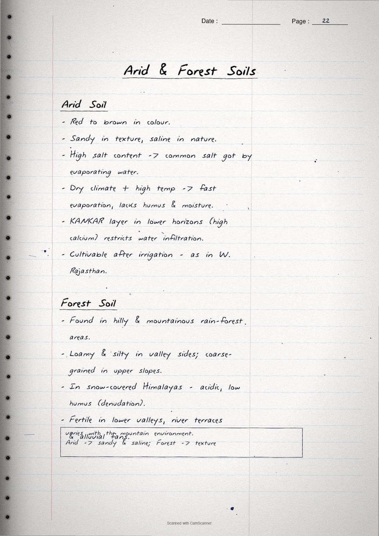
- Arid soil: sandy and saline Rajasthan; a kankar layer restricts water; cultivable after irrigation.
- Forest soil: hilly and snow-covered areas; loamy and silty in valleys, coarse on upper slopes.
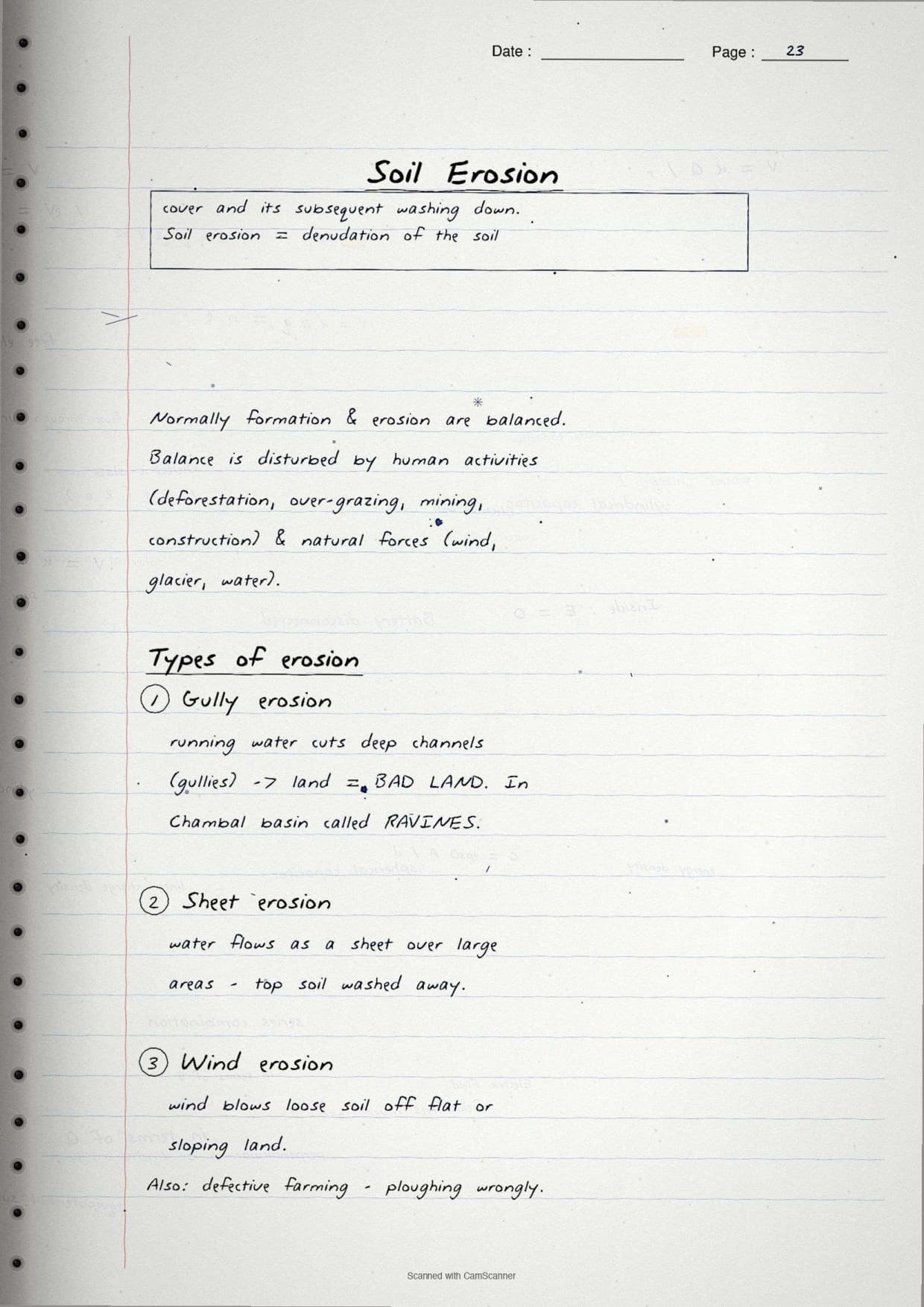
For soil erosion, the four types and matching cures are boxed together. Gully erosion makes ravines in the Chambal basin, sheet erosion washes off flat top soil, and wind erosion lifts loose soil from dry land. The cures are contour ploughing, terrace farming, strip cropping and shelter belts, each linked by a margin arrow to the erosion it stops.
How to Use These Handwritten Notes
Handwritten notes work best as a final layer of revision, not your first read. A simple plan:
- First pass: read the notes once in the classification, planning, land and soil order.
- Active recall: cover the boxed terms and write each soil type and its crop from memory.
- Map practice: redraw the India soil-map sketch and shade the six soil regions without looking.
- Self-test: attempt a short class 10 geography chapter 1 mcq drill to check the small facts.
Since the pages are scanned, students can save them on a phone and revise offline before the exam. Pair them with the full solutions to check your written answers against model points.
Common Mistakes These Notes Help You Avoid
A few errors cost marks every year, mostly from mixing up soil types or the bases of classification. The notes flag each in the margin.
- Mixing up the four bases of classification - keep origin, exhaustibility, ownership and development status separate.
- Calling black soil red soil - black soil (regur) suits cotton, red soil forms on crystalline igneous rock.
- Writing that forest cover meets the target - it is still below the 33% set in 1952.
- Confusing net sown area with gross cropped area - the second counts land sown more than once.
- Naming only one cure for soil erosion - match each erosion type to its own method.
Students who fix these five points usually move from average to high marks. The exam rewards a clear cause-and-cure answer, so always pair the problem with its solution.
How These Notes Pair with the Solutions and Book PDF
These handwritten notes are a revision layer. To prepare fully, students should use them with the other resources for the same chapter, all linked in the table below. Read the notes, then test yourself with the solutions, and open the book PDF for the original text, maps and figures.
| Resource | Best used for |
|---|---|
| Resources and Development NCERT Solutions | Step-by-step answers to every back-exercise question |
| Resources and Development Class 10 Notes | Quick chapter summary with all soil types, land-use data and key terms in one place |
| Resources and Development NCERT Book PDF | Reading the original NCERT chapter text, soil map and figures |
Tip: use the handwritten soil map to memorise which soil sits where, then write the full answer in your own words. Drawing the soil map once from memory fixes the map-work answer for good.
All Class 10 Geography Handwritten Notes by Chapter
The table links the handwritten notes for every chapter in Class 10 Geography Contemporary India II, so students can move across the course in one click. Resources and Development is highlighted.
| Chapter | Handwritten Notes |
|---|---|
| Chapter 1 | Resources and Development |
| Chapter 2 | Forest and Wildlife Resources |
| Chapter 3 | Water Resources |
| Chapter 4 | Agriculture |
| Chapter 5 | Minerals and Energy Resources |
| Chapter 6 | Manufacturing Industries |
| Chapter 7 | Lifelines of National Economy |
Resources and Development Class 10 Handwritten Notes Common Questions
Ques. Where can I download the Resources and Development handwritten notes PDF?
Ans. You can download the Resources and Development handwritten notes PDF directly from this page. It is free, follows the 2026-27 NCERT, and gives the chapter as clean scanned notebook pages with boxed terms, a labelled soil profile and an India soil-map sketch.
Ques. Are handwritten notes good enough for the class 10 geography board exam?
Ans. Yes, for revision. Handwritten notes are best used as a final layer after you have read the chapter and practised the solutions. They make the four bases of classification, the six soil types and the soil-conservation methods quick to recall in the exam.
Ques. What does the Resources and Development chapter cover?
Ans. It covers what a resource is, how resources are classified by origin, exhaustibility, ownership and development status, sustainable development and resource planning, land use in India, land degradation and conservation, and the six major soil types with soil erosion.
Ques. How many soil types are there in Resources and Development class 10?
Ans. There are six soil types in the chapter: alluvial, black (regur), red and yellow, laterite, arid and forest soil. The handwritten notes box each soil type with its region and best crop so students never mix them up in the board paper.
Ques. How should I use these notes for quick revision?
Ans. Read the pages once in the classification, planning, land and soil order, cover the boxed terms and write each soil type and crop from memory, redraw the India soil-map sketch, then attempt a short class 10 geography chapter 1 mcq drill to test the small facts.



Comments