




These Class 12 Geography Chapter 8 International Trade notes cover every NCERT definition, India's export-import composition, direction of trade, major sea ports and their hinterlands, and air transport, aligned to the 2026-27 syllabus.


- Concept-first revision: what international trade means and how India's trade volume grew from Rs. 1,214 crore (1950-51) to over Rs. 77 lakh crore (2020-21).
- Changing composition of exports and imports, direction of trade, and India's aim to double its world-trade share.
- Cross-pointers to the matching NCERT Solutions, Handwritten Notes and NCERT Book PDF.
Written by Collegedunia geography experts, mapped to the 2026-27 NCERT India People and Economy textbook.
Student Feedback
71% of students found port-hinterland mapping the most-confused area. Students who paired these notes with the Solutions PDF scored 2 to 3 marks higher in map and data questions.
Source: 2026-27 Class 12 Geography poll of 9,600 CBSE students.
Quick Concept Recap: International Trade at a Glance
No country is fully self-sufficient, so nations buy and sell across borders: this is international trade, mutually beneficial by definition. India is about one per cent of global trade volume, yet matters for the diversity of what it trades.
- Volume growth: from Rs. 1,214 crore (1950-51) to Rs. 77,19,796 crore (2020-21).
- Persistent trade deficit: imports exceed exports every year in the NCERT data.
- Composition shift: from agriculture to manufactured goods (67.8% of exports), and from foodgrains to petroleum, capital goods and gold.
- Routes: mostly sea and air; a small part by land to neighbours.
- Ports: 12 major ports (Central Government), about 200 minor (State Governments).
- Policy aim: double India's share in world trade via liberalisation and product patents.
Use the matching NCERT Solutions for Class 12 Geography Chapter 8 for the map-based and data-response drill.
Source: Humanities Wallah - Class 12th on YouTube
Key Definitions for International Trade Class 12 Geography
The definitions below use the one-line form CBSE markers look for.
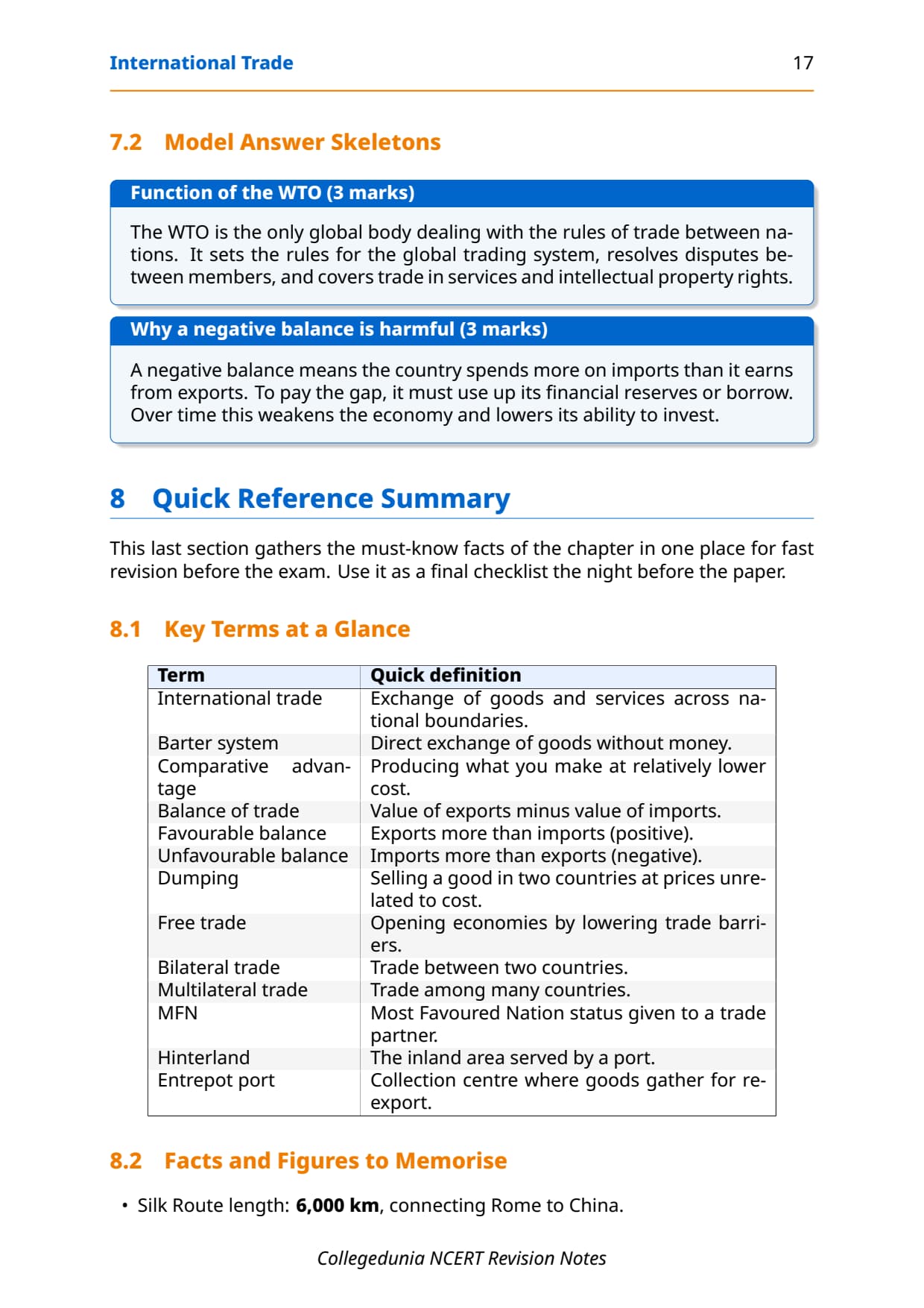
| Term | One-line definition | NCERT pointer |
|---|---|---|
| International Trade | The exchange of goods and services between two or more countries across national borders. | Chapter intro |
| Trade Balance | The difference between a country's total exports and total imports; negative when imports exceed exports (trade deficit). | Table 8.1 |
| Composition of Trade | The type and share of different commodities in a country's exports and imports in a given year. | Tables 8.2, 8.4 |
| Direction of Trade | The identification of the countries or regions with which a nation conducts its import and export trade. | Table 8.6 |
| Port | A harbour with facilities for loading and unloading cargo and for the collection and distribution of goods. | Sea Ports section |
| Harbour | A sheltered area of deep water where ships can anchor safely; a harbour may or may not be developed as a port. | Sea Ports section |
| Hinterland | The area from which a port draws its trade; the inland region served by a port for the movement of goods in and out. | Sea Ports section |
| Major Port | One of the 12 ports managed by the Central Government of India that handle a larger share of total traffic and have larger infrastructure. | Sea Ports section |
| Minor Port | One of the approximately 200 ports whose policy and functions are regulated by the respective State Governments. | Sea Ports section |
| Import Substitution | A trade and economic policy that replaces foreign imports with domestic production to reduce dependence on overseas goods. | Chapter text |
These cover roughly 8 of the 10 theory questions CBSE has asked since 2020; port vs harbour and hinterland are the highest-leverage items.
Changing Composition of India's Exports and Imports
The composition of trade has shifted dramatically since Independence, and CBSE often asks students to explain why.
Composition of India's Exports
In 2021-22, manufactured goods made up 67.8% of India's exports, agriculture 11.9%, crude and petroleum 16.4%, ores and minerals about 2%. The manufacturing share keeps rising while traditional farm commodities fall.
- Agriculture: cashew and traditional items fell; marine products, fresh fruits, sugar and flowers rose.
- Manufactured goods: engineering goods, gems and jewellery are large shares; China and East Asia are the main competitors.
- Petroleum: rose from 11.9% (2015-16) to 16.4% (2021-22) as India became a refining hub.
- Ores and minerals: steady at around 2%.
Composition of India's Imports
In the 1950s-60s India's biggest import was foodgrains; the Green Revolution ended that, but the 1973 energy crisis pushed up petroleum bills. Today the main imports are petroleum, capital goods, gold, chemicals and electronics.
| Commodity Group | 2015-16 (%) | 2021-22 (%) | Key reason for change |
|---|---|---|---|
| Fuel (Coal, Petroleum) | 25.4 | 31.6 | Rising industrialisation and living standards |
| Capital Goods | 13.0 | 10.1 | Steady decline as domestic manufacturing grows |
| Food and Allied Products | 5.1 | 4.4 | Green Revolution eliminated foodgrain imports |
| Fertilisers | 2.1 | 2.3 | Agricultural input demand remains steady |
| Others | 38.1 | 38.5 | Pearls, precious stones, gold, non-ferrous metals |
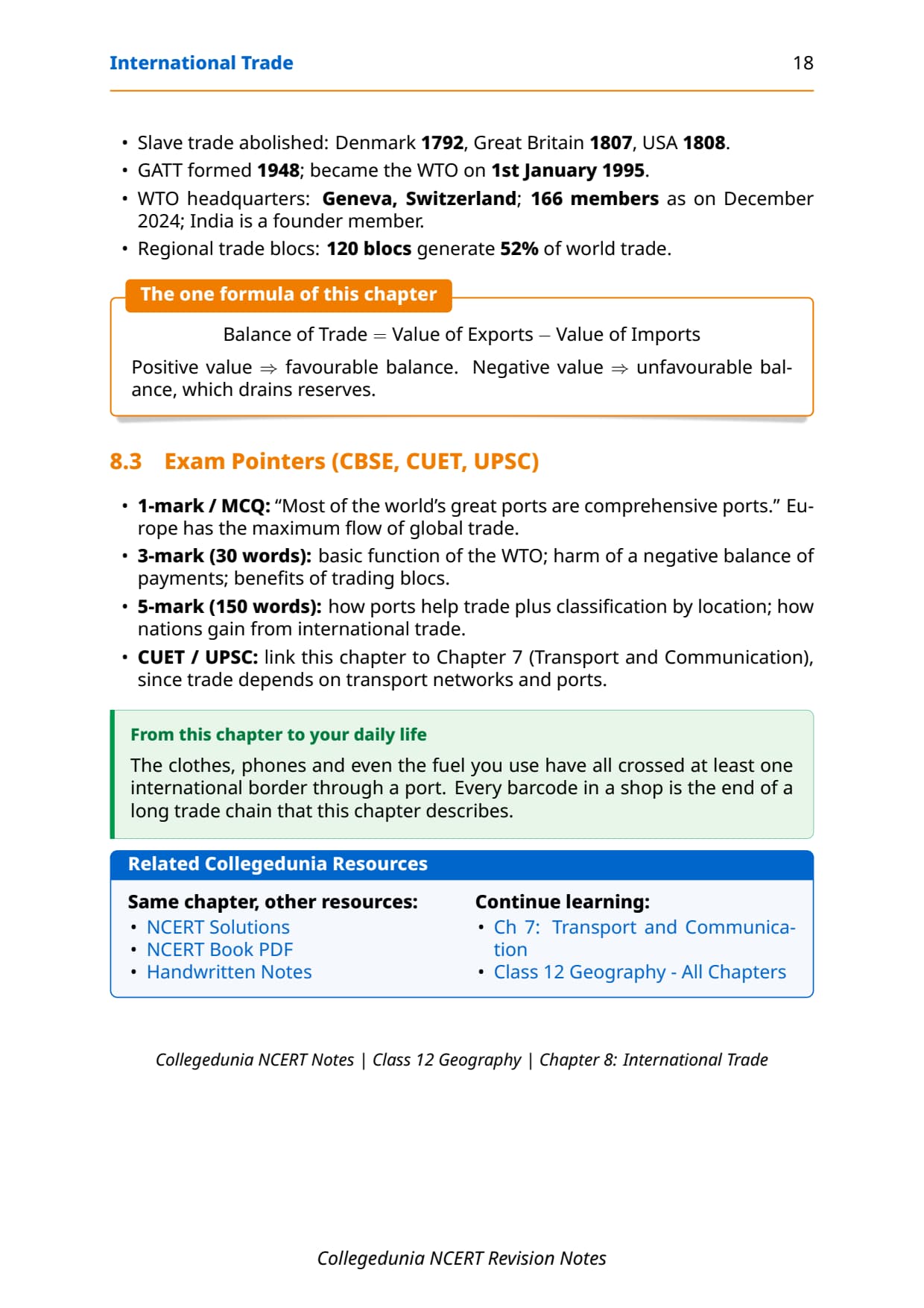
Key trend: petroleum dominates imports and is rising, while capital goods imports fall as domestic manufacturing grows.
Direction of India's Trade: Region-wise Overview
In 2021-22, Asia and ASEAN is India's largest trading region at Rs. 29,18,577 crore in imports, nearly double 2016-17. Europe is second, then North America and Africa.
| Region | Imports 2016-17 (Rs. Crore) | Imports 2021-22 (Rs. Crore) | Change |
|---|---|---|---|
| Asia and ASEAN | 15,44,520 | 29,18,577 | Large increase |
| Europe | 4,03,972 | 6,40,577 | Moderate increase |
| North America | 1,95,332 | 3,78,041 | Moderate increase |
| Africa | 1,93,327 | 3,68,156 | Moderate increase |
| Latin America | 1,15,762 | 1,61,995 | Small increase |
India aims to double its share in world trade through import liberalisation, lower duties, delicensing and product patents. China, the USA and the UAE are among its largest individual partners.
Memory hook: Asia leads on proximity, supply chains and ASEAN agreements; Europe is second on historic ties and high-value machinery and chemicals; Africa and Latin America are smaller but growing.
Major Ports of India and Their Hinterlands
Port-hinterland pairs appear regularly as map and short-answer questions. Learn each port's location, coast and main hinterland.
West Coast Ports
India's west coast has more ports than its east coast.
- Deendayal (Kandla): Gulf of Kuchchh; petroleum and fertiliser; serves north-west India; relieves Mumbai.
- Mumbai: India's biggest natural harbour, 54 berths; closest to Middle East, Africa, America and Europe routes; hinterland M.P., Maharashtra, Gujarat, U.P., Rajasthan.
- Jawaharlal Nehru (Nhava Sheva): satellite to Mumbai; India's largest container port.
- Mormugao: natural harbour, Goa; iron-ore exports to Japan; hinterland Karnataka, Goa, south Maharashtra.
- New Mangalore: Karnataka; iron-ore, fertilisers, coffee, tea, petroleum products.
- Cochin: "Queen of the Arabian Sea"; natural harbour at Vembanad Kayal; serves Kerala, south Karnataka, south-west T.N.
East Coast Ports
- Shyama Prasad Mookerjee (Kolkata): on the Hugli, 128 km inland; serves the north-east, U.P., Bihar, Jharkhand, West Bengal, Sikkim, Nepal and Bhutan.
- Haldia: 105 km downstream of Kolkata; satellite port; coal, petroleum, iron ore, jute, cotton.
- Paradwip: Mahanadi delta, Odisha; India's deepest harbour; mainly iron-ore; hinterland Odisha, Chhattisgarh, Jharkhand.
- Visakhapatnam: Andhra Pradesh; land-locked harbour linked by a channel; iron-ore, petroleum, general cargo.
- Chennai: one of the oldest east-coast ports; artificial harbour (1859); shallow waters; hinterland Tamil Nadu, Puducherry.
- Kamarajar (Ennore): 25 km north of Chennai; built to relieve Chennai.
- V.O. Chidambaranar (Tuticorin): Tamil Nadu; coal, salt, foodgrains, edible oils, sugar, chemicals, petroleum.
Quick fact: Indian port capacity rose from 20 million tonnes (1951) to over 837 million tonnes (2016). After losing Karachi and Chittagong at Partition, India built new ports like Kandla and Diamond Harbour.
Air Transport and Its Role in International Trade
Air transport is fastest and ideal for high-value or perishable goods, but costly and unsuitable for bulky cargo, so its share stays smaller than sea routes. NCERT notes 25 major airports (2016-17), and UDAN has added 73 airports since 2017.
- Advantage: fastest mode; suits perishables and high-value goods (electronics, gems).
- Disadvantage: expensive; cannot carry bulky cargo like coal, iron ore or petroleum.
- Major airports: Delhi, Mumbai, Kolkata, Chennai, Bengaluru, Hyderabad among 25.
- UDAN scheme: Regional Connectivity Scheme; 73 airports added since 2017.
Most foreign trade moves by sea and air combined, with a small fraction by land to neighbours ("Sea and air" is the NCERT MCQ answer).
Common Mistakes Students Make in This Chapter
Repeat-offender mistakes CBSE examiners flag each year:
- Port vs harbour: a harbour is sheltered water for anchoring; a port adds loading and storage. Visakhapatnam is a land-locked harbour, not a natural one like Mumbai.
- East vs west coast: Mumbai, Kandla, Mormugao, Mangalore, Cochin are WEST; Kolkata, Haldia, Paradwip, Visakhapatnam, Chennai, Ennore, Tuticorin are EAST.
- Largest container port: Jawaharlal Nehru Port (Nhava Sheva), NOT Mumbai.
- Trade deficit: imports exceed exports in every NCERT year, so the balance is always negative.
- Why petroleum imports rose: the 1973 energy crisis.
Previous Year Question Trends from International Trade Class 12
The table below maps what CBSE has asked over the last five years.
| Year | Question type asked | Marks | Notes section to revise |
|---|---|---|---|
| 2025 | Describe composition of exports 2021-22 + name east coast ports | 5 + 2 | Composition section + Ports section |
| 2024 | Explain hinterland concept + distinguish port from harbour | 3 + 3 | Key Definitions table |
| 2023 | MCQ on land-locked harbour + changing import pattern 150 words | 1 + 5 | Ports section + Composition section |
| 2022 | Direction of trade overview + why petroleum imports rose | 4 + 3 | Direction of Trade section |
| 2021 | Map marking of 3 major ports + hinterland of Mumbai port | 3 + 3 | Major Ports section |
The chapter carries 10 to 12 marks per year across MCQ, short-answer and map questions. The port map question has appeared in every CBSE paper since 2018.
Other Resources for Class 12 Geography Chapter 8 International Trade
Pair these notes with the resources below.
| Resource | What it covers | Open |
|---|---|---|
| Notes | Concept-first revision notes covering definitions, trade composition, direction of trade, major ports and air transport. | You are here |
| NCERT Solutions | Step-by-step answers to all exercise questions with Expert's Solution alternatives for every short and long answer. | Class 12 Geography Chapter 8 NCERT Solutions |
| Handwritten Notes | Topper's handwritten revision pages for last-minute board exam practice. | Class 12 Geography Chapter 8 Handwritten Notes |
| NCERT Book PDF | Official NCERT India People and Economy Chapter 8 textbook in PDF form. | Class 12 Geography Chapter 8 NCERT Book PDF |
| Subject Hub | All chapters of Class 12 Geography with every resource in one place. | Class 12 Geography Subject Hub |
All Chapters Notes for Class 12 Geography India People and Economy
Related Links: Notes for the other chapters of Class 12 Geography India People and Economy.
| Chapter | Topic | Notes link |
|---|---|---|
| Chapter 1 | Population: Distribution, Density, Growth and Composition | Class 12 Geography Population Notes |
| Chapter 2 | Human Settlements | Class 12 Geography Human Settlements Notes |
| Chapter 3 | Land Resources and Agriculture | Class 12 Geography Land Resources Notes |
| Chapter 4 | Water Resources | Class 12 Geography Water Resources Notes |
| Chapter 5 | Mineral and Energy Resources | Class 12 Geography Mineral and Energy Resources Notes |
| Chapter 6 | Planning and Sustainable Development in Indian Context | Class 12 Geography Planning and Sustainable Development Notes |
| Chapter 7 | Transport and Communication | Class 12 Geography Transport and Communication Notes |
| Chapter 8 | International Trade | You are here |
| Chapter 9 | Geographical Perspective on Selected Issues and Problems | Coming soon |
NCERT Notes Class 12 Geography Chapter 8 International Trade FAQs
Ques. What are the international trade class 12 notes meant to be used for?
Ans. The international trade class 12 notes are a concept-first revision file that compresses the entire NCERT Chapter 8 of Class 12 Geography (India: People and Economy) into a printable study guide. They cover definitions, the changing composition of exports and imports, direction of trade, all 12 major ports with their hinterlands, and the role of air transport. Students typically use these notes for the 30-minute first-pass revision and the 15-minute night-before pass; the worked exercise answers live in the matching NCERT Solutions PDF, not in this Notes file.
Ques. What is international trade class 12 geography about?
Ans. The international trade class 12 geography chapter covers how India buys and sells goods and services with other countries. It explains why international trade is mutually beneficial (no country is self-sufficient), traces the change in India's trade volume from Rs. 1,214 crore in 1950-51 to over Rs. 77 lakh crore in 2020-21, describes the shifting composition of exports (now dominated by manufactured goods) and imports (now dominated by petroleum), maps the direction of trade (Asia-ASEAN is the largest partner region), and explains the role of India's 12 major ports and their hinterlands. Air transport's limited but growing role in high-value trade is also covered.
Ques. What is the difference between a port and a harbour in class 12 geography?
Ans. A harbour is a naturally or artificially sheltered area of deep water where ships can anchor safely. A port is a harbour that has been developed with facilities for loading, unloading, storing and distributing cargo. Every port needs a harbour, but not every harbour is a port. For example, Visakhapatnam is described in the NCERT chapter as a "land-locked harbour" connected to the sea by a channel cut through solid rock and sand - it is both a harbour and a developed port. Mumbai is a natural harbour that was developed into India's biggest port. CBSE regularly asks students to distinguish between the two in 3-mark questions.
Ques. What is hinterland in international trade class 12?
Ans. Hinterland refers to the inland area from which a port draws its trade. It is the region that supplies goods for export through the port and receives imported goods from the port. For example, the hinterland of Mumbai port includes Maharashtra, Madhya Pradesh, Gujarat, Uttar Pradesh and parts of Rajasthan. The hinterland of Kolkata port extends to Uttar Pradesh, Bihar, Jharkhand, West Bengal, Sikkim and the north-eastern states, and also includes the neighbouring land-locked countries of Nepal and Bhutan. A port's hinterland can overlap with that of a neighbouring port and is not fixed over space.
Ques. Which is India's largest container port?
Ans. Jawaharlal Nehru Port at Nhava Sheva (near Mumbai) is India's largest container port, as stated in the NCERT Chapter 8 textbook. It was developed as a satellite port to relieve the pressure at Mumbai port, which is India's biggest port overall in terms of total cargo handling and size. The distinction between Mumbai (biggest port overall) and Jawaharlal Nehru Port (largest container port specifically) appears as a one-mark MCQ or fill-in-the-blank question in CBSE papers.
Ques. What are the major items India imports according to class 12 geography?
Ans. According to NCERT Chapter 8 data for 2021-22, India's major imports include petroleum, oil and lubricants (the single largest item at Rs. 12,07,803 crore), non-ferrous metals, pearls and precious stones, chemical products, edible oils, iron and steel, fertilisers and pharmaceutical products. Earlier, India also imported large quantities of foodgrains (which stopped after the Green Revolution) and capital goods (whose share has declined as Indian manufacturing has grown). The sharp rise of petroleum in the import basket dates to the energy crisis of 1973.
Ques. Which coast of India has more ports and why?
Ans. India's west coast has more ports than its east coast. The NCERT chapter notes this as an interesting fact without giving a single definitive reason; geographers point to factors such as the presence of natural harbours along the west coast (deep estuaries and backwaters), the historically greater volume of trade with the Middle East, Africa and Europe that flows across the Arabian Sea, and the colonial-era development of ports like Mumbai as the primary gateway for British India's overseas trade. Some CBSE papers ask students to "find out the reasons for the variations in the location of ports along the two coasts" as an activity.
Ques. What was the impact of Partition on India's ports?
Ans. The Partition of India in 1947 was a major setback for the country's port infrastructure. Two very important ports were lost: Karachi port went to Pakistan and Chittagong port went to what was then East Pakistan (now Bangladesh). To compensate for these losses, India developed new ports: Kandla (now Deendayal Port) on the west coast and Diamond Harbour near Kolkata on the river Hugli in the east. Despite this setback, Indian ports continued to grow after Independence and are now equipped with modern infrastructure handling large volumes of domestic and overseas trade.
Ques. How does air transport contribute to international trade in class 12 geography?
Ans. Air transport plays an important but limited role in India's international trade. Its main advantage is speed: it takes the least time of all transport modes and is best for high-value or perishable goods like pharmaceuticals, flowers, fresh seafood, gems and electronics over long distances. Its main disadvantage is high cost, which makes it unsuitable for heavy or bulky commodities like petroleum, iron ore and coal. This means air transport's overall share in international trade is small compared to sea routes. India currently has 25 major airports, and the UDAN scheme has operationalised 73 more previously unserved airports since 2017.
Ques. What are the main reasons for the rise in India's international trade volume?
Ans. The NCERT chapter identifies three main reasons for the sharp rise in India's overseas trade from Rs. 1,214 crore in 1950-51 to Rs. 77,19,796 crore in 2020-21: first, the momentum picked up by India's manufacturing sectors; second, liberal trade policies introduced by the government (including import liberalisation, reduction in import duties and delicensing); and third, the diversification of markets as India built trade relationships with countries and regions across the globe. India's aim to further double its share in world trade involves switching from process patents to product patents as an additional policy measure.
Ques. Is the Class 12 Geography Chapter 8 syllabus changing in 2026-27?
Ans. No major reductions to Chapter 8 have been announced for the 2026-27 syllabus cycle. The NCERT India People and Economy textbook chapter structure remains the same, and CBSE continues to test ports-hinterland mapping, trade composition data interpretation and the definition-based short answers in the board paper. These international trade class 12 notes for 2026-27 are aligned to the unchanged textbook and the latest CBSE sample paper released for the 2026 boards.
Ques. Which region is India's largest trading partner as per class 12 geography?
Ans. Asia and ASEAN is India's largest trading partner region by import volume, as per the NCERT Chapter 8 data for 2021-22 (Rs. 29,18,577 crore in imports). Europe is the second-largest region, followed by North America and Africa. Latin America is the smallest of the five regions listed in the NCERT table. The dominance of Asia and ASEAN reflects geographic proximity, shared regional supply chains and the trade agreements India has signed with ASEAN member countries. This data comes up in CUET Geography and UPSC Prelims questions on India's trade patterns.



Comments