




Geography gives about 15 to 20 marks in the Class 10 Social Science board paper, and Lifelines of National Economy is one of its most map-and-fact heavy chapters.
Chapter7LifelinesofNationalEconomySolutions.pdf?page=1&dpi=150)
Chapter7LifelinesofNationalEconomySolutions.pdf?page=2&dpi=150)
Chapter7LifelinesofNationalEconomySolutions.pdf?page=3&dpi=150)
Chapter7LifelinesofNationalEconomySolutions.pdf?page=4&dpi=150)
Chapter7LifelinesofNationalEconomySolutions.pdf?page=5&dpi=150)
Chapter7LifelinesofNationalEconomySolutions.pdf?page=6&dpi=150)
Chapter7LifelinesofNationalEconomySolutions.pdf?page=7&dpi=150)
Chapter7LifelinesofNationalEconomySolutions.pdf?page=8&dpi=150)
Chapter7LifelinesofNationalEconomySolutions.pdf?page=9&dpi=150)
Chapter7LifelinesofNationalEconomySolutions.pdf?page=10&dpi=150)
Chapter7LifelinesofNationalEconomySolutions.pdf?page=11&dpi=150)
Chapter7LifelinesofNationalEconomySolutions.pdf?page=12&dpi=150)
The NCERT Solutions for Class 10 Geography Chapter 7 Lifelines of National Economy answer every exercise question, as per the 2026-27 CBSE syllabus. Each answer names the transport mode, route, port and trade type.
- 7 NCERT questions solved: 1 MCQ set of six, 4 short 30-word answers and 2 long 120-word answers.
- A regular source of 1, 3 and 5 mark questions in the Class 10 board paper.
- Free PDF download in Normal and HD, plus a Hindi-medium read.
Every answer is written by Collegedunia subject experts, checked against the 2026-27 NCERT textbook, and refined using the last five years of CBSE board papers.
What This Class 10 Geography Chapter Covers for the Boards
This chapter shows how transport, communication and trade act as lifelines that link supply and demand across India. It covers roads, railways and gauges, pipelines, waterways, ports, airways, and internal versus international trade.
- Roadways: the six classes (Golden Quadrilateral, National, State, District, Other and Border roads).
- Railways and gauges: the most important mode, with broad, metre and narrow gauge.
- Pipelines and waterways: the H.V.J. gas pipeline, inland waterways and the major sea ports.
- Corridors and ports: the North-South and East-West corridors and key ports like Vishakhapatnam.
- Communication and trade: mass and personal communication, internal versus international trade.
Lifelines of National Economy Class 10 One-Shot Revision for Boards
Source: Magnet Brains on YouTube
Lifelines of National Economy Class 10 Question Answer: MCQ Section
The lifelines of national economy class 10 MCQs test the corridor end-points, the pipeline route, the deepest port and the meaning of trade. Anchor each option to one keyword, then read the map in your head.
| Question | Answer and the one fact that proves it |
|---|---|
| Which two locations are connected by the East-West corridor | (b) Silchar and Porbandar. The corridor joins Silchar in Assam (far east) to Porbandar in Gujarat (far west). |
| Which mode reduces trans-shipment losses and delays | (c) Pipeline. Liquids and gases flow continuously with no repeated loading or unloading, so losses are least. |
| Which state is not connected with the H.V.J. pipeline | (b) Maharashtra. The Hazira-Vijaipur-Jagdishpur line runs through Gujarat, Madhya Pradesh and Uttar Pradesh only. |
| Which is the deepest land-locked, well-protected east-coast port | (d) Vishakhapatnam. It is the deepest, well-sheltered, land-locked port on the east coast. |
| Which is the most important mode of transportation in India | (b) Railways. They carry the bulk of long-distance passenger and goods traffic. |
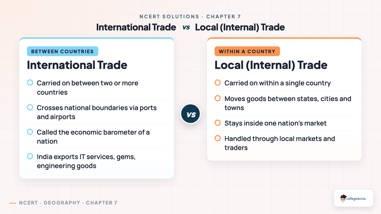
| Which term describes trade between two or more countries | (b) International trade. Trade between two or more countries, unlike internal or local trade. |
Tip: learn one keyword per option. That single line, Silchar to Porbandar or pipeline for continuous flow, is usually worth the full mark.
Lifelines of National Economy Important Question: 30-Word Section
The 30-word questions carry the short-answer marks. Each lifelines of national economy important question asks for a precise, comparison-based point, so padding wastes the word limit. Give the defining keyword with one reason.
- Three merits of roadways: lower construction cost, ability to cross hilly terrain, and economical door-to-door service.
- Where rail is most convenient: the level northern plains, where flat land and dense population make track-laying easy.
- Significance of border roads: they give defence forces quick access to frontier areas and develop these remote regions.
- Meaning of trade: the exchange of goods; international trade is between countries, local trade within one country.
Memorise the three merits of roadways (cost, terrain, door-to-door) and keep border roads = defence plus development ready, as these appear most years.
Transport Modes and Corridors Explained for Class 10 Geography
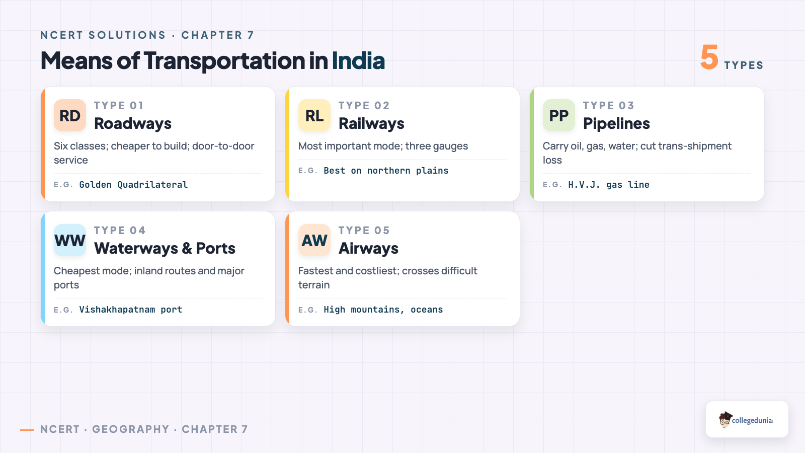
The classification of means of transportation is the backbone of this chapter. The quickest way to remember a mode is to tie it to land, water or air first.
| Mode of transport | Key facts that prove it |
|---|---|
| Roadways | Six classes (Golden Quadrilateral, National, State, District, Other and Border roads); cheaper to build, door-to-door service. |
| Railways | The most important mode; three gauges (broad 1.676 m, metre 1.000 m, narrow 0.762/0.610 m); best on the level northern plains. |
| Pipelines | Carry crude oil, gas and water continuously; the H.V.J. line runs through Gujarat, Madhya Pradesh and Uttar Pradesh. |
| Waterways and ports | Cheapest mode; Vishakhapatnam is the deepest land-locked, well-protected port on the east coast. |
| Airways | Fastest, costliest mode; vital over high mountains, dense forests and long oceanic stretches. |
A handy rule: land, water, air, then split land into road, rail and pipeline. Naming the mode and one route is often worth a mark.
The Changing Nature of International Trade in This Chapter
The two 120-word questions test why transport and communication are lifelines, and how India's international trade has changed in fifteen years. The change splits into composition (what is traded) and form (how it is traded). Name the axis of change plus one example for full marks.
| Axis of change | What changed and the example |
|---|---|
| Commodities to services | Trade in commodities is being replaced by information and knowledge-based services, with India a leading software exporter. |
| Wider basket of goods | Exports now span manufactured goods, gems and jewellery, chemicals and engineering goods, not just raw materials. |
| New foreign-exchange earners | International tourism has grown into a trade in services that brings in foreign exchange. |
| Form of trade | Fast electronic and IT-enabled links now carry much of the trade, replacing physical movement. |
Group your points by axis, composition, range, new earners, form, so a loose list becomes four buckets that are easy to recall.
Common Mistakes Students Make in This Class 10 Geography Chapter
A few slips lose easy marks every year. Fix these first.
- Swapping corridor end-points. North-South joins Srinagar to Kanniyakumari; East-West joins Silchar to Porbandar.
- Listing road features instead of road merits like cheaper cost and door-to-door reach.
- Adding Maharashtra to the H.V.J. pipeline, which runs only through Gujarat, Madhya Pradesh and Uttar Pradesh.
- Writing only that trade "increased", instead of naming the shift from commodities to IT services and tourism.
How to Use the NCERT Solutions Class 10 Geography Chapter 7 Page
Use these solutions in three short blocks so revision stays focused. Read the chapter, attempt the questions, then compare and fix the gaps.
- Read and list: note every transport mode, corridor route and port name on a blank map.
- Attempt first: answer all 7 questions on your own before opening the solutions.
- Compare and flag: match your answer with the solution and mark the missing fact-lines.
For long-answer practice, write the lifelines and changing-trade answers in full at least once. The set mirrors the board's 5-mark pattern.
Practice All NCERT Solutions for This Class 10 Geography Chapter with Step-by-Step Solutions
Open the question bank below to attempt all 7 solved questions with collapsible Solution and Expert Solution tabs. Every lifelines of national economy question answer is mapped to the NCERT text, the way a board examiner expects.
All Solved Questions for this Class 10 Geography Chapter
Practise every MCQ, 30-word and 120-word question with step-by-step and expert solutions.
Student Feedback
What 14,820 students told us about this chapter before the 2026 boards.
- 69% of students rated the corridor and pipeline MCQs as the ones they most often mixed up.
- 57% of students said the changing-trade 120-word answer was the hardest to keep inside the word limit.
- Most-confused pair: the North-South versus East-West corridor end-points, swapped by about 36% of students.
Source: 2026-27 Class 10 Geography student poll. Sample of 14,820 students from CBSE schools across 15 states.
Class 10 Geography Other Resources for This Chapter
Pair these solutions with the other Class 10 Geography resources for this chapter, all linked below.
| Resource | Best used for |
|---|---|
| Lifelines of National Economy Class 10 Notes | Quick concept recap before the exam |
| Lifelines of National Economy Class 10 Handwritten Notes | Last-minute scanned revision |
| Lifelines of National Economy Class 10 NCERT Book PDF | Reading the original chapter text |
All Chapters NCERT Solutions for Class 10 Geography (Contemp India II)
Browse the full set of ncert solutions for class 10 geography chapter by chapter.
| Chapter | NCERT Solutions |
|---|---|
| Chapter 1 | Resources and Development Class 10 NCERT Solutions |
| Chapter 2 | Forest and Wildlife Resources Class 10 NCERT Solutions |
| Chapter 3 | Water Resources Class 10 NCERT Solutions |
| Chapter 4 | Agriculture Class 10 NCERT Solutions |
| Chapter 5 | Minerals and Energy Resources Class 10 NCERT Solutions |
| Chapter 6 | Manufacturing Industries Class 10 NCERT Solutions |
| Chapter 7 | Lifelines of National Economy Class 10 NCERT Solutions |
Lifelines of National Economy Class 10 Geography NCERT Solutions FAQs
Ques. Where can I download the NCERT Solutions Class 10 Geography Chapter 7 Lifelines of National Economy PDF?
Ans. You can download the lifelines of national economy class 10 ncert solutions PDF directly from this page. Both the Normal and HD versions are free, and a Hindi-medium read is available too.
Ques. How many questions are solved in class 10 geography chapter 7 question answer?
Ans. All 7 NCERT questions are solved: 1 MCQ set of six parts, 4 short 30-word answers and 2 long 120-word answers, each with a step-by-step solution and an expert version.
Ques. Is this NCERT Solutions page aligned with the 2026-27 syllabus?
Ans. Yes. This page reflects the current 2026-27 syllabus for Class 10 Geography, and every answer is checked against the latest NCERT edition of Contemporary India II.
Ques. Why are transport and communication called the lifelines of a nation and its economy?
Ans. Transport moves goods and people from places of supply to places of demand, while communication carries information, ideas and money across distances. Working together they keep production, trade and progress alive, so they are called the lifelines of the nation and its economy.
Ques. What are the three merits of roadways in class 10 geography chapter 7?
Ans. Roads cost less to build than railway lines, they can cross hilly and dissected terrain that rail cannot manage, and they give economical door-to-door service for short distances and small loads, also feeding goods to railways, ports and airports.
Ques. Which is the deepest land-locked port on the east coast and which states does the H.V.J. pipeline cross?
Ans. Vishakhapatnam is the deepest, well-protected, land-locked port on the east coast. The H.V.J. (Hazira-Vijaipur-Jagdishpur) gas pipeline runs through Gujarat, Madhya Pradesh and Uttar Pradesh, but not Maharashtra.
Ques. How has India's international trade changed in the last fifteen years?
Ans. India's international trade has grown in value and shifted in character, from exchanging mainly commodities to exporting information technology and knowledge-based services, a wider basket of manufactured goods, and earning from international tourism through fast electronic links.



Comments