




This is the 2026-27 print of the NCERT Class 10 Geography book PDF Chapter 7 Lifelines of National Economy, the transport, communication, and trade chapter of Contemporary India II. The full 12-page chapter is free to download below, with a page-by-page map so you can jump straight to roadways, railways, the major sea ports, or international trade. Read it cover to cover or use the section map for quick board revision.
The lifelines of national economy class 10 PDF on this page is free and updated for the 2026-27 CBSE syllabus.
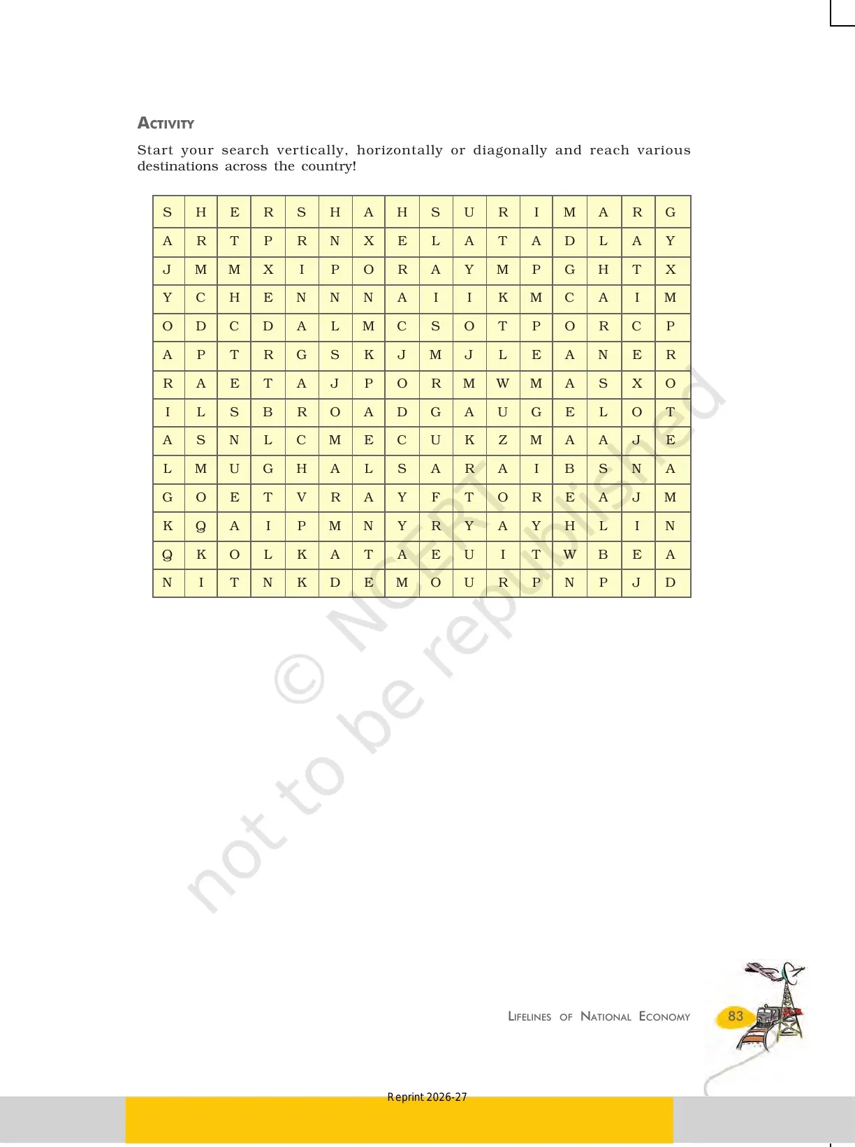
- CBSE Weightage: 6 to 7 marks per board paper, from Unit 4 Lifelines of National Economy.
- Question Mix: 1 MCQ, one 3-mark merits or significance question, and one 5-mark transport or trade answer in most papers.
- Most Tested: the six classes of roads, the railway gauges and zones, and the major sea ports.
This NCERT book PDF page is curated by subject experts, taken from the 2026-27 NCERT print, and checked against the last five years of CBSE Class 10 Social Science papers.
How the NCERT Class 10 Geography Book PDF Chapter 7 Helps You Prepare
Lifelines of National Economy is the seventh chapter in Contemporary India II and a reliable scorer, carrying 6 to 7 marks. It ties together the means of transport, communication, and international trade. This page is built for fast board revision:
- Page-Band Map: every topic is tagged with its page range in the official PDF.
- Transport Focus: roadways, railways, and sea ports are pulled into single tables for fast recall.
- Exam-Tagged Reading: each section is flagged with the question type CBSE asks from it.
Lifelines of National Economy Class 10 Explained for Boards
Source: Magnet Brains on YouTube
What the Lifelines of National Economy Class 10 PDF Contains
The chapter opens with why transport and communication matter, then moves through the four means of transport, the major sea ports, communication, and international trade, ending with tourism as a trade. The table lists each part with its page band in the official PDF.
| Topic | Page Range | What it Covers |
|---|---|---|
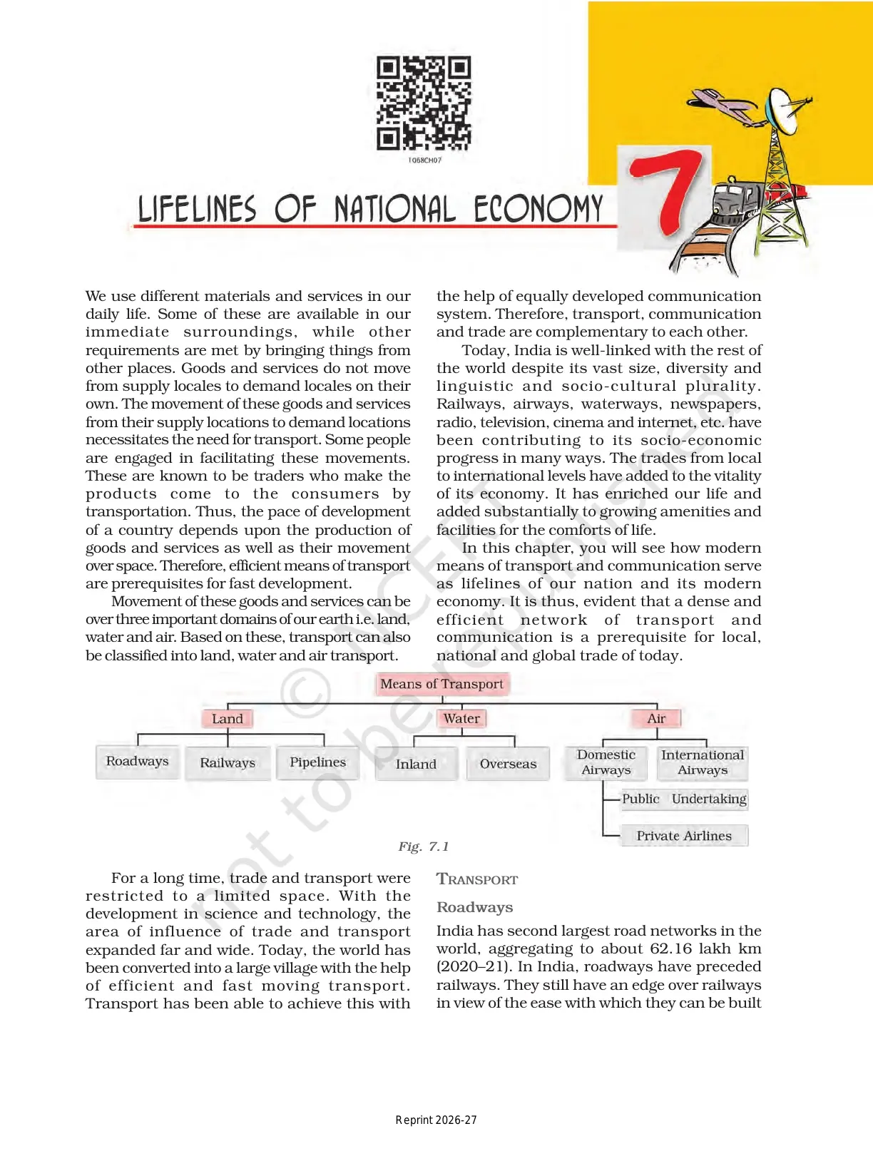
| Means of Transport | 71 | Why transport, communication, and trade are complementary lifelines (Fig 7.1). |
| Roadways | 72-74 | Second largest road network, the six classes of roads, Golden Quadrilateral. |
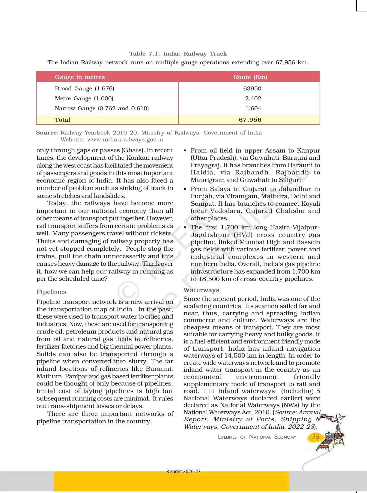
| Railways and Pipelines | 74-75 | 17 railway zones, three gauges, three pipeline networks (Table 7.1). |
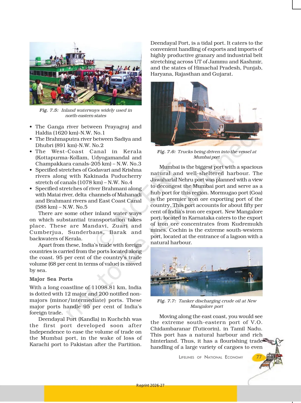
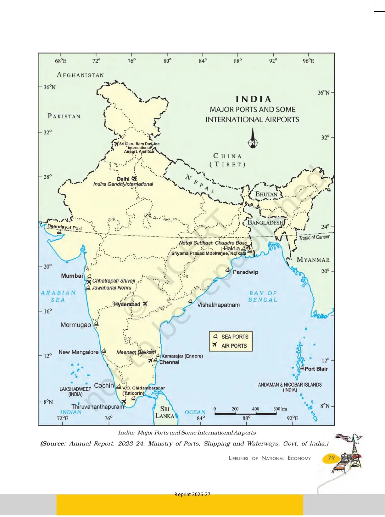
| Waterways and Sea Ports | 75-78 | National Waterways and the 12 major sea ports (Fig 7.5 to 7.8). |
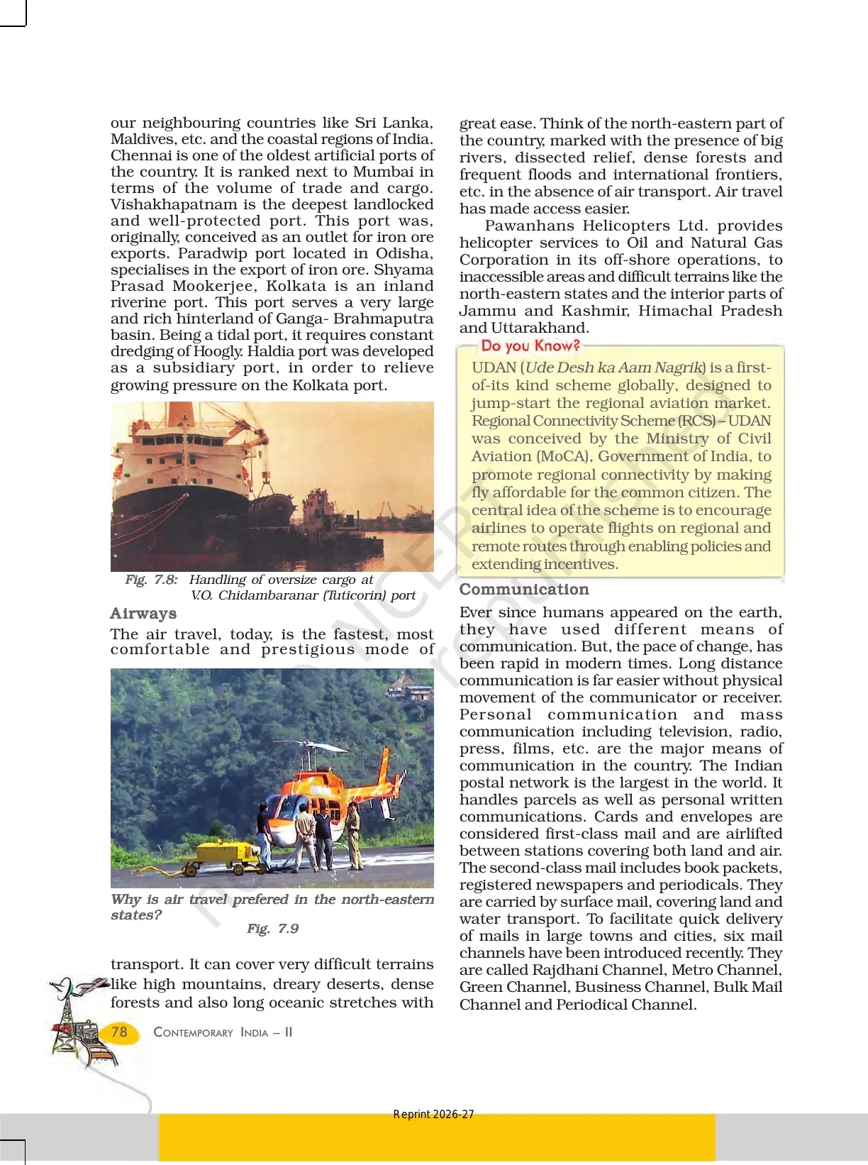
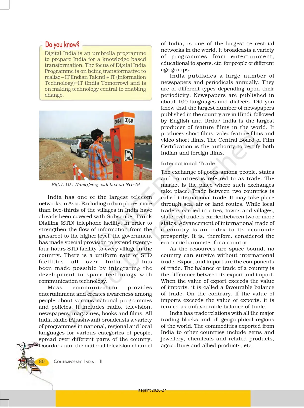
| Airways and Communication | 78-80 | Air travel, postal network, mass communication, UDAN scheme. |
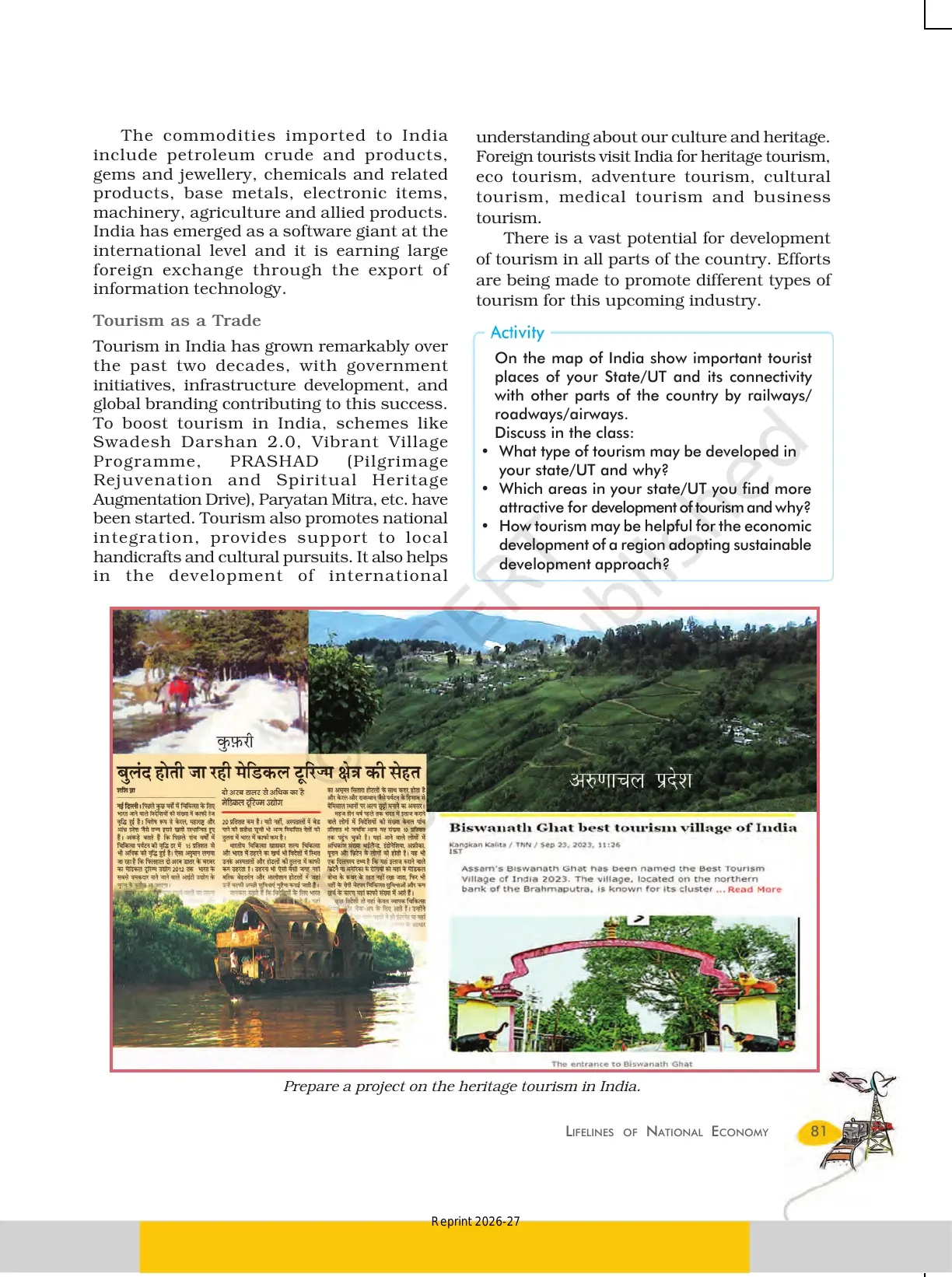
| International Trade and Tourism | 80-81 | Balance of trade, exports and imports, tourism as a trade. |
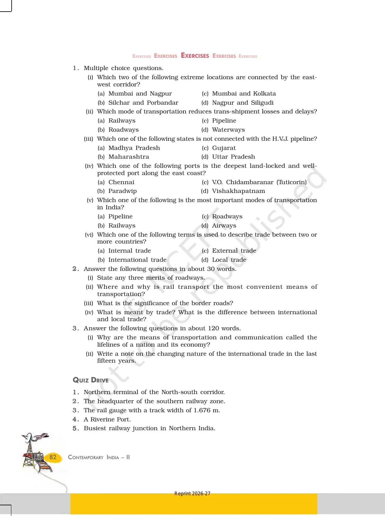
| Exercises and Quiz Drive | 82 | 6 MCQs, 30-word and 120-word questions, quiz drive. |
Treat roadways (pages 72 to 74) and the major sea ports (pages 77 to 78) as primary; the communication notes are a supporting read.
Means of Transport in NCERT Class 10 Geography Chapter 7
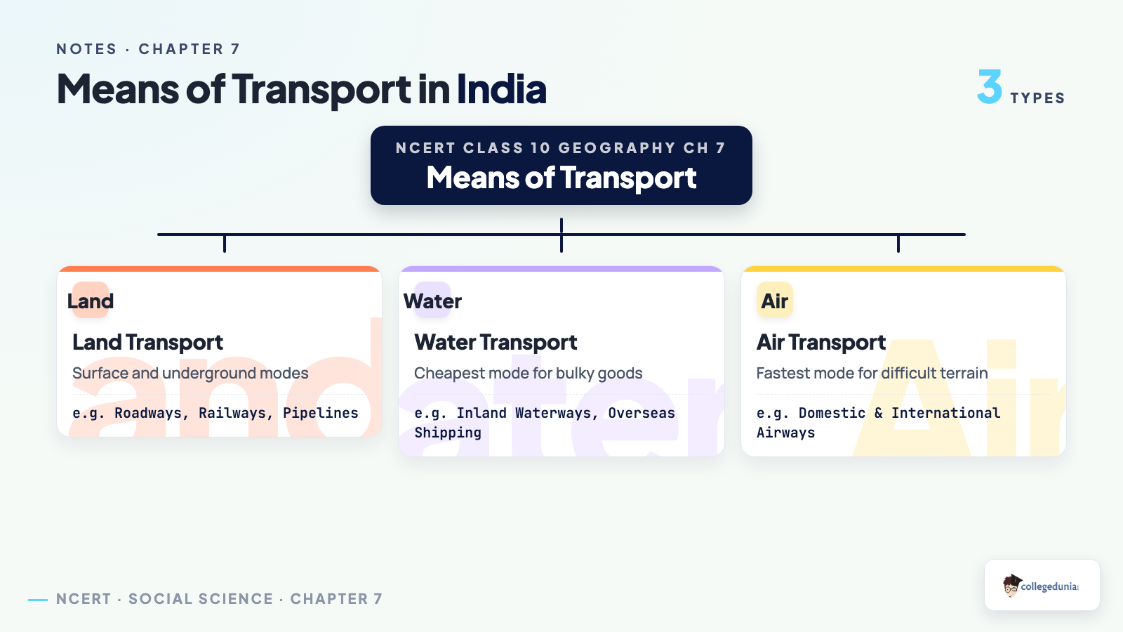
Transport, communication, and trade are complementary, and a dense, efficient network is a prerequisite for trade. Transport moves over three domains, the source of most 1-mark questions:
- Land transport: roadways, railways, and pipelines carry goods and people over the surface and underground.
- Water transport: inland waterways along rivers and canals, and overseas shipping across the oceans.
- Air transport: domestic and international airways, the fastest and most prestigious mode for difficult terrain.
A country's development depends on the movement of goods and services over space, which is why these means are called the lifelines of a nation and its economy, a favourite 5-mark reasoning question.
Roadways and the Six Classes of Roads in Class 10 Geography Chapter 7
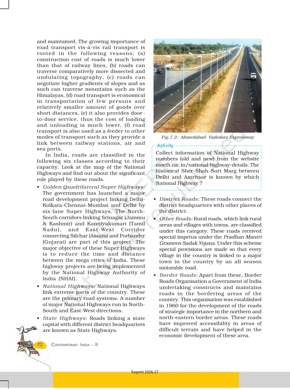
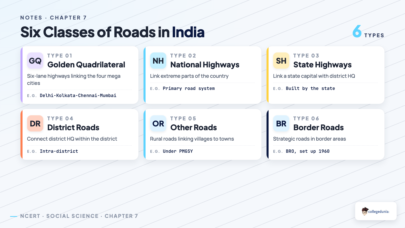
India has the second largest road network in the world, about 62.16 lakh km, and roadways have an edge over railways: cheaper to build, able to cross difficult terrain, and door-to-door. NCERT sorts roads into six classes, a guaranteed 3-mark question.
| Class of Road | Key Detail |
|---|---|
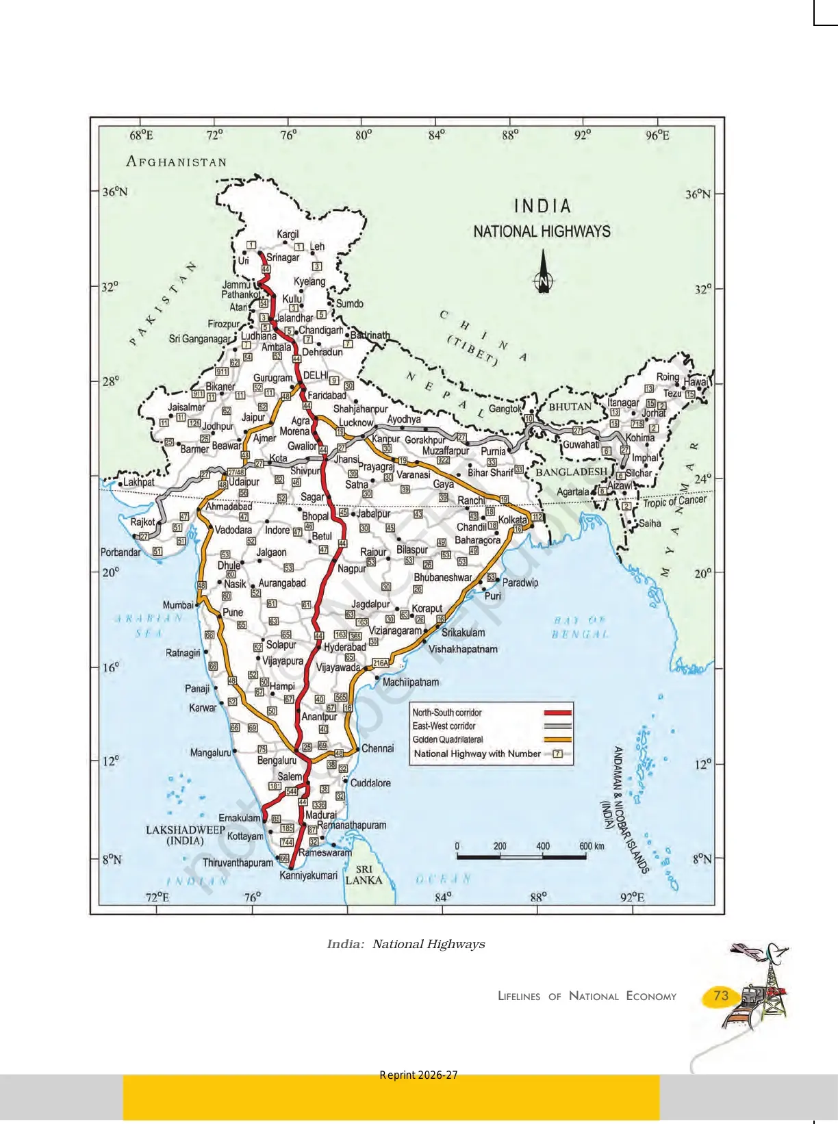
| Golden Quadrilateral Super Highways | Six-lane highways linking Delhi, Kolkata, Chennai, and Mumbai; built by NHAI to cut travel time. |
| National Highways | Link extreme parts of the country; the primary road systems. |
| State Highways | Link a state capital with different district headquarters. |
| District Roads | Connect district headquarters with other places of the district. |
| Other Roads | Rural roads linking villages with towns, built under the Pradhan Mantri Grameen Sadak Yojana. |
| Border Roads | Built by the Border Roads Organisation, set up in 1960 for strategic roads in border areas. |
Roads are also classified by material into metalled all-weather roads and unmetalled roads. A common 3-mark question asks for three merits of roadways over railways.
Railways, Pipelines, and Waterways in NCERT Chapter 7
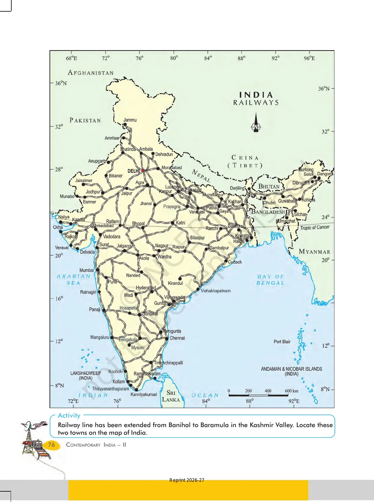
Railways are the principal mode for freight and passengers and a great integrating force for over 150 years. The first train ran Mumbai to Thane in 1853 over 34 km, and the network is now in 17 zones, with figures that often appear as 1-mark answers.
- Railway gauges: 67,956 km on three gauges, with broad gauge (1.676 m) carrying the bulk (Table 7.1).
- Pipelines: carry crude oil, petroleum products, and natural gas to refineries and plants; the first HVJ gas pipeline links Mumbai High and Bassein with fertiliser and power complexes.
- Waterways: the cheapest, most fuel-efficient mode; India has 14,500 km of navigable inland waterways, with NW No. 1 on the Ganga (Prayagraj to Haldia, 1620 km).
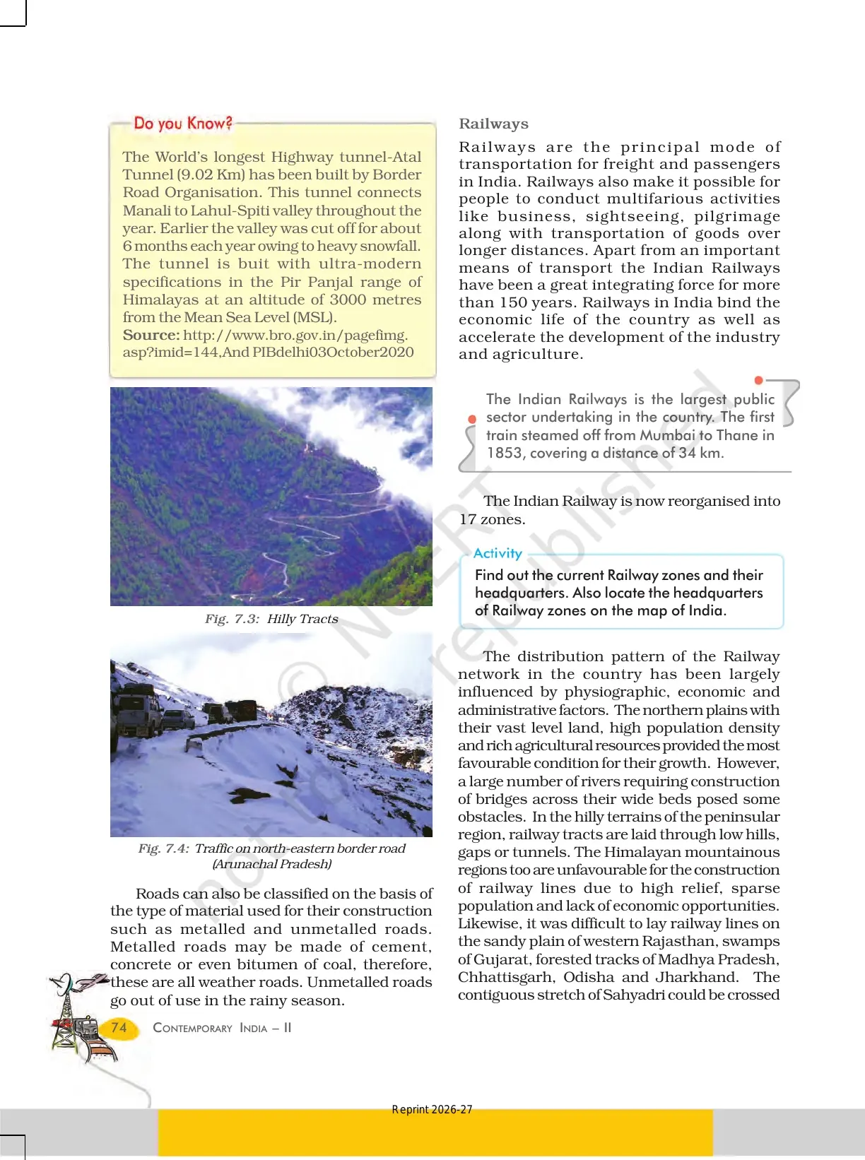
The railway network is shaped by physiographic, economic, and administrative factors, so the northern plains have a dense network while the Himalayas and western Rajasthan are sparse, a favourite 3-mark reasoning question.
Major Sea Ports in Lifelines of National Economy Class 10 PDF
India has 12 major and 200 notified non-major ports, and the major ports handle 95 per cent of India's foreign trade. The named ports and their specialities are the most exam-relevant block, so learn one stand-out fact for each.
- Deendayal (Kandla) and Mumbai: Deendayal was the first port developed after Independence; Mumbai is the biggest, with a well-sheltered natural harbour.
- Jawaharlal Nehru and Marmagao: Jawaharlal Nehru was planned to decongest Mumbai; Marmagao (Goa) is the premier iron-ore exporting port.
- New Mangalore and Cochin: New Mangalore handles iron-ore concentrate from Kudremukh; Cochin sits at the entrance of a lagoon with a natural harbour.
- Visakhapatnam and Paradip: Visakhapatnam is the deepest land-locked, well-protected port; Paradip (Odisha) specialises in iron-ore export.
About 95 per cent of trade volume is moved by sea, so the ports are the gateways of international trade. A frequent question asks the deepest land-locked, well-protected port on the east coast: Visakhapatnam.
Airways, Communication, and International Trade in Chapter 7
Airways are the fastest, most prestigious mode and can cross difficult terrain like mountains and forests; communication and international trade close the chapter. The points below are the source of the long-answer questions.
- Airways: cover difficult terrain with ease; Pawanhans serves ONGC and remote areas, and the UDAN scheme promotes affordable regional connectivity.
- Communication: the Indian postal network is the largest in the world; mass communication via radio, TV, newspapers, and films creates awareness.
- International trade: the balance of trade is the difference between exports and imports.
- Tourism as a trade: promotes national integration, supports local handicrafts, and is boosted by Swadesh Darshan 2.0 and PRASHAD.
International trade is the economic barometer of a country, and no country can survive without international trade because resources are space bound, a line worth memorising.
How to Read the Lifelines of National Economy Chapter for Boards
The chapter is 12 pages, so one focused session covers it. Use a three-pass routine: read, table-make, then practise.
- Pass 1: read all sections once and mark every defined term (gauge, balance of trade, terminal, riverine port).
- Pass 2: build two tables from memory, one for the six classes of roads and one for the major sea ports and their specialities.
- Pass 3: solve the page-82 MCQs and 30-word questions, then both 120-word answers; memorise the railway gauge figures and named sea ports.
NCERT Class 10 Geography Chapter 7 Important Questions and Exercises
The official exercises on page 82 mirror the CBSE question pattern. Solving them once is enough practice for the board version of each type:
- MCQs: the east-west corridor's extreme locations; which mode cuts trans-shipment losses; the deepest land-locked port on the east coast.
- 30-word answers: three merits of roadways; the significance of border roads; what is meant by trade.
- 120-word answers: why transport and communication are called lifelines; the changing nature of international trade.
Also Check: These Collegedunia resources cover the same chapter in other formats.
| Resource | Best Used For |
|---|---|
| Lifelines of National Economy Class 10 NCERT Solutions | Step-by-step answers to every exercise question. |
| Lifelines of National Economy Class 10 Notes | Quick revision of every section with diagrams. |
| Lifelines of National Economy Class 10 Handwritten Notes | One-shot scanned revision before the exam. |
NCERT Class 10 Geography Book PDF: All Chapters
Other Class 10 Geography (Contemporary India II) NCERT book PDFs you can download free:
| Chapter | Resource |
|---|---|
| Chapter 1 | Resources and Development NCERT PDF |
| Chapter 2 | Forest and Wildlife Resources NCERT PDF |
| Chapter 3 | Water Resources NCERT PDF |
| Chapter 4 | Agriculture NCERT PDF |
| Chapter 5 | Minerals and Energy Resources NCERT PDF |
| Chapter 6 | Manufacturing Industries NCERT PDF |
Lifelines of National Economy NCERT PDF: available above as a free download, taken from the 2026-27 NCERT print.
NCERT Class 10 Geography Book PDF Chapter 7 Lifelines of National Economy - Frequently Asked Questions
Ques. Where can I download the lifelines of national economy class 10 PDF for Chapter 7 for free?
Ans. You can download the Lifelines of National Economy NCERT PDF directly from this page. The full 12-page chapter from the 2026-27 NCERT print is free to download.
Ques. Is this Lifelines of National Economy Class 10 PDF aligned with the 2026-27 CBSE syllabus?
Ans. Yes. The page reflects the current 2026-27 Class 10 Geography (Contemporary India II) syllabus. It keeps all sections, the means of transport, the major sea ports, communication, and international trade.
Ques. Why are means of transport and communication called the lifelines of a nation?
Ans. They move goods, services, and people from supply areas to demand areas and link local, national, and global trade. Because the pace of a country's development depends on this movement, a dense and efficient network of transport and communication is a prerequisite for the economy, which is why it is called a lifeline.
Ques. What are the six classes of roads in Class 10 Geography Chapter 7?
Ans. NCERT classifies roads into Golden Quadrilateral Super Highways, National Highways, State Highways, District Roads, Other Roads (rural roads under PMGSY), and Border Roads built by the Border Roads Organisation set up in 1960.
Ques. Which are the major sea ports covered in this chapter?
Ans. India has 12 major ports. The chapter names Deendayal (Kandla), Mumbai, Jawaharlal Nehru, Marmagao, New Mangalore, Cochin, Visakhapatnam, Paradip, Chennai, Kolkata (Shyama Prasad Mookerjee), Haldia, and V.O. Chidambaranar (Tuticorin), each with its own speciality.
Ques. How many marks does the Lifelines of National Economy chapter carry in the Class 10 board exam?
Ans. The chapter usually carries 6 to 7 marks in the CBSE Class 10 Social Science paper. Most papers ask one MCQ, one 3-mark merits or significance answer, and one 5-mark transport or trade-based answer from it.
Ques. What is the difference between a favourable and an unfavourable balance of trade?
Ans. The balance of trade is the difference between a country's exports and imports. When the value of exports exceeds imports it is a favourable balance of trade; when imports exceed exports it is an unfavourable balance of trade.



Comments