




These lifelines of national economy class 10 notes compress NCERT Chapter 7 of Geography (Contemporary India II) into one printable revision sheet: why transport, communication and trade are the lifelines of the economy, the classes of roads and the Golden Quadrilateral, the railway gauges and zones, pipelines and the HVJ line, waterways and sea ports, airways, communication and international trade with tourism.
Chapter7LifelinesofNationalEconomyNotes.pdf?page=1&dpi=150)
Chapter7LifelinesofNationalEconomyNotes.pdf?page=2&dpi=150)
Chapter7LifelinesofNationalEconomyNotes.pdf?page=3&dpi=150)
Chapter7LifelinesofNationalEconomyNotes.pdf?page=4&dpi=150)
Chapter7LifelinesofNationalEconomyNotes.pdf?page=5&dpi=150)
Chapter7LifelinesofNationalEconomyNotes.pdf?page=6&dpi=150)
Chapter7LifelinesofNationalEconomyNotes.pdf?page=7&dpi=150)
Chapter7LifelinesofNationalEconomyNotes.pdf?page=8&dpi=150)
Chapter7LifelinesofNationalEconomyNotes.pdf?page=9&dpi=150)
Chapter7LifelinesofNationalEconomyNotes.pdf?page=10&dpi=150)
Chapter7LifelinesofNationalEconomyNotes.pdf?page=11&dpi=150)
Chapter7LifelinesofNationalEconomyNotes.pdf?page=12&dpi=150)
Chapter7LifelinesofNationalEconomyNotes.pdf?page=13&dpi=150)
Chapter7LifelinesofNationalEconomyNotes.pdf?page=14&dpi=150)
Chapter7LifelinesofNationalEconomyNotes.pdf?page=15&dpi=150)
Chapter7LifelinesofNationalEconomyNotes.pdf?page=16&dpi=150)
Chapter7LifelinesofNationalEconomyNotes.pdf?page=17&dpi=150)
Chapter7LifelinesofNationalEconomyNotes.pdf?page=18&dpi=150)
Chapter7LifelinesofNationalEconomyNotes.pdf?page=19&dpi=150)
Chapter7LifelinesofNationalEconomyNotes.pdf?page=20&dpi=150)
Built for a 30-minute night-before revision, as per the 2026-27 CBSE syllabus.
- Concept-first revision for the full chapter: roadways and the Golden Quadrilateral, railways and gauges, pipelines, waterways, ports, airways, communication and international trade.
- Every mode of transport linked to its key facts, leading examples and the exact one-line data CBSE markers reward, including the 17 rail zones, the HVJ pipeline and the balance of trade formula.
- Cross-pointers to the matching NCERT Solutions, Handwritten Notes and NCERT Book PDF for Class 10 Geography Chapter 7 Lifelines of National Economy.
Every line in these lifelines of national economy class 10 notes is written by Collegedunia geography experts, based on the 2026-27 NCERT Contemporary India II textbook, and checked against the last five years of CBSE Class 10 Social Science board papers.
Student Feedback: What 11,800 students told us about revising this chapter
71% of Class 10 students said matching each pipeline, national waterway and rail gauge to its correct fact was the single most-confused area when they sat down to revise this chapter. 3 out of 4 students rated the Golden Quadrilateral corridors and the changing nature of international trade as the parts most worth revising from a printable notes sheet.
Toppers reported that pairing these lifelines of national economy class 10 notes with the matching NCERT Solutions PDF added 2 to 3 marks per 5-mark answer in mock tests. The average student finished the full notes revision in 30 minutes against a one-hour budget for the chapter.
Source: 2026-27 Class 10 Social Science student poll. Sample of 11,800 students from CBSE schools across 15 states, conducted before the 2026 boards.
Quick Concept Recap: Lifelines of the National Economy at a Glance
Chapter 7 explains why transport, communication and trade are called the lifelines of a nation. Production is not complete until goods reach the consumer, and that movement of goods, people and information is what these three pillars provide. This recap fixes the whole chapter in one screen.
- Three pillars: transport moves goods and people, communication moves information, trade exchanges goods and services.
- Roadways and railways: six classes of roads topped by the Golden Quadrilateral (NHAI); railways run on broad, metre and narrow gauge in 17 zones.
- Pipelines, waterways, trade: HVJ line carries oil and gas; 111 National Waterways are the cheapest mode; balance of trade is exports minus imports, and tourism is an invisible trade.
This recap covers the same topics that the matching NCERT Solutions for Class 10 Geography Chapter 7 walks through one question at a time.
Why Transport, Communication and Trade Are the Lifelines of the Economy
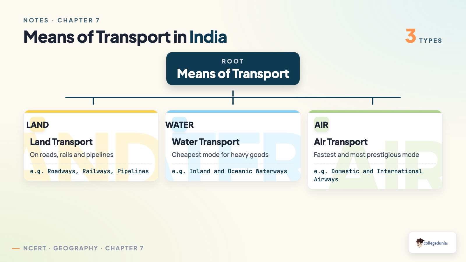
Production is not complete until goods reach the consumer, and for that we need transport, communication and trade together. A one-mark or three-mark question often asks students to distinguish them, so the table below is worth memorising.
| Pillar | What it does | Examples |
|---|---|---|
| Transport | Moves goods and people physically from one place to another. | Roads, railways, pipelines, ships, aircraft |
| Communication | Moves information without moving the sender or receiver. | Post, telephone, radio, television, internet |
| Trade | Exchanges goods and services between people, states and countries. | Local markets, interstate trade, international trade |
- Means of transport are classified into land (roadways, railways, pipelines), water (inland and oceanic waterways) and air (domestic and international airways).
- A dense and efficient network of these lifelines is a prerequisite for local, national and global development.
Memory hook: "TCT" = Transport moves goods and people, Communication moves information, Trade exchanges goods and services.
Lifelines of National Economy Class 10 Explained in Simple Language
Source: Magnet Brains on YouTube
Roadways and the Golden Quadrilateral: Six Classes of Roads
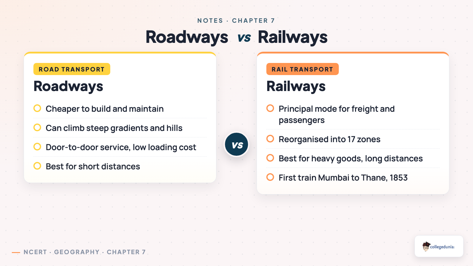
India has one of the largest road networks in the world. Road transport is preferred over railways for short distances because roads are cheaper to build, can negotiate steep gradients, and offer door-to-door service with lower loading costs. Know the six classes of roads and the Golden Quadrilateral.
| Class of Road | Key Facts | Built / Maintained by |
|---|---|---|
| Golden Quadrilateral | Six-lane super highways linking Delhi, Kolkata, Chennai and Mumbai. | NHAI |
| National Highways | Primary roads linking extreme parts of the country. | NHAI / CPWD |
| State Highways | Link the state capital with district headquarters. | State PWD |
| District Roads | Connect district headquarters with district places. | Zila Parishad |
| Other / Rural Roads | Link villages; built under PMGSY. | PMGSY |
| Border Roads | Strategic roads in high-altitude border areas. | Border Roads Organisation |
- The Golden Quadrilateral links Delhi, Kolkata, Chennai and Mumbai; the North-South corridor joins Srinagar to Kanniyakumari and the East-West corridor joins Silchar to Porbandar.
- Roads are also classified by material: metalled (pucca, all-weather) and unmetalled (kutcha) roads that break down in the rainy season.
- The Border Roads Organisation builds roads in border areas, improving accessibility in high-altitude mountainous regions.
Common mistake: do not swap the corridors. North-South joins Srinagar to Kanniyakumari; East-West joins Silchar to Porbandar. CBSE asks the terminals almost every year.
Railways: Gauges, Zones and the Factors Behind the Network
Railways are the principal mode of transport for freight and passengers and a great integrating force for over 150 years. The first train ran from Mumbai to Thane in 1853, covering 34 km. Indian Railways is reorganised into 17 zones. Know the three gauges and the factors shaping the network.
| Rail Gauge | Track Width | Where it is used |
|---|---|---|
| Broad Gauge | 1.676 m | Most of the network; under Project Unigauge most lines are being converted to broad gauge. |
| Metre Gauge | 1.000 m | Older lines being phased out and converted. |
| Narrow Gauge | 0.762 m / 0.610 m | Hilly terrain; mostly heritage mountain railways. |
- Distribution of the network depends on physiographic, economic and administrative factors. The northern plains have a dense network because of level land, high population and rich agriculture.
- The Himalayan, sandy desert, swampy and forested regions are unfavourable, so the network thins out there.
- Problems include travelling without tickets, theft and damage of property, and pulling the chain unnecessarily, which causes delays.
Easy mark: "First train Mumbai to Thane, 1853, 34 km" and "17 zones" fetch full marks in a one-mark factual question on railways.
Pipelines, Waterways and Major Sea Ports
India moves liquids, gases and bulky cargo through pipelines and over water. Pipelines are the newest arrival, while waterways are the oldest and cheapest mode. This section covers the pipeline networks, the inland National Waterways and the major sea ports.
| Mode | Key Facts | Examples |
|---|---|---|
| Pipelines | Carry crude oil, gas and solids as slurry; reduce trans-shipment losses. | HVJ (Hazira-Vijaipur-Jagdishpur) |
| Waterways | Cheapest, eco-friendly; best for bulky goods. 14,500 km navigable inland. | 111 National Waterways (2016 Act) |
| Sea Ports | Handle bulk overseas trade; 12 major ports on a 7,516 km coastline. | Mumbai (largest), Kandla, Marmagao |
- The pipeline networks connect oil and gas fields to refineries, fertiliser factories and thermal power plants; far-inland plants at Barauni, Mathura and Panipat exist only because of pipelines.
- Under the National Waterways Act, 2016, 111 inland waterways were made National Waterways; waterways are the cheapest mode for heavy, bulky goods.
- Port superlatives: Mumbai is the biggest, Kandla the first after Partition, Jawaharlal Nehru the largest container port.
Easy mark: the HVJ (Hazira-Vijaipur-Jagdishpur) pipeline is the standard one-mark example. If a question asks "which mode reduces trans-shipment losses?", the answer is always the pipeline.
Airways, Communication and International Trade with Tourism
The last block covers the fastest mode of transport, the networks that move information, and the trade that earns foreign exchange. Airways are costly but vital for difficult terrain, communication is personal and mass, and international trade with tourism is the economic barometer of the country.
| Topic | Key Facts | Why it matters |
|---|---|---|
| Airways | Fastest mode; vital over difficult terrain like the Himalayas. Air India and Pawan Hans operate. | Reaches remote areas quickly. |
| Communication | Personal (post, telephone) and mass (radio, TV, newspapers, internet). | Knits the nation together. |
| International Trade | Trade between countries by sea, air and land; the economic barometer. | Earns foreign exchange. |
| Tourism | An invisible trade; boosted by Swadesh Darshan 2.0 and PRASHAD. | Earns exchange, promotes integration. |
- The balance of trade is exports minus imports: Balance of Trade = Exports - Imports . A surplus is favourable, a deficit unfavourable.
- Mass communication (radio, TV, newspapers, internet) creates awareness, while personal communication (post, telephone) links individuals.
- Tourism is an invisible trade because it earns foreign exchange, generates employment and promotes national integration.
Common mistake: balance of trade is only exports minus imports of goods, not the whole balance of payment. State the formula and label surplus or deficit for full marks.
CBSE Previous Year Trends and Highest-Yield Topics for the Board Exam
This chapter is a steady source of marks, including a map-work question on roads, railways and ports. Prioritise these high-yield topics.
- Highest-yield: the Golden Quadrilateral with its corridors and the changing nature of international trade (often 3 or 5 marks).
- Must-know facts: 17 rail zones; first train Mumbai to Thane 1853; HVJ pipeline; 111 National Waterways; Mumbai the biggest port; balance of trade = exports minus imports.
- Whole-chapter recall: "R-R-P-W-A-C-T" = Roadways, Railways, Pipelines, Waterways, Airways, Communication, Trade.
How These Notes Pair with NCERT Solutions, Handwritten Notes and the Book PDF
These notes work best as part of a four-file revision stack. Use the Notes for the concept and the memory hooks, then jump to the matching NCERT Solutions for Class 10 Geography Chapter 7 for the full worked answers on the Golden Quadrilateral and international trade. The Handwritten Notes are scanned-style pages for tactile revision, and the NCERT Book PDF is the canonical source.
Other Resources for Class 10 Geography Chapter 7 Lifelines of National Economy
Pair these revision notes with the matching NCERT Solutions, handwritten notes and the official NCERT book chapter. The cross-resource table below links to every Collegedunia file for Class 10 Geography Chapter 7.
| Resource | What it covers | Open |
|---|---|---|
| Notes | Concept-first revision notes covering roadways, railways, pipelines, waterways, ports, airways, communication and international trade. | You are here |
| NCERT Solutions | Step-by-step answers to every exercise question, including the 3-mark and 5-mark answers with full detail. | Class 10 Geography Chapter 7 NCERT Solutions |
| Handwritten Notes | Scanned-style handwritten revision pages for last-minute board exam practice. | Class 10 Geography Chapter 7 Handwritten Notes |
| NCERT Book PDF | Official NCERT Contemporary India II Chapter 7 textbook in PDF form. | Class 10 Geography Chapter 7 NCERT Book PDF |
All Chapters Notes for Class 10 Geography Contemporary India II
Related Links: Use the table below to reach the Notes for the other chapters of Class 10 Geography Contemporary India II. Every chapter ships with the same revision-friendly structure, key definitions and FAQ block.
| Chapter | Topic | Notes link |
|---|---|---|
| Chapter 1 | Resources and Development | Class 10 Geography Chapter 1 Notes |
| Chapter 2 | Forest and Wildlife Resources | Class 10 Geography Chapter 2 Notes |
| Chapter 3 | Water Resources | Class 10 Geography Chapter 3 Notes |
| Chapter 4 | Agriculture | Class 10 Geography Chapter 4 Notes |
| Chapter 5 | Minerals and Energy Resources | Class 10 Geography Chapter 5 Notes |
| Chapter 6 | Manufacturing Industries | Class 10 Geography Chapter 6 Notes |
| Chapter 7 | Lifelines of National Economy | You are here |
NCERT Notes Class 10 Geography Chapter 7 Lifelines of National Economy FAQs
Ques. What do the lifelines of national economy class 10 notes cover?
Ans. The lifelines of national economy class 10 notes are a concept-first revision file that compress the entire NCERT Chapter 7 of Class 10 Geography Contemporary India II into a printable study guide. They cover why transport, communication and trade are called the lifelines of the economy, the six classes of roads and the Golden Quadrilateral, the railway gauge system and the 17 rail zones, pipelines and the HVJ line, inland waterways and the major sea ports, airways, personal and mass communication, and international trade with tourism as an invisible trade. Students typically use these notes for a 30-minute first-pass revision and a 20-minute night-before pass; the worked answers to the NCERT exercise questions live in the matching NCERT Solutions PDF.
Ques. Why are transport, communication and trade called the lifelines of the national economy?
Ans. The production of goods and services is not complete until they reach the consumer, and these three pillars make that possible. Transport physically moves goods and people from one place to another by land, water and air. Communication moves information without moving the sender or receiver, through personal means like post and telephone and mass means like radio, television, newspapers and the internet. Trade is the exchange of goods and services between people, states and countries. Together they have converted the world into a global village, and a dense and efficient network of all three is a prerequisite for local, national and global development, which is why the chapter calls them lifelines.
Ques. What is the Golden Quadrilateral and what are its corridors?
Ans. The Golden Quadrilateral is a major road-development project of six-lane super highways linking the four mega cities of Delhi, Kolkata, Chennai and Mumbai, implemented by the National Highways Authority of India (NHAI). Two corridors run with it: the North-South corridor links Srinagar in Jammu and Kashmir to Kanniyakumari in Tamil Nadu, and the East-West corridor links Silchar in Assam to Porbandar in Gujarat. The aim of these super highways is to reduce the time and distance between India's mega cities, which speeds up the movement of goods and people and lowers transport costs. Knowing the four cities and the two corridor terminals correctly fetches full marks in the frequently asked map-work and MCQ questions.
Ques. Why are pipelines important, and what is the HVJ pipeline?
Ans. Pipelines are the newest arrival on India's transport map and carry crude oil, petroleum products and natural gas from oil and gas fields to refineries, fertiliser factories and big thermal power plants; even solids can be moved as slurry. Their biggest advantage is that they reduce trans-shipment losses and delays, and once the high initial cost of laying the pipeline is met, the running cost is minimal with almost no risk of theft. The HVJ pipeline, which stands for Hazira-Vijaipur-Jagdishpur, is the standard one-mark example. Far-inland refineries and fertiliser plants at Barauni, Mathura and Panipat exist only because pipelines can deliver their feedstock cheaply.
Ques. How many National Waterways does India have and why are waterways important?
Ans. Under the National Waterways Act, 2016, a total of 111 inland waterways, including the five declared earlier, were made National Waterways. Waterways are the cheapest means of transport and are most suitable for carrying heavy and bulky goods; they are also fuel-efficient and environment-friendly. India has about 14,500 km of navigable inland waterways. The first five National Waterways are National Waterway 1 on the Ganga (Allahabad to Haldia), National Waterway 2 on the Brahmaputra (Sadiya to Dhubri), National Waterway 3 the West Coast Canal in Kerala, National Waterway 4 on the Godavari and Krishna, and National Waterway 5 on the Brahmani and the Mahanadi delta. CBSE often asks students to match a river to its National Waterway number.
Ques. What is the balance of trade and how does tourism count as a trade?
Ans. The balance of trade is the difference between the value of a country's exports and the value of its imports, written as balance of trade equals exports minus imports. When exports exceed imports the country has a favourable trade surplus, and when imports exceed exports it has an unfavourable trade deficit. International trade is the economic barometer of a country because it reflects the health of the economy. Tourism is treated as an invisible trade because it earns valuable foreign exchange, generates large-scale employment and promotes national integration without exporting any physical good. Schemes such as Swadesh Darshan 2.0, PRASHAD and the Vibrant Village Programme have been launched to boost tourism in India.
Ques. Are these lifelines of national economy class 10 notes updated for the 2026-27 session?
Ans. Yes. These lifelines of national economy class 10 notes are based on the 2026-27 NCERT Contemporary India II textbook and the latest CBSE Class 10 Social Science sample paper. The chapter structure is unchanged for the current cycle, and the CBSE marking scheme continues to reward well-organised, point-wise answers for the 3-mark and 5-mark questions on the Golden Quadrilateral and the changing nature of international trade. Students should use these notes for both the short-answer and long-answer parts of the chapter, then move to the matching NCERT Solutions PDF for full worked answers.



Comments