




The Class 12 Geography Chapter 4 Water Resources textbook PDF is the official NCERT source for every board question on India's surface water, groundwater, water demand, irrigation, watershed development, and rainwater harvesting. It carries about 5 to 6 marks in the CBSE board exam and is one of the most fact-dense chapters in India: People and Economy.
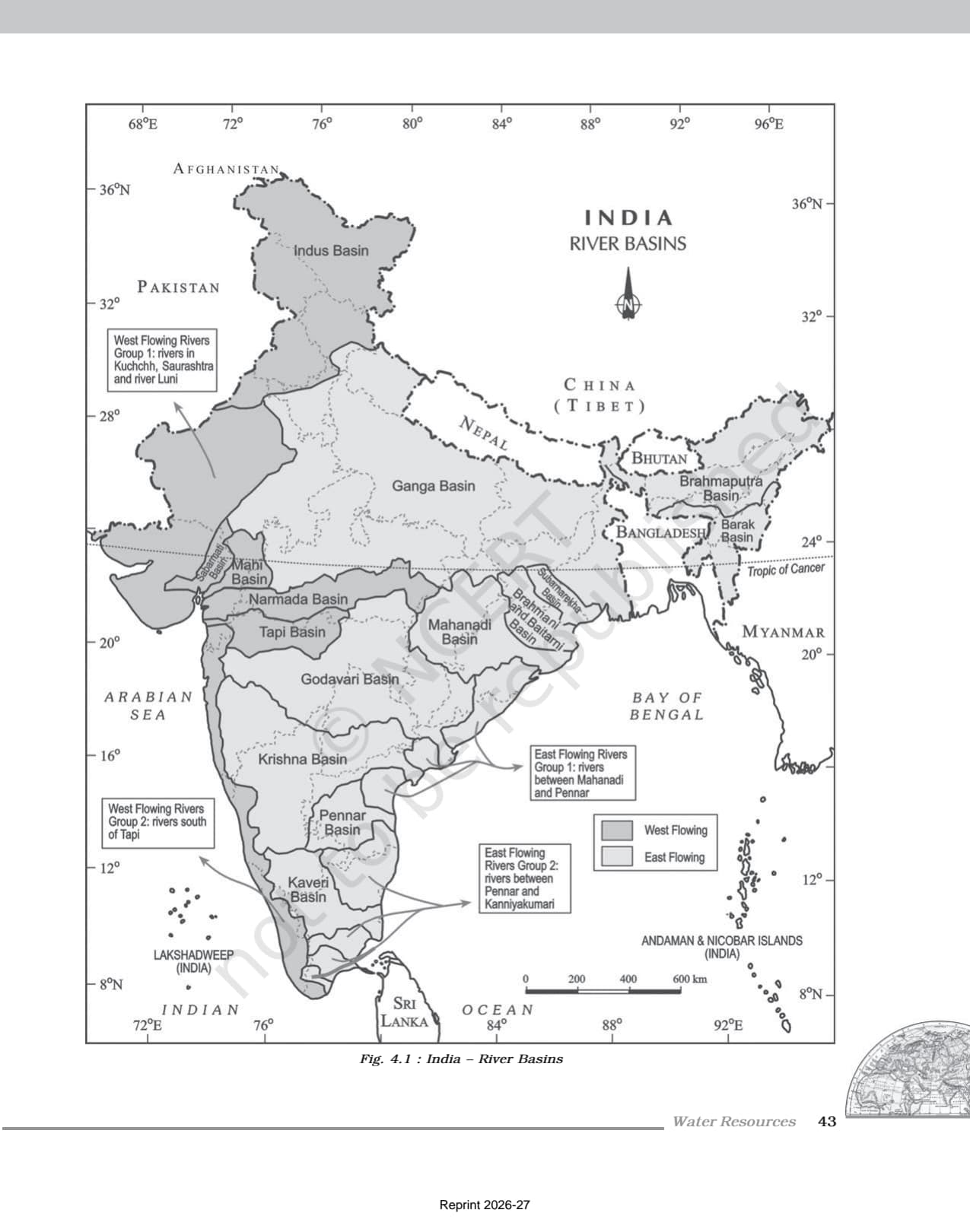
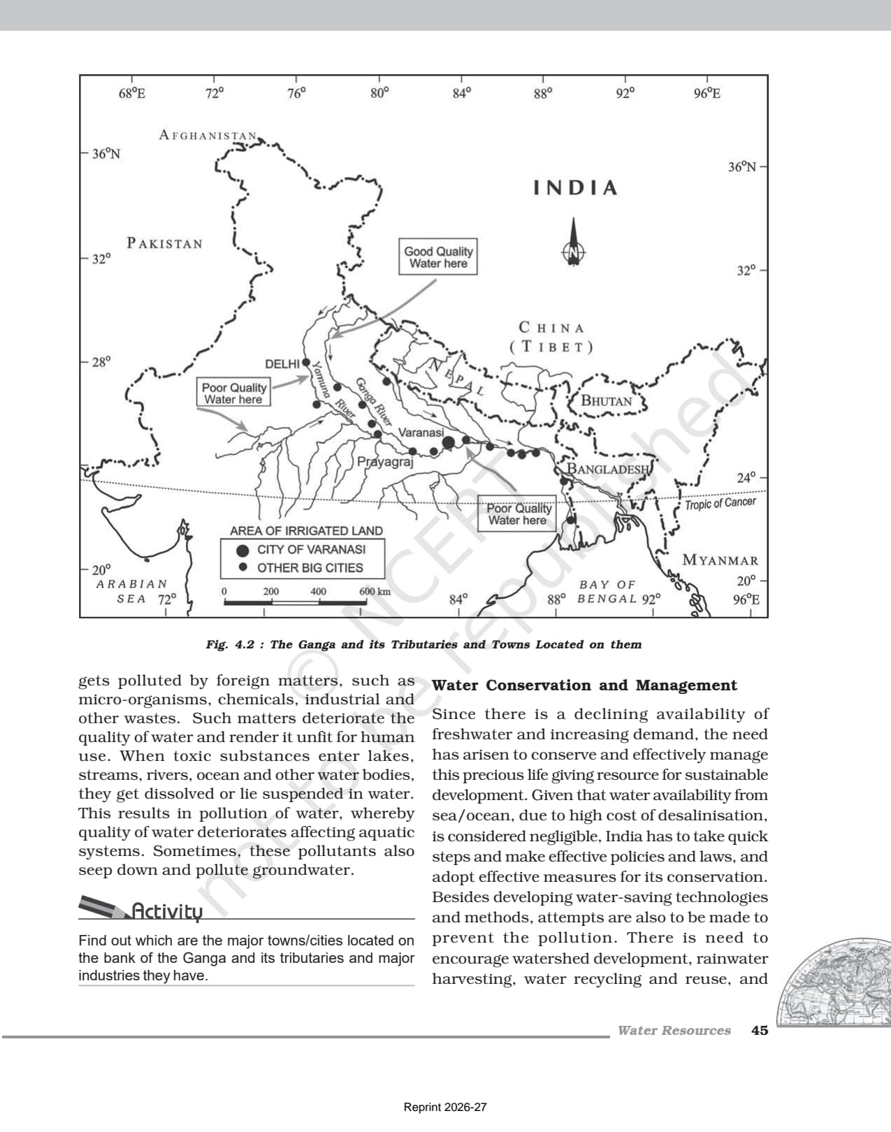
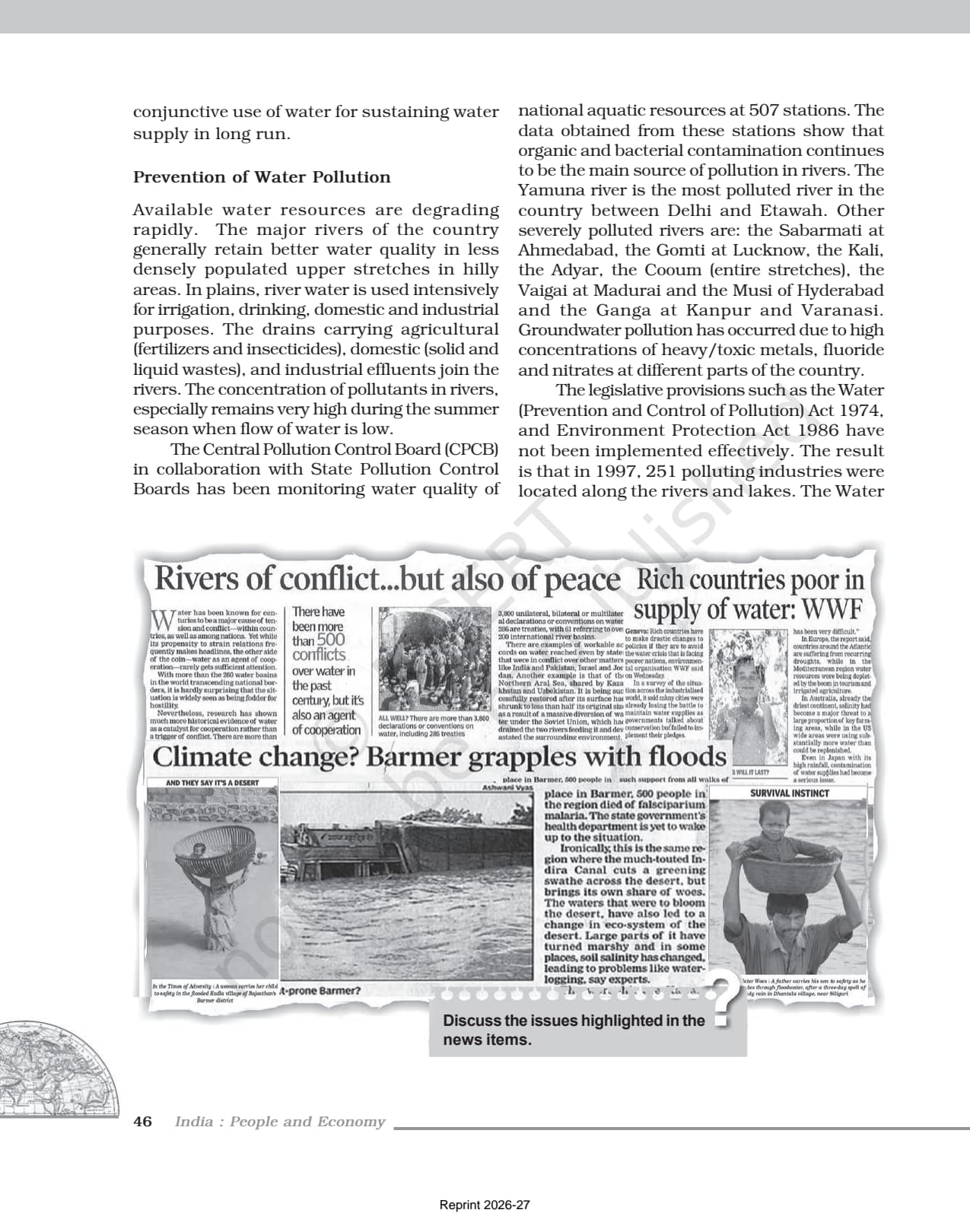
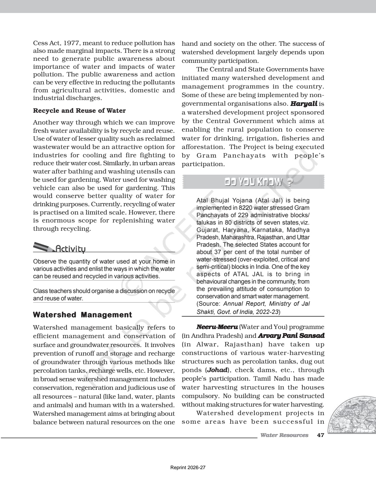
- Official NCERT India: People and Economy Class 12 Chapter 4 PDF covering India's water resources, spatial distribution, sectoral utilisation, water conservation, watershed development, and the National Water Policy 2012.
- 5-6 marks CBSE board-paper weightage for Chapter 4; the official textbook is the only source CBSE references when it sets data-based, map-based, and definition questions on water resources.
- Pair with the matching NCERT Solutions, Notes and Handwritten Notes for full chapter coverage.
Student Feedback
In a 2026 Collegedunia poll of 10,800 Class 12 Geography students, 83% said reading the NCERT chapter PDF directly improved their board-paper answers on water resources and conservation more than any guide book. Students who read the full PDF averaged 4.7 out of 5 marks on questions from this chapter.
What This Chapter Covers in the NCERT Class 12 Book
The water resources class 12 geography chapter is the most data-intensive chapter in India: People and Economy. CBSE draws its data-based, map-based, and definition questions straight from this NCERT PDF, so read it before any guide book. The chapter moves from India's water availability to surface and groundwater distribution, demand across sectors, irrigation problems, and the conservation methods of watershed development and rainwater harvesting. Key figures to note: about 4,000 cubic km of total water from precipitation, only 1,122 cubic km utilisable, and agriculture using 89% of surface water and 92% of groundwater. It closes with the National Water Policy 2012 and the Jal Kranti Abhiyan 2015-16.
Source: HUMAN-AT-EASE on YouTube
Topics in the Chapter (Section-Wise Map of the NCERT PDF)
The NCERT PDF for water resources class 12 is organised into eight sections. The table below maps each one to its dominant exam concept for the 2026-27 board paper.
| Section | NCERT Sub-topic | Dominant Exam Concept |
|---|---|---|
| 4.1 | Water Resources of India | Total water from precipitation (4,000 cubic km); utilisable water (1,122 cubic km); India's share of world water (4%) |
| 4.2 | Surface Water Resources | Four sources: rivers, lakes, ponds, tanks; 10,360 rivers; mean annual flow 1,869 cubic km; Ganga-Brahmaputra-Barak basins have 60% of surface water |
| 4.3 | Groundwater Resources | Total replenishable groundwater 432 cubic km; high utilisation in Punjab, Haryana, Rajasthan, Tamil Nadu |
| 4.4 | Lagoons and Backwaters | Kerala, Odisha, West Bengal; brackish water used for fishing and certain crops |
| 4.5 | Water Demand and Utilisation | Agriculture dominates: 89% surface water + 92% groundwater; multipurpose projects; industrial and domestic shares |
| 4.6 | Demand of Water for Irrigation | Spatio-temporal variability in rainfall; Punjab-Haryana groundwater depletion; fluoride and arsenic contamination; PMKSY |
| 4.7 | Watershed Development | Ralegan Siddhi case study; need for integrated water resource management |
| 4.8 | Rainwater Harvesting | Kund/Tanka in Rajasthan; benefits; urban and rural applications; National Water Policy 2012; Jal Kranti Abhiyan |
Sections 4.5, 4.6, and 4.8 carry the largest share of board questions, because water demand, irrigation problems, and conservation methods are the most frequently tested topics.
Key Concepts From the NCERT Class 12 Geography Textbook
The concept blocks below are taken directly from this chapter. Reproducing the exact NCERT phrasing in the board paper is the fastest route to full marks on theory questions.
India's Water Availability: The Key Numbers
Five figures appear almost every year in one-mark and two-mark questions. India has about 2.45% of the world's surface area, 4% of its water resources, and over 17% of its population. Total water from precipitation is about 4,000 cubic km per year, of which only 1,122 cubic km is utilisable. The Ganga, Brahmaputra, and Barak basins cover one-third of the country but hold 60% of its surface water.
Sectoral Water Demand and Over-Extraction Problems
Agriculture dominates water use: 89% of surface water and 92% of groundwater. Industry takes 2% of surface water and 5% of groundwater; domestic use takes 9% of surface water. In Punjab, Haryana, and western Uttar Pradesh, over 85% of the net sown area is irrigated. This over-extraction has caused declining groundwater tables, fluoride contamination in Rajasthan and Maharashtra, and arsenic in parts of West Bengal and Bihar. These consequences are common five-mark questions.
Watershed Development: The Ralegan Siddhi Case Study
Watershed management means conserving, regenerating, and judicious use of all resources within a watershed. The NCERT model case is Ralegan Siddhi in Ahmadnagar, Maharashtra. In 1975 a retired army man transformed this drought-prone village through voluntary labour, a ban on open grazing and liquor, and percolation tanks, a ban on water-intensive sugarcane, and a shift to pulses and oilseeds. It shows watershed development can rejuvenate both the environment and the local economy.
Rainwater Harvesting and the National Water Policy 2012
Rainwater harvesting captures and stores rainwater for use and to recharge aquifers; the NCERT calls it a low-cost, eco-friendly technique. In Rajasthan, traditional covered underground tanks called Kund or Tanka have been used for centuries. It increases water availability, checks declining groundwater tables, improves water quality, prevents soil erosion, and arrests salt-water intrusion in coastal areas. The National Water Policy 2012 recommends treating water as an economic good once basic needs are met, developing water footprints and auditing benchmarks, and managing water with community participation.
Previous Year Question Trends From This Chapter
The water resources class 12 important questions follow a consistent pattern, and the 2026-27 paper should look similar. This chapter has contributed 5 to 6 marks across recent board papers, through MCQs, short answers, data-based questions, and long-answer questions.
| Year | Marks | Question Types | Most Common Topic |
|---|---|---|---|
| 2025 | 5 | 1 MCQ + 1 short answer + 1 long answer | Rainwater harvesting benefits; groundwater depletion in Punjab |
| 2024 | 6 | 2 MCQs + 1 short answer + 1 long answer | Sectoral water utilisation; watershed management |
| 2023 | 5 | 1 MCQ + 1 short answer + 1 data question | India's water availability figures; surface vs groundwater |
| 2022 | 4 | 1 MCQ + 1 short answer + 1 long answer | Ralegan Siddhi watershed model; PMKSY |
| 2020 | 6 | 2 MCQs + 1 short + 1 long + 1 map | River basins; groundwater states; rainwater harvesting methods |
The most repeated question type is a three-mark or five-mark question on watershed management with an example, or the benefits of rainwater harvesting. Both need NCERT phrasing and textbook detail, not a guide-book summary.
Connecting This Chapter to the Rest of India: People and Economy
Chapter 4 builds on Chapter 3's land-use data and feeds into every later chapter on resource use and planning, so its water figures underpin roughly 40% of the India: People and Economy paper.
| Later Chapter | Concept Inherited From Chapter 4 |
|---|---|
| Chapter 5: Mineral and Energy Resources | Energy required to pump groundwater; hydroelectric potential of major river systems; water used in mining and processing |
| Chapter 6: Planning and Sustainable Development | Water scarcity as a development constraint; watershed development as a sustainable development tool; PMKSY and Jal Kranti Abhiyan as planning interventions |
| Chapter 7: Transport and Communication | Inland waterways as transport corridors along major rivers; canal networks serving agricultural zones |
| Chapter 8: International Trade | Export of water-intensive agricultural commodities (rice, cotton, sugarcane products); virtual water trade concept |
| Chapter 9: Geographical Perspective on Selected Issues | Water scarcity and water pollution as environmental issues; farmer indebtedness linked to irrigation costs |
Quick Glossary From the NCERT Chapter
Students should be able to define each term below in one line for one-mark MCQs and two-mark questions, using NCERT phrasing.
- Utilisable water: The share of total precipitation water that can be put to beneficial use after topographical and hydrological constraints; about 1,122 cubic km in India.
- Multipurpose River Valley Projects: Large dams serving irrigation, hydroelectric power, flood control, and navigation at once; for example Bhakra-Nangal, Hirakud, and Damodar Valley.
- Replenishable Groundwater: Groundwater recharged annually by precipitation and percolation; about 432 cubic km in India.
- Watershed: A land area from which water drains to a common outlet; the basic unit of integrated water resource management.
- Percolation Tank: A shallow reservoir that lets water seep slowly into the ground to recharge the water table.
- Kund (Tanka): A covered underground tank used in Rajasthan to store harvested rainwater.
- Jal Gram: One water-stressed village per district chosen under the Jal Kranti Abhiyan as a model of water conservation.
Also Explore Other Resources for Class 12 Geography Chapter 4
| Resource | Link |
|---|---|
| NCERT Solutions | Class 12 Geography Chapter 4 NCERT Solutions |
| Revision Notes | Class 12 Geography Chapter 4 Notes |
| Handwritten Notes | Class 12 Geography Chapter 4 Handwritten Notes |
| Subject Hub | Class 12 Geography All Chapters |
All Chapters: Class 12 Geography India: People and Economy NCERT Book PDF
| Chapter | NCERT Book PDF |
|---|---|
| Chapter 1 | Population Distribution, Density, Growth and Composition NCERT Book PDF |
| Chapter 2 | Human Settlements NCERT Book PDF |
| Chapter 3 | Land Resources and Agriculture NCERT Book PDF |
| Chapter 4 | Water Resources NCERT Book PDF (You are here) |
| Chapter 5 | Mineral and Energy Resources NCERT Book PDF |
| Chapter 6 | Planning and Sustainable Development NCERT Book PDF |
| Chapter 7 | Transport and Communication NCERT Book PDF |
| Chapter 8 | International Trade NCERT Book PDF |
| Chapter 9 | Geographical Perspective on Selected Issues NCERT Book PDF |
Frequently Asked Questions on Class 12 Geography Chapter 4 Water Resources NCERT Book PDF
Ques. Where can students download the official NCERT Class 12 Geography Chapter 4 PDF?
Ans. Students can download the official water resources class 12 NCERT book PDF directly from the download card at the top of this page. The PDF is the single-chapter file from the NCERT India: People and Economy textbook, aligned to the 2026-27 CBSE syllabus.
Ques. What is the total utilisable water resource in India according to the NCERT Class 12 textbook?
Ans. According to the NCERT textbook, the total water available from precipitation in India is about 4,000 cubic km per year. The availability from surface water and replenishable groundwater is 1,869 cubic km. Of this, only about 60% can be put to beneficial use, giving a utilisable water resource of 1,122 cubic km.
Ques. Which river basins have the highest surface water resources in India?
Ans. The Ganga, Brahmaputra, and Barak river basins together account for about 60% of India's total surface water resources, even though they cover only about one-third of the country's total area. This is because precipitation in their catchment areas is relatively high and concentrated during the monsoon season.
Ques. What percentage of water in India is used by agriculture?
Ans. Agriculture is the dominant water user in India. It accounts for 89% of the surface water utilisation and 92% of the groundwater utilisation. The industrial sector uses only 2% of surface water and 5% of groundwater. The domestic sector uses 9% of surface water. The NCERT notes that as development progresses, the shares of industrial and domestic sectors are likely to increase in the future.
Ques. Why is groundwater being over-exploited in Punjab, Haryana, and Rajasthan?
Ans. The over-exploitation of groundwater in these states is mainly due to intensive irrigation for agriculture. In Punjab and Haryana, more than 85% of the net sown area is under irrigation, with 76.1% of Punjab's irrigated area relying on wells and tubewells. The high-yielding variety crops introduced during the Green Revolution require regular moisture supply, making these states heavily dependent on groundwater. As a result, the groundwater table has declined significantly, and there is increased concentration of fluoride in Rajasthan and arsenic in parts of West Bengal and Bihar due to over-withdrawal.
Ques. What is watershed development and why is Ralegan Siddhi important?
Ans. Watershed development refers to the conservation, regeneration, and judicious use of all natural resources within a watershed (a land area draining to a common outlet) to restore the ecological balance. Ralegan Siddhi in Ahmadnagar, Maharashtra is the NCERT's model example. In 1975, a retired army man led the transformation of this poverty-stricken village through voluntary labour, construction of percolation tanks, banning open grazing and cultivation of water-intensive crops like sugarcane, and encouraging pulses and oilseeds with low water requirements. The village became water-sufficient and economically prosperous, making it a nationally recognised model of watershed development.
Ques. What are the benefits of rainwater harvesting according to the NCERT textbook?
Ans. The NCERT Chapter 4 lists the following benefits of rainwater harvesting: it increases water availability; checks the declining groundwater table; improves groundwater quality by diluting contaminants like fluoride and nitrates; prevents soil erosion and flooding; arrests salt water intrusion in coastal areas when used to recharge aquifers; reduces community dependence on groundwater for domestic use; and saves energy otherwise used to pump groundwater. In Rajasthan, traditional structures called Kund or Tanka have been used for centuries to harvest rainwater.
Ques. What are the salient features of the National Water Policy 2012?
Ans. The National Water Policy 2012 aims to propose a unified national framework for water resource management. Key features include: emphasis on a national water framework law; treating water as an economic good after meeting basic needs for drinking water, sanitation, food security, and ecosystem needs; developing water footprints and water auditing benchmarks; adapting to climate change in water resource management; removing disparity between urban and rural water supply norms; and managing water resources with community participation.
Ques. What is the Jal Kranti Abhiyan and what are its main objectives?
Ans. The Jal Kranti Abhiyan was launched by the Government of India in 2015-16 with the aim of ensuring water security through per capita availability of water. Its key activities include: selecting one water-stressed village (Jal Gram) in each of 672 districts; identifying model command areas of about 1,000 hectares in different parts of the country; reducing groundwater pollution; constructing arsenic-free wells; and creating mass awareness through social media, radio, television, print media, and school competitions.
Ques. How are lagoons and backwaters used as water resources in India?
Ans. India's coastline, especially in states like Kerala, Odisha, and West Bengal, is very indented, which has led to the formation of lagoons and lakes. Although the water in these lagoons is generally brackish (partially saline), it is used for fishing and for irrigating certain crops like specific varieties of paddy, coconut, and other coastal agricultural produce. These water bodies represent a unique category of surface water resource distinct from rivers and groundwater.
Ques. Is the Class 12 Geography syllabus changing for 2026-27?
Ans. No major changes. The India: People and Economy textbook chapter structure is unchanged for 2026-27, and the official NCERT PDF on this page is aligned to the 2026-27 CBSE syllabus. CBSE marking schemes continue to reward textbook phrasing in theory questions and complete, reasoned answers in long-answer questions from this chapter.
Ques. What is the best order to use the NCERT PDF, Notes, and Solutions for Class 12 Geography Chapter 4?
Ans. Read the NCERT PDF cold first to get the full chapter narrative and data. Then read the matching Class 12 Geography Chapter 4 Notes alongside the PDF for structured revision of all key figures, sectoral data, and conservation methods. Attempt all exercise questions and verify against the NCERT Solutions. Use the handwritten notes for last-mile revision the night before the board exam.



Comments